Muncy Creek facts for kids
Quick facts for kids Muncy Creek |
|
|---|---|

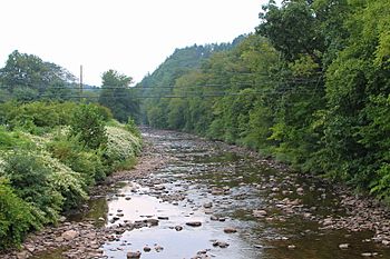
Muncy Creek looking upstream in Picture Rocks
|
|
| Native name | Occohpocheny |
| Physical characteristics | |
| Main source | southeastern Laporte Township, Sullivan County, Pennsylvania 2,260 to 2,280 feet (688.8 to 694.9 m) |
| River mouth | West Branch Susquehanna River in Muncy Creek Township, Lycoming County, Pennsylvania slightly less than 480 feet (150 m) 41°12′35″N 76°48′12″W / 41.2098°N 76.8033°W |
| Length | 35.8 mi (57.6 km) |
| Basin features | |
| Basin size | 216 sq mi (560 km2) |
| Tributaries |
|
Muncy Creek (also known as Big Muncy Creek) is a beautiful stream in Sullivan County and Lycoming County, Pennsylvania. It flows into the West Branch Susquehanna River. The creek is about 34.5 miles (55.5 km) long.
The land area that drains into Muncy Creek, called its watershed, is 216 square miles (560 km2). The amount of water flowing in the creek changes a lot. It averages 49 cubic feet per second at Sonestown. But it can be a thousand times higher in Muncy during floods!
The creek starts high up on the Allegheny Plateau. Its path goes through different rock types, including the Chemung and Catskill Formations. There are also several lakes in the Muncy Creek watershed, like Eagles Mere Lake.
Native Americans called this creek Occohpocheny. People started settling near the creek in 1783. Over time, many mills and other businesses were built along its banks. Today, wild trout live in parts of Muncy Creek. You can even go canoeing on some sections of the creek!
Contents
The Creek's Journey
Muncy Creek begins its journey in southeastern Laporte Township, Sullivan County. It flows southwest, then west, passing through a valley. Along the way, many smaller streams, called tributaries, join it. Some of these include Rock Run and Lopez Pond Branch.
As the creek continues, it passes by the community of Nordmont. Here, Elklick Run flows into it. Muncy Creek then heads southwest and west, with Deep Hollow Run joining it. It then enters Davidson Township.
After several miles, the creek reaches Sonestown, where Big Run adds its waters. Muncy Creek then turns sharply south, flowing next to U.S. Route 220. It passes Muncy Valley and leaves Davidson Township.
Entering Lycoming County
When Muncy Creek enters Lycoming County, it flows along the border of Shrewsbury Township and Penn Township. It continues to follow U.S. Route 220, picking up more tributaries like Lick Run. The creek goes past Glen Mawr and Tivoli.
In Picture Rocks, the creek crosses Pennsylvania Route 864. It then flows south into Wolf Township, passing the eastern edge of Hughesville. Sugar Run joins the creek, and a few miles later, it leaves Wolf Township.
Finally, Muncy Creek enters Muncy Creek Township. Here, Little Muncy Creek flows into it. The creek then turns northeast, crosses Pennsylvania Route 405, and turns southwest, going under Interstate 180. After Wolf Run joins it, Muncy Creek flows into the West Branch Susquehanna River.
Creek Branches (Tributaries)
Muncy Creek has several important branches that feed into it. The two largest are Little Muncy Creek and Wolf Run.
- Little Muncy Creek's watershed covers about 82.30 square miles (213.2 km2). It joins Muncy Creek about 3.90 miles (6.28 km) before Muncy Creek reaches the big river.
- Wolf Run's watershed is about 11.10 square miles (28.7 km2). It joins Muncy Creek very close to its mouth, just 0.06 miles (0.097 km) upstream.
Other significant tributaries include Lewis Creek, Rock Run, and Sugar Run. Each of these has a watershed area of about 10 to 14 square miles (26 to 36 km2). Many smaller streams also flow into Muncy Creek.
Water Conditions (Hydrology)
The amount of water flowing in Muncy Creek can change a lot. Near Muncy, the highest recorded flow was 46,600 cubic feet (1,320 m3) per second. In 2012 and 2013, the flow usually ranged from 29 to 379 cubic feet (0.82 to 10.73 m3) per second.
The water's pH (how acidic or basic it is) near Muncy was between 7.0 and 7.5 in 2012 and 2013. This means the water is mostly neutral. The water's temperature also changes with the seasons. In winter, it can be as low as 1.4 °C (34.5 °F). In summer, it can reach about 20.6 °C (69.1 °F).
The water in Muncy Creek has some dissolved solids, usually between 50 and 80 milligrams per liter. This includes minerals like calcium and magnesium, which make the water a bit "hard." There are also tiny amounts of other substances like nitrogen and chloride, which are common in natural waters.
Land and Rocks (Geography and Geology)
Muncy Creek starts high up in the mountains, about 2,260 to 2,280 feet (689 to 695 m) above sea level. Its mouth, where it meets the West Branch Susquehanna River, is much lower, at just under 480 feet (150 m). This big drop in elevation means the water flows downhill quite a bit!
The creek's source is in the mountainous Allegheny Plateau. The valley of Muncy Creek is surrounded by hills that look like they have wavy edges. The creek itself winds and turns a lot, but its general direction is southwest.
Along Muncy Creek, you can see different types of rock formations. In Shrewsbury Township, there's a narrow band of the Chemung Formation. The Catskill Formation is also found along parts of the creek. These formations often contain shale and sandstone. Near the creek's mouth, you might find limestone.
There's a special cliff on the creek called Picture Rock. Also, an area with large boulders creates a "Class 2" rapid, which is a fun challenge for canoers. In Hughesville, there's a levee built along Muncy Creek to help prevent flooding.
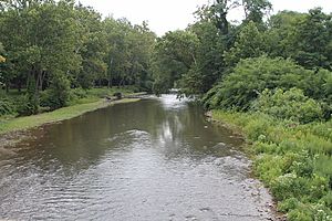
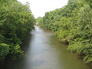
The soils in the Muncy Creek valley are deep but not very rich. However, people have farmed in this valley for a long time. The valley is also surrounded by forested hills. The creek's channel is curvy, with high banks, and you can see cobble and gravel bars in the water.
The Creek's Drainage Area (Watershed)
The watershed of Muncy Creek covers a large area of 216 square miles (560 km2). This means all the rain and snow that falls in this area eventually flows into Muncy Creek. About half of the total watershed is upstream of Hughesville. The watershed includes parts of Lycoming, Sullivan, Columbia, and Montour Counties.
Several lakes are found within the Muncy Creek watershed:
- Eagles Mere Lake is the largest, covering 116.2 acres (47.0 hectares).
- Hunters Lake is 90.2 acres (36.5 hectares).
- Highland Lake is 10 acres (4.0 hectares).
- Beaver Lake, which is 6 acres (2.4 hectares), is in the watershed of Little Muncy Creek.
Many communities are located in the Muncy Creek watershed, including Hughesville, Picture Rocks, Lairdsville, and Sonestown. Smaller towns like Muncy Valley, Eagles Mere, and Nordmont are also part of this area. The valley of Muncy Creek is mostly natural and undeveloped, with lots of forests.
A Look Back (History)
Muncy Creek gets its name from the Munsee Indians, a Native American group. Sometimes, the name was spelled "Muncey Creek."
Long ago, Native Americans knew the creek as Occohpocheny. They even painted on Picture Rock, the cliff along the creek. Stone tools, like lance heads, have been found near the creek, showing that Native Americans lived and hunted here.
The first European settler, John Beeber, arrived at Muncy Creek in 1783. Over the years, many mills were built along the creek. For example, the Willow Grove Mill was built in 1797. There were also sawmills and woolen mills. An aqueduct (a bridge for water) that carried the West Branch Canal once crossed Muncy Creek.
In the past, railroads ran alongside Muncy Creek for many miles. There were also several train stations along the creek. The Reading Railroad even had a bridge over the creek. Muncy Creek experienced a big flood in 1889.
In the early 1900s, some waste from towns and factories was unfortunately released into Muncy Creek. This included waste from tanneries (where animal hides are processed) and chemical plants. Because of this, the creek's water was mainly used for power during that time, not for drinking or other uses.
Animals and Nature (Biology)
Muncy Creek is a special place for fish and other wildlife. From its source down to a certain point, the creek is considered an "Exceptional Value" stream and a "Migratory Fishery." This means it's a very healthy environment and important for fish that travel. Further downstream, it's a "Coldwater Fishery" and "Trout Stocked Fishery," meaning it's good for cold-water fish like trout, and sometimes trout are added here.
Wild trout naturally reproduce in Muncy Creek from Trout Run all the way to its mouth. This is a great sign of a healthy ecosystem! About 92 percent of the streams in the Muncy Creek watershed have trout. Most of these streams have brook trout, while some have brown trout, and a few have both.
Many of the smaller streams that flow into Muncy Creek are considered high-quality coldwater fisheries. This includes Lick Run, Rock Run, and Spring Run in Lycoming County, and Big Run and Trout Run in Sullivan County. These areas are important for keeping the water clean and healthy for fish.
There are also forested areas along the creek's floodplain (the flat land next to the creek that can flood). Keeping these natural areas helps improve the water quality of Muncy Creek.
Fun on the Water (Recreation)
Muncy Creek is a great place for canoeing! You can canoe on the creek when there's enough water, like during snowmelt or after heavy rainstorms. While it's popular with local canoers, it's not as well-known as some other nearby creeks.
Edward Gertler, who wrote a book about canoeing, says Muncy Creek is especially good for beginners. He describes it as a "pleasing but generally mediocre mountain stream." You can canoe on about 24.3 miles (39.1 km) of the creek. The difficulty for canoeing ranges from 1+ to 2, which is fairly easy.
There's a boat ramp near the lower part of Muncy Creek. This ramp belongs to the Pennsylvania Fish and Boat Commission and is a good spot to launch or take out your canoe.
 | Chris Smalls |
 | Fred Hampton |
 | Ralph Abernathy |


