Bronson, Kansas facts for kids
Quick facts for kids
Bronson, Kansas
|
|
|---|---|

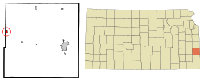
Location within Bourbon County and Kansas
|
|

|
|
| Country | United States of America |
| State | Kansas |
| County | Bourbon |
| Founded | 1880s |
| Incorporated | 1881 |
| Named for | Ira Bronson |
| Area | |
| • Total | 0.45 sq mi (1.16 km2) |
| • Land | 0.45 sq mi (1.16 km2) |
| • Water | 0.00 sq mi (0.00 km2) |
| Elevation | 1,070 ft (330 m) |
| Population
(2020)
|
|
| • Total | 304 |
| • Density | 676/sq mi (262.1/km2) |
| Time zone | UTC-6 (CST) |
| • Summer (DST) | UTC-5 (CDT) |
| ZIP code |
66716
|
| Area code | 620 |
| FIPS code | 20-08475 |
| GNIS ID | 2393424 |
Bronson is a small city in Bourbon County, Kansas, in the United States. In 2020, about 304 people lived there. It's a quiet place with a rich history.
Contents
History of Bronson
Bronson was started in the 1880s. The very first store and post office opened in September 1881. The city was first called Wilsonville. Later, it was renamed after Ira Bronson, a lawyer from Fort Scott.
The town of Bronson was moved to its current spot. This happened because the Missouri Pacific Railroad built its tracks away from the original town site.
Bronson's Growth and Importance
Bronson became an important place for shipping and supplies. It was located halfway between Fort Scott and Iola on the main highway and railroad. This made it a good spot for farmers to send their goods and get what they needed.
The town grew slowly but steadily. In 1885, only a few people lived there. By 1910, the population had grown to 595 residents. In 1912, Bronson had two banks, a post office, and telephone service. It also had a local newspaper called the Bronson Pilot.
World's First Horseshoe Tournament
Did you know that Bronson held a special event? In 1910, the world's first horseshoe pitch tournament took place right here in Bronson!
Bronson's Location and Area
Bronson is a small city. It covers an area of about 0.43 square miles (1.11 square kilometers). All of this area is land.
Highways in Bronson
U.S. Route 54 is a major highway that goes through Bronson. It crosses another road called K-3 on the east side of the city.
People of Bronson
| Historical population | |||
|---|---|---|---|
| Census | Pop. | %± | |
| 1890 | 352 | — | |
| 1900 | 361 | 2.6% | |
| 1910 | 595 | 64.8% | |
| 1920 | 590 | −0.8% | |
| 1930 | 450 | −23.7% | |
| 1940 | 421 | −6.4% | |
| 1950 | 415 | −1.4% | |
| 1960 | 354 | −14.7% | |
| 1970 | 397 | 12.1% | |
| 1980 | 414 | 4.3% | |
| 1990 | 343 | −17.1% | |
| 2000 | 346 | 0.9% | |
| 2010 | 323 | −6.6% | |
| 2020 | 304 | −5.9% | |
| U.S. Decennial Census | |||
Population in 2020
In 2020, the 2020 United States census counted 304 people living in Bronson. There were 107 households, which are groups of people living together. The average age of people in Bronson was about 32.3 years old.
Population in 2010
Back in 2010, the census showed that 323 people lived in the city. There were 131 households at that time. The average age of people in Bronson was about 39.6 years old.
Education in Bronson
Students in Bronson attend schools in the Uniontown USD 235 public school district. The mascot for Uniontown High School is the Eagles.
Long ago, Bronson had its own high school. Its mascot was the Bulldogs. However, those schools closed when school districts were combined. The Marmaton Valley USD 256 school district starts near the west edge of Bronson.
Famous People from Bronson
- Jonathan M. Davis: He was born and grew up in Bronson. He became an important person in Kansas politics. He served as a state representative and a senator. He also became the 22nd governor of Kansas.
See also
 In Spanish: Bronson (Kansas) para niños
 | Bessie Coleman |
 | Spann Watson |
 | Jill E. Brown |
 | Sherman W. White |

