Buchtel, Ohio facts for kids
Quick facts for kids
Buchtel, Ohio
|
|
|---|---|
|
Village
|
|

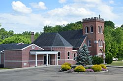
St. Mary of the Hills Church
|
|

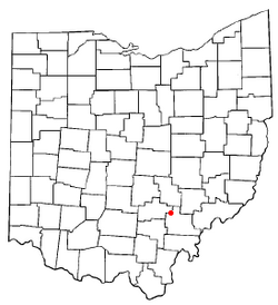
Location of Buchtel, Ohio
|
|

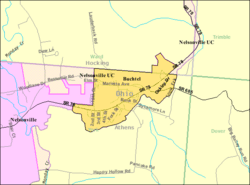
Detailed map of Buchtel
|
|
| Country | United States |
| State | Ohio |
| Counties | Athens, Hocking |
| Area | |
| • Total | 0.47 sq mi (1.22 km2) |
| • Land | 0.47 sq mi (1.22 km2) |
| • Water | 0.00 sq mi (0.00 km2) |
| Elevation | 692 ft (211 m) |
| Population
(2020)
|
|
| • Total | 518 |
| • Estimate
(2023)
|
513 |
| • Density | 1,102.13/sq mi (425.90/km2) |
| Time zone | UTC-5 (Eastern (EST)) |
| • Summer (DST) | UTC-4 (EDT) |
| ZIP code |
45716
|
| Area code(s) | 740 |
| FIPS code | 39-09834 |
| GNIS feature ID | 2397481 |

Buchtel is a small village in the state of Ohio, located in both Athens and Hocking counties. It is just northeast of Nelsonville. Buchtel is in an area called the Hocking Valley, and it was a very important place for coal mining in the late 1800s and early 1900s. In 2020, about 518 people lived there. The village was once known as Bessemer.
Contents
History of Buchtel
Buchtel was officially established in 1876. It was named after John R. Buchtel, who worked for the Akron Iron Company. This company owned a lot of land in the Hocking Valley region. A post office opened in Buchtel in 1879, which helped the community grow and connect with other places.
Coal Mining and Strikes
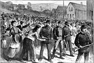
The village of Buchtel grew because of the many coal mines in the area. In 1884, mine workers in Buchtel went on strike. This means they stopped working to ask for better pay or working conditions. The company then hired Pinkerton guards to protect new workers. These new workers were sometimes called "strikebreakers" or "Blacklegs" by the union workers. Union workers often strongly disagreed with strikebreakers, and sometimes these disagreements led to conflict.
Geography of Buchtel
Buchtel is located along Snow Fork, which is a small stream that flows into Monday Creek.
According to the United States Census Bureau, the village covers a total area of about 0.49 square miles (1.22 square kilometers). All of this area is land.
Population and People
| Historical population | |||
|---|---|---|---|
| Census | Pop. | %± | |
| 1880 | 417 | — | |
| 1910 | 1,180 | — | |
| 1920 | 1,178 | −0.2% | |
| 1930 | 799 | −32.2% | |
| 1940 | 775 | −3.0% | |
| 1950 | 569 | −26.6% | |
| 1960 | 499 | −12.3% | |
| 1970 | 592 | 18.6% | |
| 1980 | 585 | −1.2% | |
| 1990 | 640 | 9.4% | |
| 2000 | 574 | −10.3% | |
| 2010 | 558 | −2.8% | |
| 2020 | 518 | −7.2% | |
| 2023 (est.) | 513 | −8.1% | |
| U.S. Decennial Census | |||
2010 Census Information
In 2010, there were 558 people living in Buchtel. They lived in 235 households, and 152 of these were families. The village had about 1138.8 people per square mile.
Most of the people living in Buchtel were White (97.8%). A small number were African American (1.1%) or from two or more races (1.1%). About 1.1% of the population was Hispanic or Latino.
About 28.9% of households had children under 18 living with them. Many households (47.7%) were married couples living together. The average household had 2.37 people, and the average family had 2.84 people.
The average age in the village was 38 years old. About 21.9% of residents were under 18, and 14.7% were 65 or older. The population was almost evenly split between males (48.6%) and females (51.4%).
Public Services for Buchtel
The children of Buchtel attend schools in the Nelsonville-York City School District, including Nelsonville-York High School. Even though Buchtel is close to the school campus, the school buildings are actually located within the city limits of Nelsonville.
The City of Nelsonville also provides important services to Buchtel residents, such as water, sewer, and police protection. Fire services are provided by the York Township Volunteer Fire Department.
Residents can also use the Athens County Public Library. This library has branches in several nearby towns, including Albany, Athens, Chauncey, Coolville, Glouster, Nelsonville, and The Plains.
See also
 In Spanish: Buchtel (Ohio) para niños
 | Selma Burke |
 | Pauline Powell Burns |
 | Frederick J. Brown |
 | Robert Blackburn |

