Buckbarrow facts for kids
Quick facts for kids Buckbarrow |
|
|---|---|

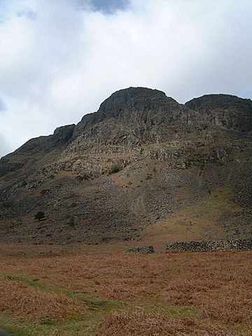
The cliffs of Buckbarrow are unassailable to walkers and prevent a direct ascent
|
|
| Highest point | |
| Elevation | 423 m (1,388 ft) |
| Prominence | less than 5 m |
| Parent peak | Seatallan |
| Listing | Wainwright |
| Geography | |
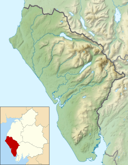
| Location | Cumbria, England |
| Parent range | Lake District, Western Fells |
| OS grid | NY135061 |
| Topo map | OS Landranger 89, OS Explorer OL6 |
Buckbarrow is a small mountain, or 'fell', in England's beautiful Lake District. It looks out over the western part of Wast Water, a famous lake. This fell is mentioned in Alfred Wainwright's popular guidebooks about the Lakeland Fells.
Buckbarrow is about 423 meters (1,388 feet) high. Its name is quite old and means 'The hill of the buck or goat'. This name comes from either the Old English word bucc (meaning buck) or the Old Norse word bokki (meaning a male goat).
Exploring Buckbarrow's Landscape
The Western Fells are a group of mountains in the Lake District. They form a triangle shape, with rivers on two sides. Buckbarrow is part of the southern side of this mountain range.
Buckbarrow isn't really a separate mountain. It's more like the rocky end of a ridge connected to a nearby fell called Seatallan. Seatallan is much taller, reaching 692 meters (2,270 feet).
The land slopes gently from Seatallan at first. Then it narrows down to a spot called Cat Bields. From there, the slope continues towards the main road. Another smaller ridge branches off from Cat Bields. This ridge ends in a wall of cliffs, which is Buckbarrow. These cliffs drop about 900 feet to the road below.
Buckbarrow's Amazing Views
The cliffs of Buckbarrow face the famous Wastwater Screes across the lake. They look like a smaller version of these impressive screes. Buckbarrow's southern side is about three-quarters of a mile long. It has several rocky sections like Long Crag, Pike Crag, Bull Crag, and Broad Crag.
To the west, Gill Beck stream forms a boundary. To the east, Greendale Gill stream separates Buckbarrow from Middle Fell.
Climbing to the Top of Buckbarrow
The best views from Buckbarrow are from a rocky spot above Pike Crag. From here, you can see the entire length of Wast Water. You also get a fantastic view of Great Gable and the Scafells, which are some of the highest mountains in England.
Climbing Buckbarrow can look tricky because of its steep cliffs. However, there are safe ways to reach the top. Most people start their climb from the small road at the bottom of the hill.
One way to climb is to begin near Harrow Head farm. You can follow Gill Beck stream upwards. Once you reach about 350 meters (1,150 feet), you turn towards the highest point above the cliffs. Another option is to start from Greendale and follow Greendale Gill. Many hikers also visit Buckbarrow as they are coming down from climbing Seatallan.
The challenging cliffs of Buckbarrow are also a popular spot for rock climbing.
 | Madam C. J. Walker |
 | Janet Emerson Bashen |
 | Annie Turnbo Malone |
 | Maggie L. Walker |


