Burntside Lake facts for kids
Quick facts for kids Burntside Lake |
|
|---|---|
 |
|
| Location | Morse Township / Slim Lake, Saint Louis County, near Ely, Minnesota |
| Coordinates | 47°55′27″N 91°59′42″W / 47.92417°N 91.99500°W |
| Primary inflows | Tamarack Creek, Coo Lake, Crab Lake, Slim Lake, Hanson Lake, Chant Lake, Everett Lake (via Twin Lakes and Dead River), Minister Lake |
| Primary outflows | Burntside River |
| Basin countries | United States |
| Surface area | 7,139 acres (2,889 ha) |
| Max. depth | 126 ft (38 m) |
| Surface elevation | 1,371 ft (418 m) |
| Islands | >100 |
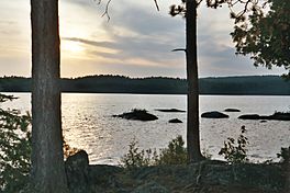
Burntside Lake is a beautiful and large lake in Minnesota. It covers about 7,139 acres, which is a huge area! This makes it a great spot for outdoor adventures.
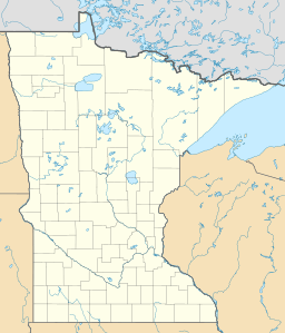
The lake is located about 3 miles northwest of Ely, Minnesota. It's in Saint Louis County. Part of its western side touches the Boundary Waters Canoe Area Wilderness. This is a special protected area for nature lovers.
Fish in the Lake
Burntside Lake is home to many different kinds of fish. If you like fishing, you might catch some of these native species:
- Bluegill
- Golden Shiner
- Green Sunfish
- Lake Trout
- Lake Whitefish
- Northern Pike
- Rainbow Smelt
- Rock Bass
- Shorthead Redhorse
- Smallmouth Bass
- Walleye
- White Sucker
- Yellow Perch
Places to Stay
Along the shores of Burntside Lake, you can find some historic places. Two resorts have been open for a very long time. They have original cabins built over 100 years ago!
- Burntside Lodge opened in 1913.
- Camp Van Vac opened in 1918.
Both resorts have been welcoming guests continuously since they first opened. The YMCA's Camp Widjiwagan is also located on the lake's shore. It's a popular place for summer camps and outdoor activities.
Many Islands
Burntside Lake has more than 100 islands! Each island has its own unique feel. Some of the islands have fun names like:
- Beach Island
- Bear Island
- Berry Island
- Blueberry Island
- Brownell Island
- Burnt Island
- Burntside Islands
- Gem Island
- Dollar Island
- Evans Island
- Good Dog Island
- Half Dollar Island
- Honeymoon Island
- Indian Island
- Lockhart Island
- Long Island
- Lost Girl Island
- Miller Island
- Oliver Island
- Picnic Island
- Porkchop Island
- Ripple Island
- Snake Island
- State Island
- Sumpter Island
- Waters Island
Long Island was recently bought by a group called the Trust for Public Land. This helps protect the island for everyone to enjoy.
The Burntside Islands, including Snellman and Pine, are special places. They are called Scientific and Natural Areas (SNAs). These areas are protected by the DNR (Department of Natural Resources). They were given as gifts by the Nature Conservancy. This helps keep these islands wild and natural.
 | Audre Lorde |
 | John Berry Meachum |
 | Ferdinand Lee Barnett |


