Càrn Gorm facts for kids
Quick facts for kids Càrn Gorm |
|
|---|---|

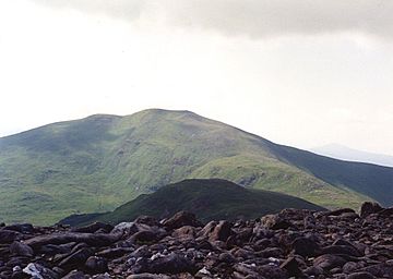
Càrn Gorm seen from Meall Garbh, two km to the NE. The Munro “Top” of An Sgorr is in the foreground.
|
|
| Highest point | |
| Elevation | 1,029 m (3,376 ft) |
| Prominence | 182 m (597 ft) |
| Parent peak | Carn Mairg |
| Listing | Munro, Marilyn |
| Naming | |
| English translation | Blue Hill |
| Language of name | Gaelic |
| Geography | |
| Location | Perth and Kinross, Scotland |
| Parent range | Grampians |
| OS grid | NN635500 |
| Topo map | OS Landranger 51, OS Explorer 378 |
| Listed summits of Càrn Gorm | ||||
| Name | Grid ref | Height | Status | |
|---|---|---|---|---|
| An Sgorr | NN640509 | 924 m (3031 ft) | Munro Top | |
Càrn Gorm is a mountain in Scotland. It is located about 22 kilometers west of Aberfeldy. This mountain is part of a special group. These four mountains are called the Càrn Mairg group. They are also known as the Glen Lyon Horseshoe. You can find them on the north side of Glen Lyon.
| Top - 0-9 A B C D E F G H I J K L M N O P Q R S T U V W X Y Z |
Discover Càrn Gorm: A Scottish Mountain
Càrn Gorm stands tall at 1029 meters (3376 feet). This height makes it a Munro. A Munro is a Scottish mountain over 914.4 meters (3000 feet) high. It is also a Marilyn. A Marilyn is a hill with a drop of at least 150 meters on all sides.
The Glen Lyon Horseshoe Walk
Many people climb Càrn Gorm as part of a longer hike. This hike is called the Glen Lyon Horseshoe. It includes four Munros that form a curve. These mountains are around the Invervar Burn. Càrn Gorm is usually the first mountain climbed. This happens when you walk the route clockwise. After Càrn Gorm, you would climb Meall Garbh. Then comes Càrn Mairg and Meall nan Aighean.
Why Càrn Gorm is Special
Even though it's not the tallest in its group, Càrn Gorm is often seen as the most beautiful. Its top looks like a neat cone. The name "Càrn Gorm" comes from Gaelic. It means "Blue Hill." But "gorm" can also mean the green color of plants. So, it likely refers to the dark green grass on the hillside. You might see large groups of deer on its slopes. The mountain is part of the Chesthill estate.
Exploring Càrn Gorm's Landscape
Càrn Gorm has mostly grassy slopes. You can also see some rocky areas. Its attractive top is where four ridges meet. These ridges are like long paths coming down the mountain.
The Longest Ridge and Ancient Woods
The longest ridge goes northwest. It stretches for eight kilometers. It ends near the shores of Loch Rannoch. The lower parts of this ridge have woodlands. These are the Carie and Cragganester Woods. They are part of a SSSI. An SSSI is a special area protected for its wildlife or geology. These woods are also part of the ancient Black Wood of Rannoch.
Eastern Slopes and Rare Plants
The southeast ridge goes down to the Invervar Burn valley. This area has many conifer trees planted on its lower slopes. The eastern side of the mountain is also an SSSI. This SSSI is called Càrn Gorm and Meall Garbh. It covers a huge area of 1930 hectares. It is a natural mountain habitat. It has rare plant species. Lower down, near the Invervar Burn, you can find old shielings. Shielings were small huts. People used them when they brought cattle to graze in the summer.
The North Ridge and An Sgorr
The south ridge is short and steep. It has some rocky cliffs. It goes down quickly to Glen Lyon. It's usually not a good path for walking. The north ridge is more important. It connects Càrn Gorm to another Munro called Meall Garbh. First, it goes over a smaller peak called An Sgorr. An Sgorr means "The Rocky Peak." It is 924 meters high. It is listed as a "Munro Top" of Càrn Gorm. When walking between the two Munros, you can go around An Sgorr. But most walkers climb it. Then they drop to a col. A col is a low point between two peaks. This col is 845 meters high. After that, they climb to Meall Garbh.
Water Flow from the Mountain
All the water from Càrn Gorm flows into the River Tay. Most of it goes south through Glen Lyon. A small amount goes north through Loch Rannoch.
Climbing Càrn Gorm
Càrn Gorm is usually the first peak climbed on the Glen Lyon horseshoe walk. You can start this walk at Invervar in Glen Lyon. There is a small car park there (grid reference NN665482). The path goes north through the woods for about a kilometer. Then you reach the open hillside. You can climb the mountain using its southeast ridge.
Other Climbing Options
Instead of the horseshoe walk, you can climb Càrn Gorm with Beinn Dearg. Beinn Dearg is a Corbett. A Corbett is a Scottish mountain between 762 and 914.4 meters high. Beinn Dearg is about 2.5 kilometers west of Càrn Gorm. You would start this climb at Camusvrachan (grid reference NN619478).
The Summit Views
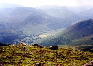
The top of Càrn Gorm has two high points. The true summit has a small cairn. A cairn is a pile of stones used as a marker. About 80 meters northwest is where an OS trig point used to be. A trig point is a concrete pillar used for surveying. This one has fallen over. It is now lying on its side. It is surrounded by a wind shelter. From the summit, the best views are to the south. You can see a great view of Glen Lyon. You can also see the Ben Lawers mountain range.
 | John T. Biggers |
 | Thomas Blackshear |
 | Mark Bradford |
 | Beverly Buchanan |


