Caddo Valley, Arkansas facts for kids
Quick facts for kids
Caddo Valley, Arkansas
|
|
|---|---|
 |
|

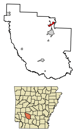
Location of Caddo Valley in Clark County, Arkansas.
|
|
| Country | United States |
| State | Arkansas |
| County | Clark |
| Area | |
| • Total | 3.11 sq mi (8.06 km2) |
| • Land | 3.10 sq mi (8.02 km2) |
| • Water | 0.01 sq mi (0.03 km2) |
| Elevation | 279 ft (85 m) |
| Population
(2020)
|
|
| • Total | 595 |
| • Density | 192.06/sq mi (74.15/km2) |
| Time zone | UTC-6 (Central (CST)) |
| • Summer (DST) | UTC-5 (CDT) |
| ZIP code |
71923
|
| Area code(s) | 870 |
| FIPS code | 05-10360 |
| GNIS feature ID | 2405355 |
Caddo Valley is a small town in Clark County, Arkansas. In 2010, about 635 people lived there.
Where is Caddo Valley?
Caddo Valley is in the northeast part of Clark County. It sits on the north side of the Caddo River. This is about 2 miles (3.2 km) west of where the Caddo River joins the Ouachita River. The town is also about 4 miles (6.4 km) north of Arkadelphia. Arkadelphia is the main city in Clark County.
The total area of Caddo Valley is about 3.1 square miles (8.0 square kilometers). Only a tiny part of this area, about 0.01 square miles (0.03 square kilometers), is water.
How Many People Live Here?
| Historical population | |||
|---|---|---|---|
| Census | Pop. | %± | |
| 1980 | 388 | — | |
| 1990 | 389 | 0.3% | |
| 2000 | 563 | 44.7% | |
| 2010 | 635 | 12.8% | |
| 2020 | 595 | −6.3% | |
| U.S. Decennial Census | |||
In 2000, there were 563 people living in Caddo Valley. These people lived in 242 different homes. About 150 of these were families. The town had about 74 people per square kilometer (191 people per square mile). There were 274 housing units, which are places where people can live.
Most people in Caddo Valley were White (about 87%). About 10% were Black or African American. A small number of people were Native American or from other backgrounds. About 1% of the people were Hispanic or Latino.
About 32% of homes had children under 18 living there. Nearly half of the homes (48%) were married couples living together. About 31% of all homes had just one person living there.
The average age of people in Caddo Valley was 28 years old. About 26% of the population was under 18. About 10% of the people were 65 or older. For every 100 females, there were about 99 males.
The average income for a home in Caddo Valley was $28,750. For families, the average income was $35,417. About 16% of all people and 10% of families lived below the poverty line. This included about 20% of children under 18.
Roads and Travel
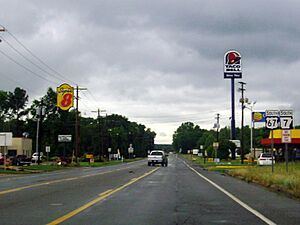
Caddo Valley became a town in 1974. It is an important place for highways. U.S. Route 67 goes through the town. It leads north about 4 miles (6.4 km) to Arkadelphia. It also goes northeast about 21 miles (34 km) to Malvern.
Interstate 30 also has an exit (Exit 78) in Caddo Valley. This interstate goes northeast about 64 miles (103 km) to Little Rock. It also goes southwest about 79 miles (127 km) to Texarkana.
Arkansas Highway 7 starts in Caddo Valley and goes north. It leads about 30 miles (48 km) to Hot Springs and Hot Springs National Park.
Caddo Valley is also close to some fun places. DeGray Dam is about 3 miles (4.8 km) north. DeGray Lake Resort State Park is about 5 miles (8.0 km) north. Because of this, Caddo Valley is sometimes called "The Gateway to DeGray Lake".
Schools
Students in Caddo Valley attend schools in the Arkadelphia School District. This district operates Arkadelphia High School.
See also
 In Spanish: Caddo Valley (Arkansas) para niños
 | Calvin Brent |
 | Walter T. Bailey |
 | Martha Cassell Thompson |
 | Alberta Jeannette Cassell |

