Texarkana, Arkansas facts for kids
Quick facts for kids
Texarkana, Arkansas
|
|||||
|---|---|---|---|---|---|
|
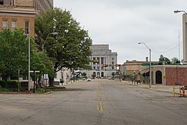
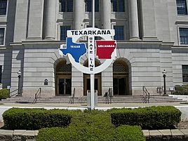
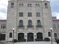
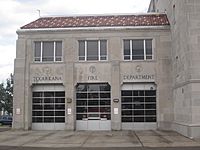
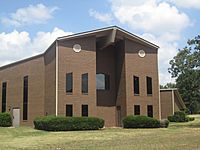
From top, left to right: Downtown, Augustus M. Garrison House, Texarkana City Hall, Texarkana state line
|
|||||
|
|||||
| Nickname(s):
The Arkansas Side, TXK
|
|||||
| Motto(s):
"Twice as Nice"
|
|||||
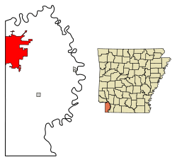
Location in Miller County, Arkansas
|
|||||
| Country | United States | ||||
| State | Arkansas | ||||
| County | Miller | ||||
| Incorporated | August 10, 1880 | ||||
| Government | |||||
| • Type | Council-Manager | ||||
| Area | |||||
| • Total | 42.21 sq mi (109.31 km2) | ||||
| • Land | 41.98 sq mi (108.72 km2) | ||||
| • Water | 0.23 sq mi (0.59 km2) | ||||
| Elevation | 358 ft (109 m) | ||||
| Population
(2020)
|
|||||
| • Total | 29,387 | ||||
| • Density | 700.06/sq mi (270.30/km2) | ||||
| Time zone | UTC−6 (Central (CST)) | ||||
| • Summer (DST) | UTC−5 (CDT) | ||||
| ZIP code |
71854
|
||||
| Area code(s) | 870 | ||||
| FIPS code | 05-68810 | ||||
| GNIS feature ID | 2405580 | ||||
Texarkana is a city in Arkansas, USA. It's the main city of Miller County, right on the state's southwest border. In 2020, about 29,387 people lived there. It's known as a "twin city" because it sits right next to Texarkana, Texas, just across the state line.
The city started on December 8, 1873, where two railroads met. It officially became a city in Arkansas on August 10, 1880. Texarkana, Arkansas, and Texarkana, Texas, together form the larger Texarkana area. In 2021, this area had about 147,174 people.
Texarkana is in a region called Ark-La-Tex, which is part of southwest Arkansas. It's located in the Piney Woods, a forest area with lots of oak and hickory trees. The city's economy mainly relies on farming. It has always been a big trading spot. First, it was important because major railroads crossed here. Now, three main Interstate highways meet in Texarkana: Interstate 30 (I-30), I-49, and the future I-69. The Red River Army Depot is the biggest employer in the city.
The Texarkana Arkansas School District is the largest public school system on the Arkansas side. The city also has a campus of the University of Arkansas Hope-Texarkana (UAHT). Texarkana College is located on the Texas side of the city.
Contents
History of Texarkana
Miller County was created in 1820 when Arkansas was a territory. It was named after James Miller, who was Arkansas' first governor and a general in the War of 1812. The Red River forms much of its eastern border.
Back then, people weren't sure where the exact border was between the county (and the United States) and Mexico. This caused some confusion for settlers. Many people living there felt that Arkansas was taxing land that might actually belong to Mexico. Also, some settlers didn't like how Mexico was treating Texans.
After the Texas Republic became independent from Mexico, things became even more unsettled. In 1838, Governor James Conway suggested getting rid of Miller County. He thought it would help make the area more loyal to Arkansas. So, Miller County was closed down, and its land became part of Lafayette County, Arkansas.
In 1873, land was sold in Texarkana, Arkansas, at a spot where two railroads crossed. This helped the town grow quickly as a trading center. During this time, railroads were becoming more important than rivers for moving goods and people. New towns were built in places that were good for railroads. The next year, in 1874, Texarkana, Texas, was founded on the rail line just across the state border.
That same year, Arkansas decided to bring back Miller County. The town in Arkansas tried to become an official city, but it didn't happen until October 17, 1880. This was almost seven years after Texarkana, Texas, was formed. Both Texarkana cities usually say December 8, 1873, is when they started.
Geography and Climate
Texarkana is about 143 miles southwest of Little Rock. It's also 72 miles north of Shreveport, Louisiana, and 180 miles northeast of Dallas, Texas.
The city covers a total area of about 42.2 square miles. Most of this (42.0 square miles) is land, and a small part (0.2 square miles) is water. The city's water mainly drains into Nix Creek. This creek flows southwest and joins Days Creek, which is part of the Sulphur River system that leads to the Red River.
Weather in Texarkana
The weather in Texarkana has hot, humid summers. Winters are usually mild to cool. Texarkana has a humid subtropical climate. This means it gets a lot of rain throughout the year.
| Climate data for Texarkana, Arkansas (Webb Field), 1991–2020 normals, extremes 1892–present | |||||||||||||
|---|---|---|---|---|---|---|---|---|---|---|---|---|---|
| Month | Jan | Feb | Mar | Apr | May | Jun | Jul | Aug | Sep | Oct | Nov | Dec | Year |
| Record high °F (°C) | 85 (29) |
90 (32) |
94 (34) |
95 (35) |
100 (38) |
108 (42) |
110 (43) |
117 (47) |
108 (42) |
104 (40) |
89 (32) |
84 (29) |
117 (47) |
| Mean maximum °F (°C) | 73.8 (23.2) |
76.2 (24.6) |
83.0 (28.3) |
86.4 (30.2) |
91.3 (32.9) |
95.9 (35.5) |
100.1 (37.8) |
100.7 (38.2) |
96.7 (35.9) |
90.1 (32.3) |
80.1 (26.7) |
74.8 (23.8) |
102.4 (39.1) |
| Mean daily maximum °F (°C) | 54.0 (12.2) |
58.2 (14.6) |
66.7 (19.3) |
74.5 (23.6) |
81.6 (27.6) |
88.7 (31.5) |
92.7 (33.7) |
92.8 (33.8) |
86.4 (30.2) |
76.0 (24.4) |
64.3 (17.9) |
55.7 (13.2) |
74.3 (23.5) |
| Daily mean °F (°C) | 44.6 (7.0) |
48.3 (9.1) |
56.0 (13.3) |
63.6 (17.6) |
71.6 (22.0) |
78.9 (26.1) |
82.5 (28.1) |
82.0 (27.8) |
75.4 (24.1) |
64.9 (18.3) |
53.9 (12.2) |
46.4 (8.0) |
64.0 (17.8) |
| Mean daily minimum °F (°C) | 35.1 (1.7) |
38.4 (3.6) |
45.2 (7.3) |
52.7 (11.5) |
61.6 (16.4) |
69.1 (20.6) |
72.3 (22.4) |
71.3 (21.8) |
64.5 (18.1) |
53.7 (12.1) |
43.6 (6.4) |
37.2 (2.9) |
53.7 (12.1) |
| Mean minimum °F (°C) | 19.0 (−7.2) |
24.6 (−4.1) |
29.7 (−1.3) |
37.2 (2.9) |
48.2 (9.0) |
60.4 (15.8) |
65.4 (18.6) |
64.5 (18.1) |
52.0 (11.1) |
38.5 (3.6) |
28.0 (−2.2) |
22.9 (−5.1) |
16.8 (−8.4) |
| Record low °F (°C) | −7 (−22) |
−9 (−23) |
11 (−12) |
24 (−4) |
35 (2) |
50 (10) |
56 (13) |
51 (11) |
37 (3) |
21 (−6) |
15 (−9) |
−1 (−18) |
−9 (−23) |
| Average precipitation inches (mm) | 3.64 (92) |
4.28 (109) |
4.45 (113) |
4.43 (113) |
5.10 (130) |
3.92 (100) |
3.37 (86) |
2.98 (76) |
3.60 (91) |
4.51 (115) |
3.91 (99) |
4.68 (119) |
48.87 (1,241) |
| Average snowfall inches (cm) | 1.6 (4.1) |
0.2 (0.51) |
0.0 (0.0) |
0.0 (0.0) |
0.0 (0.0) |
0.0 (0.0) |
0.0 (0.0) |
0.0 (0.0) |
0.0 (0.0) |
0.0 (0.0) |
0.0 (0.0) |
0.9 (2.3) |
2.7 (6.91) |
| Average precipitation days (≥ 0.01 in) | 8.2 | 9.6 | 10.4 | 8.9 | 9.8 | 8.2 | 6.7 | 6.4 | 6.3 | 7.2 | 8.7 | 9.3 | 99.7 |
| Average snowy days (≥ 0.1 in) | 0.6 | 0.3 | 0.0 | 0.0 | 0.0 | 0.0 | 0.0 | 0.0 | 0.0 | 0.0 | 0.0 | 0.3 | 1.2 |
| Source: NOAA (snow/snow days 1981–2010) | |||||||||||||
Population and People
| Historical population | |||
|---|---|---|---|
| Census | Pop. | %± | |
| 1880 | 1,390 | — | |
| 1890 | 3,528 | 153.8% | |
| 1900 | 4,914 | 39.3% | |
| 1910 | 5,655 | 15.1% | |
| 1920 | 8,257 | 46.0% | |
| 1930 | 10,764 | 30.4% | |
| 1940 | 11,821 | 9.8% | |
| 1950 | 15,875 | 34.3% | |
| 1960 | 19,788 | 24.6% | |
| 1970 | 21,682 | 9.6% | |
| 1980 | 21,459 | −1.0% | |
| 1990 | 22,631 | 5.5% | |
| 2000 | 26,448 | 16.9% | |
| 2010 | 29,919 | 13.1% | |
| 2020 | 29,387 | −1.8% | |
| U.S. Decennial Census | |||
Texarkana's Population in 2020
| Race | Number | Percentage |
|---|---|---|
| White (non-Hispanic) | 16,113 | 54.83% |
| Black or African American (non-Hispanic) | 10,347 | 35.21% |
| Native American | 158 | 0.54% |
| Asian | 175 | 0.6% |
| Pacific Islander | 2 | 0.01% |
| Other/Mixed | 1,348 | 4.59% |
| Hispanic or Latino | 1,244 | 4.23% |
In 2020, there were 29,387 people living in Texarkana. There were 11,404 households and 7,348 families.
Texarkana's Population in 2016
In 2016, about 30,283 people lived in the city. There were 13,565 households and 7,040 families. The city had about 830.5 people per square mile.
The people living in Texarkana were mostly:
- 65.93% White
- 31.00% Black or African American
- 0.48% Native American
- 0.50% Asian
- 0.03% Pacific Islander
- 0.61% from other backgrounds
- 1.46% from two or more backgrounds
About 1.78% of the population was Hispanic or Latino.
Out of all households, 32.5% had children under 18 living with them. About 45.3% were married couples. Around 18.7% were female householders without a husband. About 32.2% were not families.
The average household had 2.45 people, and the average family had 2.99 people.
The population was spread out by age:
- 25.9% were under 18
- 10.1% were 18 to 24
- 28.5% were 25 to 44
- 21.5% were 45 to 64
- 14.0% were 65 or older
The average age in the city was 35 years. For every 100 females, there were about 92 males.
The average income for a household was $31,343. For a family, it was $38,292. About 17.2% of families and 21.7% of all people lived below the poverty line. This included 33.0% of those under 18 and 15.7% of those 65 or older.
Education in Texarkana
Texarkana has public schools for students from elementary to high school. There are two main school districts:
- Texarkana Arkansas School District: Students here graduate from Arkansas High School. Their mascot is the Razorback. The University of Arkansas chose this mascot for the school a long time ago.
- Genoa Central School District: A very small part of the city is in this district. Students graduate from Genoa Central High School. Their mascot is the Dragon, and their school colors are green and white.
There are also private schools:
- Trinity Christian School: This is a Baptist school for students from pre-kindergarten through 12th grade.
In 2012, a branch of the University of Arkansas Community College at Hope opened in Texarkana. It's called the University of Arkansas Hope-Texarkana (UAHT). Since 2015, UAHT has worked with the University of Arkansas Little Rock. This allows students to earn bachelor's degrees through UALR Texarkana, with classes held on the UAHT campus.
Pop Culture Moments
- In 2016, a video of a Texarkana minister speaking up for LGBT rights became very popular online.
- Cornelius was a small sorghum plant that grew in a sidewalk crack in 2024. By October 2024, Cornelius had many followers on Facebook!
Notable People from Texarkana
Many interesting people have come from Texarkana:
- Buster Benton: A blues singer and guitarist.
- Ben M. Bogard: He started the American Baptist Association in 1924.
- Mike Cherry: A football player for the New York Giants.
- Willie Davis: A football player who won the Super Bowl with the Green Bay Packers.
- Martin Delray: A country music singer.
- Wayne Dowd: An Arkansas state senator and lawyer.
- Wilhelm L. Friedell: A U.S. Navy rear admiral and submariner who received the Navy Cross.
- Mike Huckabee: A former governor of Arkansas. He was a pastor at Beech Street First Baptist Church.
- Parnelli Jones: The champion of the 1963 Indianapolis 500 race.
- Scott Joplin: A famous composer and pianist known for ragtime music.
- Jeff Keith: The lead singer of the rock band Tesla.
- Dana Kimmell: An actress.
- A. Lynn Lowe: A farmer and former chairman of the Arkansas Republican Party.
- Jimmy Means: A NASCAR driver and team owner.
- Bryce Mitchell: A professional mixed martial artist who competes in the UFC.
- Dustin Moseley: A Major League Baseball player for the San Diego Padres.
- Conlon Nancarrow: A composer who wrote music for the player piano.
- Charles B. Pierce: A director and movie producer of films like The Legend of Boggy Creek.
- Don Rogers: A football player for the Cleveland Browns.
- Mike Ross: A former congressman from Arkansas.
- Max Sandlin: A former congressman from Texas.
- Rod Smith: A football player for the Denver Broncos who won two Super Bowls.
- Jasper Taylor: An early jazz drummer who recorded with famous musicians like Jelly Roll Morton.
- Jerry Turner: A former Major League Baseball outfielder.
- Dennis Woodberry: A football player who won the Super Bowl with the Washington Redskins.
See also
 In Spanish: Texarkana (Arkansas) para niños
 | Sharif Bey |
 | Hale Woodruff |
 | Richmond Barthé |
 | Purvis Young |


