Lafayette County, Arkansas facts for kids
Quick facts for kids
Lafayette County
|
|
|---|---|

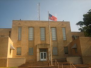
Lafayette County Courthouse, Lewisville
|
|

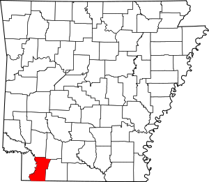
Location within the U.S. state of Arkansas
|
|
 Arkansas's location within the U.S. |
|
| Country | |
| State | |
| Founded | October 15, 1827 |
| Named for | Marquis de Lafayette |
| Seat | Lewisville |
| Largest town | Stamps |
| Area | |
| • Total | 545 sq mi (1,410 km2) |
| • Land | 528 sq mi (1,370 km2) |
| • Water | 17 sq mi (40 km2) 3.1%% |
| Population
(2020)
|
|
| • Total | 6,308 |
| • Density | 11.574/sq mi (4.469/km2) |
| Time zone | UTC−6 (Central) |
| • Summer (DST) | UTC−5 (CDT) |
| ZIP Codes |
71826, 71827, 71845, 71860, 71861
|
| Area code | 870 |
| Congressional district | 4th |
Lafayette County is a place in Arkansas, a state in the USA. It's called a county. In 2020, about 6,300 people lived there. This makes it one of the smallest counties in Arkansas by population.
The main town, called the county seat, is Lewisville. Lafayette County was started on October 15, 1827. It was named after the Marquis de Lafayette, a French hero who helped America in the American Revolutionary War.
This county is a "dry county." This means that stores and restaurants are not allowed to sell alcohol.
Contents
About Lafayette County's Land
Lafayette County covers about 545 square miles. Most of this area is land (528 square miles), and a small part (17 square miles) is water. It is the smallest county in Arkansas when you look at its total area.
Main Roads in Lafayette County
Here are some of the important roads that go through Lafayette County:
Neighboring Counties and Parishes
Lafayette County shares borders with several other counties and parishes:
- To the north: Hempstead County
- To the northeast: Nevada County
- To the east: Columbia County
- To the southeast: Webster Parish, Louisiana
- To the south: Bossier Parish, Louisiana
- To the southwest: Caddo Parish, Louisiana
- To the west: Miller County
People in Lafayette County
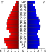
In 2020, there were 6,308 people living in Lafayette County. These people lived in 2,784 households, which are like homes or families. About 1,801 of these were families.
Most people in Lafayette County are White (about 61%). The next largest group is Black or African American (about 32%). There are also smaller groups of Native American, Asian, Pacific Islander, and people of mixed races. About 2% of the people are Hispanic or Latino.
Towns and Areas
Lafayette County has several towns and smaller areas called townships.
Towns
- Bradley
- Buckner
- Lewisville (This is the county seat, the main town)
- Stamps
Townships
Townships are smaller parts of a county. Here are the townships in Lafayette County: Townships in Arkansas are the divisions of a county. Each township includes unincorporated areas; some may have incorporated cities or towns within part of their boundaries. Arkansas townships have limited purposes in modern times. However, the United States Census does list Arkansas population based on townships (sometimes referred to as "county subdivisions" or "minor civil divisions"). Townships are also of value for historical purposes in terms of genealogical research. Each town or city is within one or more townships in an Arkansas county based on census maps and publications. The townships of Lafayette County are listed below; listed in parentheses are the cities, towns, and/or census-designated places that are fully or partially inside the township.
- Baker (This includes most of Stamps)
- French
- Hadley (This includes Buckner and a small part of Stamps)
- La Grange (This includes a small part of Lewisville)
- Mars Hill
- Roane (This includes Bradley)
- Russell
- Steel (This includes most of Lewisville)
- Walker Creek
Schools in Lafayette County
There are two main school districts in Lafayette County:
- Lafayette County School District
- Emerson-Taylor-Bradley School District
The Bradley School District used to be a separate district, but it joined with Emerson-Taylor-Bradley in 2013.
See also
 In Spanish: Condado de Lafayette (Arkansas) para niños
 | Jessica Watkins |
 | Robert Henry Lawrence Jr. |
 | Mae Jemison |
 | Sian Proctor |
 | Guion Bluford |


