Nevada County, Arkansas facts for kids
Quick facts for kids
Nevada County
|
|
|---|---|

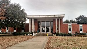
Nevada County Courthouse in Prescott
|
|

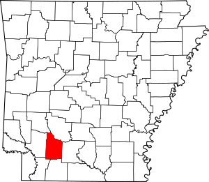
Location within the U.S. state of Arkansas
|
|
 Arkansas's location within the U.S. |
|
| Country | |
| State | |
| Founded | March 20, 1871 |
| Named for | state of Nevada |
| Seat | Prescott |
| Largest city | Prescott |
| Area | |
| • Total | 621 sq mi (1,610 km2) |
| • Land | 618 sq mi (1,600 km2) |
| • Water | 2.8 sq mi (7 km2) 0.5%% |
| Population
(2020)
|
|
| • Total | 8,310 |
| • Density | 13.382/sq mi (5.167/km2) |
| Time zone | UTC−6 (Central) |
| • Summer (DST) | UTC−5 (CDT) |
| Congressional district | 4th |
Nevada County (/nəˈveɪ.də/ nə-VAY-də) is a county in the southwestern part of Arkansas. In 2020, about 8,310 people lived there. This is much less than its highest population in 1920.
The main town and county seat is Prescott. Nevada County was created on March 20, 1871. It was formed from parts of Hempstead, Ouachita, and Columbia counties. It is Arkansas's 63rd county. The county was named after the state of Nevada. This is because its shape, when flipped, looks a bit like the state's border.
Contents
History of Nevada County
Long ago, the Caddoan Confederacy lived in this area. Their lands stretched into what is now Texas and Louisiana. They settled along rivers and used them for travel and fishing.
Later, French and European-American settlers also moved to lands near the waterways. These rivers were important for transportation until the late 1800s.
Geography of Nevada County
Nevada County covers about 621 square miles (1,608 km²). Most of this area, 618 square miles (1,601 km²), is land. Only a small part, 2.8 square miles (7.3 km²), is water.
The Little Missouri River forms the northern border. This river is a branch of the Ouachita River. Many smaller streams also flow through the county. These streams lead to the Ouachita River or the Red River. Nevada County is often seen as part of South Arkansas or Southwest Arkansas.
Main Roads in Nevada County
 Interstate 30
 U.S. Highway 67
 U.S. Highway 278
 U.S. Highway 371
 Highway 19
 Highway 24
 Highway 32
 Highway 51
 Highway 53
Neighboring Counties
Nevada County shares borders with six other counties:
- Clark County (to the northeast)
- Ouachita County (to the east)
- Columbia County (to the south)
- Lafayette County (to the southwest)
- Hempstead County (to the west)
- Pike County (to the northwest)
Population Changes in Nevada County
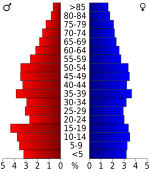
The number of people living in Nevada County dropped a lot from 1920 to 1970. This happened because farming became more automated. Also, the lumber industry had fewer jobs. Many African Americans moved away during the Great Migration. They went to cities in the Midwest and West for better jobs and more freedom.
| Historical population | |||
|---|---|---|---|
| Census | Pop. | %± | |
| 1880 | 12,959 | — | |
| 1890 | 14,832 | 14.5% | |
| 1900 | 16,609 | 12.0% | |
| 1910 | 19,344 | 16.5% | |
| 1920 | 21,934 | 13.4% | |
| 1930 | 20,407 | −7.0% | |
| 1940 | 19,869 | −2.6% | |
| 1950 | 14,781 | −25.6% | |
| 1960 | 10,700 | −27.6% | |
| 1970 | 10,111 | −5.5% | |
| 1980 | 11,097 | 9.8% | |
| 1990 | 10,101 | −9.0% | |
| 2000 | 9,955 | −1.4% | |
| 2010 | 8,997 | −9.6% | |
| 2020 | 8,310 | −7.6% | |
| 2023 (est.) | 8,120 | −9.7% | |
| U.S. Decennial Census 1790–1960 1900–1990 1990–2000 2010 |
|||
2020 Census Information
| Race | Number | Percent |
|---|---|---|
| White (not Hispanic) | 5,145 | 61.91% |
| Black or African American (not Hispanic) | 2,433 | 29.28% |
| Native American | 37 | 0.45% |
| Asian | 41 | 0.49% |
| Other/Mixed | 300 | 3.61% |
| Hispanic or Latino | 354 | 4.26% |
In 2020, there were 8,310 people living in the county. There were 3,397 households and 2,263 families.
Towns and Communities
Nevada County has several cities and towns.
Cities in Nevada County
Towns in Nevada County
- Bluff City
- Bodcaw
- Cale
- Rosston
- Willisville
- Falcon
Special Places (CDP)
- Reader is a Census-designated place. This means it's a community that the Census Bureau counts separately.
County Townships
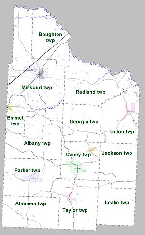
Townships in Arkansas are the divisions of a county. Each township includes unincorporated areas; some may have incorporated cities or towns within part of their boundaries. Arkansas townships have limited purposes in modern times. However, the United States Census does list Arkansas population based on townships (sometimes referred to as "county subdivisions" or "minor civil divisions"). Townships are also of value for historical purposes in terms of genealogical research. Each town or city is within one or more townships in an Arkansas county based on census maps and publications. The townships of Nevada County are listed below; listed in parentheses are the cities, towns, and/or census-designated places that are fully or partially inside the township.
- Alabama
- Albany
- Boughton
- Caney (Cale, Rosston)
- Emmet (Emmet)
- Georgia
- Jackson
- Leake
- Missouri (Prescott)
- Parker (Bodcaw)
- Redland
- Taylor (Willisville)
- Union (Bluff City, Reader)
See also
 In Spanish: Condado de Nevada (Arkansas) para niños
 | Misty Copeland |
 | Raven Wilkinson |
 | Debra Austin |
 | Aesha Ash |


