
Columbia County, Arkansas facts for kids
Quick facts for kids
Columbia County
|
|
|---|---|

Columbia County Courthouse in Magnolia
|
|

Location within the U.S. state of Arkansas
|
|
 Arkansas's location within the U.S. |
|
| Country | |
| State | |
| Founded | December 17, 1852 |
| Named for | Christopher Columbus |
| Seat | Magnolia |
| Largest city | Magnolia |
| Area | |
| • Total | 767 sq mi (1,990 km2) |
| • Land | 766 sq mi (1,980 km2) |
| • Water | 0.7 sq mi (2 km2) 0.1%% |
| Population
(2020)
|
|
| • Total | 22,801 |
| • Density | 29.728/sq mi (11.478/km2) |
| Time zone | UTC−6 (Central) |
| • Summer (DST) | UTC−5 (CDT) |
| Congressional district | 4th |
Columbia County is a place in Arkansas, a state in the United States. In 2020, about 22,801 people lived here. The main town, or county seat, is Magnolia. Columbia County was created on December 17, 1852. It was named after the famous explorer, Christopher Columbus. The whole county is part of the Magnolia, AR Micropolitan Statistical Area.
Contents
Exploring Columbia County's Geography
Columbia County covers about 767 square miles. Most of this area, 766 square miles, is land. Only a tiny part, 0.7 square miles, is water. This county is located in the southern part of Arkansas.
Did you know? Columbia County, along with Union County, has the biggest supply of Bromine in the United States. Bromine is a special chemical element.
The Dorcheat Bayou is a stream that flows through Columbia County. It starts in Nevada County and goes south into Webster Parish, Louisiana. It then empties into Lake Bistineau.
Neighboring Counties and Parishes
Columbia County shares its borders with several other counties and parishes:
- Nevada County (to the north)
- Ouachita County (to the northeast)
- Union County (to the east)
- Claiborne Parish, Louisiana (to the southeast)
- Webster Parish, Louisiana (to the south)
- Lafayette County (to the west)
People of Columbia County
| Historical population | |||
|---|---|---|---|
| Census | Pop. | %± | |
| 1860 | 12,449 | — | |
| 1870 | 11,397 | −8.5% | |
| 1880 | 14,090 | 23.6% | |
| 1890 | 19,893 | 41.2% | |
| 1900 | 22,077 | 11.0% | |
| 1910 | 23,820 | 7.9% | |
| 1920 | 27,670 | 16.2% | |
| 1930 | 27,320 | −1.3% | |
| 1940 | 29,822 | 9.2% | |
| 1950 | 28,770 | −3.5% | |
| 1960 | 26,400 | −8.2% | |
| 1970 | 25,952 | −1.7% | |
| 1980 | 26,644 | 2.7% | |
| 1990 | 25,691 | −3.6% | |
| 2000 | 25,603 | −0.3% | |
| 2010 | 24,552 | −4.1% | |
| 2020 | 22,801 | −7.1% | |
| 2023 (est.) | 22,150 | −9.8% | |
| U.S. Decennial Census 1790–1960 1900–1990 1990–2000 2010 |
|||

In 2020, the census counted 22,801 people living in Columbia County. There were 8,562 households and 5,559 families.
Getting Around: Transportation in Columbia County

Columbia County has several important roads and an airport.
Major Roads
Here are some of the main highways that go through Columbia County:
 Future Interstate 69
 U.S. Highway 79
 U.S. Highway 82
 U.S. Highway 371
 Highway 19
 Highway 98
 Highway 160
Local Airports
The Magnolia Municipal Airport is an airport in Columbia County. It is owned by the city of Magnolia. The airport is located about 6 kilometers southeast of Magnolia's main business area.
Communities in Columbia County
Columbia County has several cities, towns, and smaller communities.
Cities
- Magnolia (This is the county seat, the main town where the county government is located.)
Towns
Unincorporated Communities
These are smaller places that are not officially cities or towns:
Townships

Townships are smaller areas within a county. Here are some in Columbia County:
Education in Columbia County
Several school districts serve the students in Columbia County:
- Emerson-Taylor-Bradley School District
- Lafayette County School District (This district was formed in 2003 when the Lewisville and Stamps school districts joined together.)
- Magnolia School District
- Smackover-Norphlet School District (This district used to be called Smackover School District. The Norphlet School District joined it in 2014.)
Some school districts have changed over time:
- The Emerson-Taylor School District was formed in 2004. It combined the Emerson and Taylor school districts. In 2013, the Bradley School District also joined, and it became the Emerson-Taylor-Bradley School District.
- The Stephens School District closed in 2014. The part of it in Columbia County became part of the Magnolia district.
- The Waldo School District joined the Magnolia district in 2006.
Images for kids
-
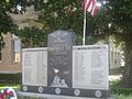
Columbia County Veterans Memorial on courthouse lawn in Magnolia

See also
 In Spanish: Condado de Columbia (Arkansas) para niños
