Bossier Parish, Louisiana facts for kids
Quick facts for kids
Bossier Parish
|
|
|---|---|
| Parish of Bossier | |

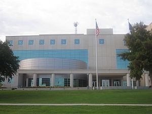
Renovated Bossier Parish Courthouse in Benton
|
|

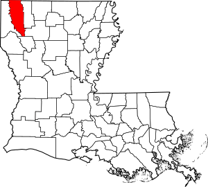
Location within the U.S. state of Louisiana
|
|

Louisiana's location within the U.S.
|
|
| Country | |
| State | |
| Region | North Louisiana |
| Founded | February 24, 1843 |
| Named for | Pierre Bossier |
| Parish seat | Benton |
| Largest city | Bossier City |
| Area | |
| • Total | 2,250 km2 (867 sq mi) |
| • Land | 2,200 km2 (840 sq mi) |
| • Water | 70 km2 (27 sq mi) |
| • percentage | 8 km2 (3.1 sq mi) |
| Population
(2020)
|
|
| • Total | 128,746 |
| • Density | 57.33/km2 (148.50/sq mi) |
| Time zone | UTC-6 (CST) |
| • Summer (DST) | UTC-5 (CDT) |
| Area code | 318 |
| Congressional district | 4th |
Bossier Parish is a special kind of county called a parish in the northwestern part of Louisiana. In 2020, about 128,746 people lived here.
The main town where the parish government is located is Benton. The biggest city in the parish is Bossier City. It sits on the east side of the Red River, right across from Shreveport.
Bossier Parish was created in 1843. It used to be part of Claiborne Parish. Today, Bossier Parish is part of the larger Shreveport–Bossier City area. This is the biggest city area in North Louisiana.
You can find parts of Lake Bistineau and Lake Bistineau State Park in Bossier Parish. They also stretch into nearby Webster and Bienville parishes. The Loggy Bayou river flows from Lake Bistineau through Bossier Parish. It eventually joins the Red River.
Contents
Exploring Bossier Parish History
Bossier Parish is named after Pierre Bossier. He was a French-speaking politician from the 1800s. He served in the Louisiana state senate and the U.S. House of Representatives.
During the American Civil War, there was no fighting directly in Bossier Parish. In July 1861, at the start of the war, the local government helped families of soldiers. They set aside $35,000 to support them. This was a lot of money back then.
After the war, the area faced many challenges. People worked to rebuild and create a new way of life.
Geography and Location
Bossier Parish covers about 867 square miles. Most of this area, about 840 square miles, is land. The remaining 27 square miles, or 3.1%, is water. Just four miles east of Bossier City, you'll find Barksdale Air Force Base.
Main Roads in Bossier Parish
Getting around Bossier Parish is easy with these major highways:
 Interstate 20
 Future Interstate 69
 U.S. Highway 71
 U.S. Highway 79
 U.S. Highway 80
 Louisiana Highway 2
 Louisiana Highway 3
Neighboring Areas
Bossier Parish shares borders with several other parishes and counties:
- Miller County, Arkansas (to the northwest)
- Lafayette County, Arkansas (to the north)
- Webster Parish (to the east)
- Bienville Parish (to the southeast)
- Red River Parish (to the south)
- Caddo Parish (to the west)
Protected Natural Areas
Part of the Red River National Wildlife Refuge is located in Bossier Parish. This area helps protect wildlife and their habitats.
Communities and Towns
Bossier Parish has several towns and cities where people live.
Cities in Bossier Parish
- Bossier City (This is the largest city in the parish.)
- Shreveport (A small part of Shreveport is also in Bossier Parish.)
Towns in Bossier Parish
- Benton (This is the parish seat, where the main government offices are.)
- Haughton
- Plain Dealing (This is the smallest town in the parish.)
Unincorporated Areas
These are areas that are not part of an official city or town.
Census-designated places
Other Communities
- Elm Grove
- Fillmore
- Princeton
- Taylortown
Population and People
| Historical population | |||
|---|---|---|---|
| Census | Pop. | %± | |
| 1850 | 6,962 | — | |
| 1860 | 11,348 | 63.0% | |
| 1870 | 12,675 | 11.7% | |
| 1880 | 16,042 | 26.6% | |
| 1890 | 20,330 | 26.7% | |
| 1900 | 24,153 | 18.8% | |
| 1910 | 21,738 | −10.0% | |
| 1920 | 22,266 | 2.4% | |
| 1930 | 28,388 | 27.5% | |
| 1940 | 33,162 | 16.8% | |
| 1950 | 40,139 | 21.0% | |
| 1960 | 57,622 | 43.6% | |
| 1970 | 64,519 | 12.0% | |
| 1980 | 80,721 | 25.1% | |
| 1990 | 86,088 | 6.6% | |
| 2000 | 98,310 | 14.2% | |
| 2010 | 116,979 | 19.0% | |
| 2020 | 128,746 | 10.1% | |
| U.S. Decennial Census 1790-1960 1900-1990 1990-2000 2010 |
|||
In 2020, the population of Bossier Parish was 128,746 people. There were about 49,735 households. The population density was about 142 people per square mile.
The people living in Bossier Parish come from many different backgrounds. In 2020, about 61.35% of the people were non-Hispanic white. About 23.2% were African American. Other groups included Native American, Asian, Pacific Islander, and people of two or more races. About 7.95% of the population identified as Hispanic or Latino.
National Guard Units
Bossier City is home to two important military units. The 165th CSS (Combat Service Support) Battalion is based here. This unit helps provide supplies and support to soldiers. It was sent to Iraq in 2008.
Also in Bossier City is the 156th Army Band. This band deployed to Iraq in 2010 as part of the 256th Infantry Brigade.
Education in Bossier Parish
The Bossier Parish School Board runs the public schools in the parish. This includes elementary, middle, and high schools.
For higher education, students can attend local colleges. These include Bossier Parish Community College and Northwest Louisiana Technical Community College.
Famous People from Bossier Parish
Many interesting people have connections to Bossier Parish. Here are a few:
- William Benton Boggs (1854–1922), the first mayor of Plain Dealing.
- George Dement, a former mayor of Bossier City.
- Mike Johnson, the Speaker of the U.S. House of Representatives.
- Jerry Miculek, a professional shooter with many world records.
- Booker T, a well-known professional wrestler.
- Jared Leto, a famous actor and singer.
- Shannon Leto, the drummer for the band Thirty Seconds to Mars.
- Dak Prescott, a professional football quarterback in the NFL.
- Joe Delaney, a professional football player who received the Presidential Citizen's Medal.
- Jesse Winchester, a talented musician and songwriter.
Images for kids
See also
 In Spanish: Parroquia de Bossier para niños
 | Victor J. Glover |
 | Yvonne Cagle |
 | Jeanette Epps |
 | Bernard A. Harris Jr. |


