Caher Island facts for kids
|
Native name:
Cathair na Naomh
|
|
|---|---|

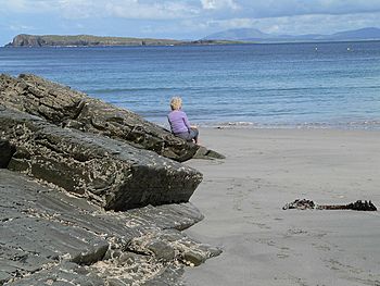
Looking towards Caher Island from Inishturk
|
|
|
Caher Island (Ireland)
|
|
| Geography | |
| Location | Atlantic Ocean |
| Coordinates | 53.°43.3′N 10°1.38′W / 53.7217°N 10.02300°W |
| Archipelago | Clew Bay |
| Total islands | 117 |
| Major islands | Clare Island, Inishturk, Inishbofin, Inishark, Achillbeg, Caher Island |
| Area | 128 acres (52 ha) |
| Highest elevation | 61 m (200 ft) |
| Highest point | Unnamed Peak |
| Administration | |
| Province | Connacht |
| County | Mayo |
| Demographics | |
| Population | 0 |
| Pop. density | 0 /km2 (0 /sq mi) |
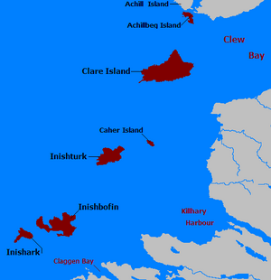
Caher Island, also known as Cathair na Naomh in Irish, is a small island located off the coast of County Mayo in Ireland. It's an uninhabited island, meaning no one lives there permanently. You can find it between two bigger islands, Clare Island and Inishturk.
What's in a Name?
The name Cathair na Naomh comes from the Irish language. It means the City of the Saints. This name hints at the island's special religious history.
Island History
Caher Island has been a special place for pilgrimage for a very long time. People still visit it today for this reason. Every year on August 15th, which is the Feast of the Assumption, there is a special pilgrimage to the island.
The island is home to an Early Christian monastery. You can still see the remains of a small chapel there, surrounded by an old enclosure. There are also several carved stone slabs. It seems the island was once a quiet place for hermitages, where monks from the seventh century lived and prayed.
Getting to the Island
You can reach Caher Island by boat, usually from the nearby island of Inishturk. It's best to approach the island with a small boat, like a currach, from the east. This spot is marked as Portatemple on maps.
However, this area is not a safe harbour. Even on calm days, big waves from the Atlantic Ocean can break through. Maps for the area warn that the entire sea up to 4 miles offshore can have unexpected breaking waves, even when the weather seems good. This means that even moderate waves can suddenly become very large and dangerous.
 | Delilah Pierce |
 | Gordon Parks |
 | Augusta Savage |
 | Charles Ethan Porter |


