
California Historical Landmarks in Orange County facts for kids
Orange County, California, is a vibrant place known for its beaches and theme parks. But did you know it's also full of amazing history? All around Orange County, you can find special places called California Historical Landmarks. These are spots that are important because of what happened there or what they represent. They help us remember the past and understand how Orange County grew into the place it is today.
These landmarks include old buildings, important natural sites, and places where big events happened. Exploring them is like taking a trip back in time! You can learn about the first people who lived here, the early settlers, and even famous leaders.
Contents
Discovering Orange County's History
Orange County is home to many fascinating historical landmarks. Each one tells a unique story about the area's past, from its earliest days to more recent times. Let's explore some of these special places.
Famous Landmarks to Explore
Anaheim Landing

This landmark in Seal Beach marks the spot where the first settlers of Anaheim landed in 1857. They came by ship, bringing supplies to start their new community. It was their main connection to the outside world before railroads were built. Imagine what it was like for those early pioneers arriving here!
Balboa Pavilion

The Balboa Pavilion is a famous building located in Newport Beach. It was built way back in 1906 and is one of California's oldest surviving waterfront buildings. For over a century, it has been a popular spot for fun and entertainment. It's a great example of early 20th-century architecture and a symbol of Newport Beach's history as a seaside resort.
Mission San Juan Capistrano

The Mission San Juan Capistrano is one of the most famous landmarks in California. Founded in 1776, it's the seventh of the 21 Spanish missions built in California. It's known for its beautiful architecture, peaceful gardens, and the legend of the swallows that return every year. This mission played a huge role in the early history of California and the local Native American communities.
Old Maizeland School

Located at Knott's Berry Farm in Buena Park, the Old Maizeland School is a real schoolhouse from 1868. It was originally in the community of Maizeland. It was moved to Knott's Berry Farm to preserve its history. This landmark gives us a peek into what school was like for kids over 150 years ago!
Richard Nixon Birthplace

In Yorba Linda, you can visit the Richard Nixon Presidential Library and Museum, which includes the small house where the 37th President of the United States, Richard Nixon, was born in 1913. It's a humble home that shows where a future president's journey began.
Old Orange County Courthouse

The Old Orange County Courthouse in Santa Ana was built in 1901. It's a beautiful example of Romanesque Revival architecture. For many years, it was the main center for justice and government in Orange County. It's now a museum where you can learn about the county's history and legal system.
Diego Sepúlveda Adobe

The Diego Sepúlveda Adobe in Costa Mesa is one of the oldest homes in Orange County. It was built in 1868 and is a great example of an adobe house from that time. It shows how early settlers lived and built their homes using natural materials.
McFadden Wharf

The McFadden Wharf was a very important pier in Newport Beach. Built in 1889, it was a busy place where goods and people arrived and departed by ship. It helped Newport Beach grow into a thriving port. Today, the Newport Pier stands near its original location.
Images for kids
-
Barton Mound site, which is now unmarked.
-
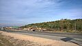
Black Star Canyon, an important Native American village site.
-
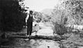
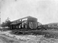
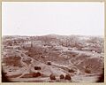
A historical photo near Carbondale.
-
Dana Point, a historic coastal landmark.
-
The Don Bernardo Yorba Hacienda.
-
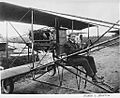
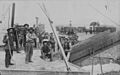
Glenn L. Martin in his pusher-biplane, related to the first water-to-water flight.
-
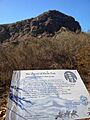
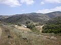
Flores Peak, a historic natural landmark.
-
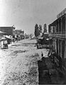
The North gate of the city of Anaheim in 1879.
-
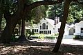
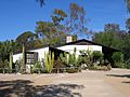
The Modjeska House, home of a famous actress.
-
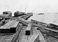
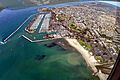
Old Landing in Newport Beach, showing McFadden Wharf.
-
Old Town Irvine, a historic district.
-
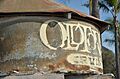
Oil wells in Olinda around 1900.
-
The Pioneer House of the Mother Colony in Anaheim.
-
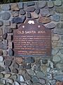
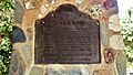
California Historical Landmark 204 marker for Old Santa Ana.
-
Farming on the Irvine Ranch near Red Hill in the 1890s.
-
The historic Serrano Adobe.
-
Silverado, a historic district.


