Canal Fulton, Ohio facts for kids
Quick facts for kids
Canal Fulton, Ohio
|
|
|---|---|

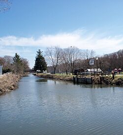
Along the Ohio and Erie Canal
|
|

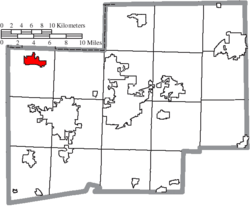
Location of Canal Fulton in Stark County
|
|
| Country | United States |
| State | Ohio |
| County | Stark |
| Area | |
| • Total | 3.48 sq mi (9.00 km2) |
| • Land | 3.41 sq mi (8.84 km2) |
| • Water | 0.06 sq mi (0.16 km2) |
| Elevation | 971 ft (296 m) |
| Population
(2020)
|
|
| • Total | 5,325 |
| • Estimate
(2023)
|
5,333 |
| • Density | 1,561.13/sq mi (602.70/km2) |
| Time zone | UTC-05:00 (Eastern (EST)) |
| • Summer (DST) | UTC-04:00 (EDT) |
| ZIP code |
44614
|
| Area code(s) | 330 |
| FIPS code | 39-11304 |
| GNIS feature ID | 2393726 |
Canal Fulton is a city in western Stark County, Ohio, United States. It is located along the Tuscarawas River. In 2020, about 5,325 people lived there. The city is part of the larger Canton–Massillon metropolitan area.
Contents
History of Canal Fulton
Canal Fulton's story began with three small villages along the Tuscarawas River. One village was called Milan, started in 1814 by Matthew Rowland. It was the first settlement west of the Tuscarawas River in Stark County. Another village, Fulton, began in 1826. It later changed its name to Canal Fulton in 1832. The name "Canal Fulton" combines the Ohio Canal and the name of an early settler, Ben Fulton. In 1843, President John Quincy Adams even visited the area.
Early Land and People
The land where Canal Fulton now stands was once home to many Native American tribes. These included the Wyandot, Lenape (Delaware), and Shawnee peoples, among others. Over time, the United States made agreements with these tribes. These agreements, called treaties, opened up the land for new settlers.
For example, the Treaty of Fort McIntosh in 1785 and the Treaty of Fort Industry in 1805 were important. They led to land being divided and sold to new settlers. By 1818, all lands in Ohio were part of the United States.
Life on the Frontier
Life for early settlers in this area was challenging. They faced wild animals and difficult travel. Settlers often arrived by canoe or on foot. Some used ox-drawn carts on rough roads. These roads were often old trails made by Native Americans.
How Land Was Divided
Before settlers arrived, surveyors carefully measured the land. This was done according to the Land Ordinance of 1785. This law created square areas of land called townships. Each township was six miles by six miles. Townships were then divided into smaller, one-square-mile sections. Each section had 640 acres.
Some sections were set aside for special purposes. For example, Section Sixteen in every township was for a public school. Other sections were reserved for soldiers who fought in the American Revolutionary War. The rest of the land was sold at public auctions.
Milan: The First Village
Matthew Rowland bought one of these land sections in 1814. He then planned out a town with 79 lots. He named this new town Milan, after a city in Italy. It was common back then to name new American towns after European cities.
Rowland's son-in-law built the first building in Milan, a log cabin. Rowland also built a gristmill and a sawmill. Milan was the only village in Lawrence Township for a while. This township was named after Captain James Lawrence. His famous words, "Don't Give up the Ship," became the township's motto.
The Canal's Impact
The Ohio Canal was built between 1826 and 1828. This brought many workers to the area. A new town, Fulton, grew on the other side of the river from Milan. Fulton became more important than Milan because of the canal. That's why "Canal" was added to its name.
Later, the railroad came, which also changed things. But eventually, main highways favored the Fulton side of the river. Milan was absorbed into Canal Fulton in 1853. Today, Milan is a quiet residential area within Canal Fulton.
Growth and Development
Canal Fulton saw many changes over the years:
- 1850: The first permanent community school opened. Railroad operations also began.
- 1853: Canal Fulton officially absorbed the villages of Milan and West Fulton.
- 1855: The Union School building was finished. It had two rooms for 100 students.
- 1869: Railroad construction was completed on the west side of the river.
- 1874: Canal Fulton approved its fire department. They got a modern steam-operated pumper.
- 1875: Sts. Philip and James School was founded.
- 1886: A new school was built to teach students through 12th grade.
Geography
Canal Fulton is located along the Tuscarawas River. The United States Census Bureau states that the city covers about 3.32 square miles (8.60 square kilometers). Most of this area is land, with a small part being water.
Population Information
| Historical population | |||
|---|---|---|---|
| Census | Pop. | %± | |
| 1870 | 1,048 | — | |
| 1880 | 1,196 | 14.1% | |
| 1890 | 1,173 | −1.9% | |
| 1900 | 1,172 | −0.1% | |
| 1910 | 978 | −16.6% | |
| 1920 | 1,057 | 8.1% | |
| 1930 | 1,160 | 9.7% | |
| 1940 | 1,115 | −3.9% | |
| 1950 | 1,258 | 12.8% | |
| 1960 | 1,555 | 23.6% | |
| 1970 | 2,367 | 52.2% | |
| 1980 | 3,481 | 47.1% | |
| 1990 | 4,157 | 19.4% | |
| 2000 | 5,061 | 21.7% | |
| 2010 | 5,479 | 8.3% | |
| 2020 | 5,325 | −2.8% | |
| 2023 (est.) | 5,333 | −2.7% | |
| Sources: | |||
2020 Census Details
In 2020, Canal Fulton had 5,325 people living in 2,294 households. The average household had about 2.25 people.
- About 19.7% of the people were 65 years or older.
- About 16.4% were under 18 years old.
- Most residents (97%) were White.
- About 1.3% of the population was Hispanic or Latino.
- Most adults (95.8%) had finished high school or higher education.
- About 27.5% had a college degree or more.
2010 Census Details
In 2010, the city had 5,479 people living in 2,186 households.
- About 32.3% of households had children under 18.
- Most households (52.4%) were married couples.
- The average age in the city was 40.3 years.
- About 23.1% of residents were under 18.
- About 17.6% were 65 or older.
- The population was 47.2% male and 52.8% female.
See also
 In Spanish: Canal Fulton (Ohio) para niños
 | Valerie Thomas |
 | Frederick McKinley Jones |
 | George Edward Alcorn Jr. |
 | Thomas Mensah |


