Canas, Ponce, Puerto Rico facts for kids
Quick facts for kids
Canas
|
|
|---|---|

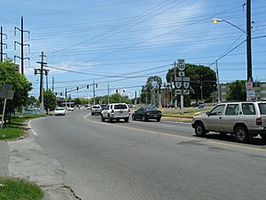
Scene in Barrio Canas at PR-585 and PR-2
|
|

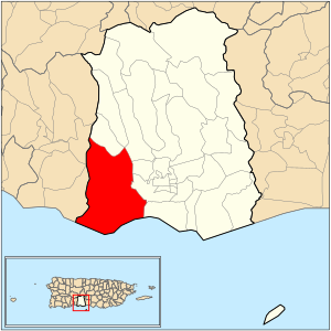
Location of barrio Canas within the municipality of Ponce shown in red
|
|
| Commonwealth | |
| Municipality | |
| Area | |
| • Total | 22.82 sq mi (59.1 km2) |
| • Land | 14.47 sq mi (37.5 km2) |
| • Water | 8.35 sq mi (21.6 km2) |
| Elevation | 217 ft (66 m) |
| Population
(2010)
|
|
| • Total | 32,708 |
| • Density | 2,260.4/sq mi (872.7/km2) |
| Source: 2010 Census | |
| Time zone | UTC−4 (AST) |
Canas is one of the 31 barrios (neighborhoods or districts) in the city of Ponce, Puerto Rico. It's a special place because it's one of Ponce's nine barrios that share a border with another city, Peñuelas. Canas is also one of Ponce's five barrios that touch the ocean. It was first settled a long time ago, around 1831.
Contents
Where is Canas?
Canas is located in the southern part of Ponce. It's west of the main city area. You can find it at about 18 degrees North latitude and 66.6 degrees West longitude. It has both flat areas and some hills.
What's in a Name?
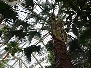
The name "Canas" might come from the native people who lived there long ago. However, some historians believe it comes from a special palm tree called Palma Cana (scientific name: Sabal domingensis). These palm trees were very common in the area. People used their leaves to make things like sombreros (hats). Canas was first settled by people who grew tobacco plants, even as far back as the 1680s.
What are its Borders?
Canas has many neighbors! To the north, it's bordered by hills and roads like PR-132. To the south, it meets the beautiful Caribbean Sea. On the west side, you'll find the El Peñón de Ponce (a rocky hill) and more hills. To the east, it's bordered by other hills and two rivers, the Río Pastillo and Río Matilde.
When we talk about other barrios, Canas is next to Quebrada Limón and Portugués to the north. To the west, it borders parts of Peñuelas. To the east, it's next to Magueyes, Magueyes Urbano, Canas Urbano, and Playa.
What's Canas Like?
Canas is a large area, covering about 14.5 square miles of land and 8.3 square miles of water. It's divided into smaller sections called Baldorioty de Castro, Clausells, and Reparada. Many communities are part of Canas, like Jardines del Caribe and El Tuque.
Canas is the barrio in Ponce with the most people! In 2010, about 32,708 people lived there. It also has the longest coastline of all the barrios in Ponce, meaning it has a lot of beach area.
Some important roads that run through Canas include PR-2 and PR-132. The highest point in Canas is a hill that reaches 918 feet high. There's also a cool rocky hill near the coast called Penon de Ponce, which is 331 feet tall.
Cool Places to Visit
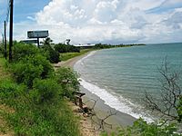
Canas is home to some neat spots! You can visit the Salinas Lagoon, which is a natural area. El Tuque Beach is also located here, perfect for enjoying the sun and sand. The Francisco Parra Duperón school is also found in this barrio.
See Also
 In Spanish: Canas (Ponce) para niños
- List of communities in Puerto Rico
 | Mary Eliza Mahoney |
 | Susie King Taylor |
 | Ida Gray |
 | Eliza Ann Grier |


