
Candy Mountain (Washington) facts for kids
Quick facts for kids Candy Mountain |
|
|---|---|

Candy Mountain
Location in Washington (state)
|
|
| Highest point | |
| Elevation | 1,394 ft (425 m) NAVD 88 |
| Prominence | 536 ft (163 m) |
| Isolation | 2.76 mi (4.44 km) |
| Geography | |
| Location | West Richland, Benton County, Washington, U.S. |
| Parent range | Columbia River Plateau |
| Topo map | USGS Richland |
| Climbing | |
| Easiest route | Hike |
Candy Mountain is a small, interesting mountain in Washington. It's located right outside West Richland. This mountain stands tall above the Tri-Cities area.
Candy Mountain sits between two other well-known spots. To its south, you'll find Badger Mountain. To the north, there's Red Mountain. These three mountains are part of the local landscape.
Candy Mountain is connected to Badger Mountain by a low area called Goose Gap. There's an old road that goes all the way to the top. You can also see the remains of an old radio tower up there.
Contents
Protecting Candy Mountain
A group called Friends of Badger Mountain works to protect natural areas. They teamed up with Benton County to do something special for Candy Mountain. They wanted to make sure people could enjoy it for years to come.
New Trails and Land
This group worked hard to raise money and get grants. They bought 200 acres of land around Candy Mountain. This land purchase was important. It allowed them to build new trails for everyone to use. It also helped connect Candy Mountain's trails to those on Badger Mountain. This means more places for people to explore!
Hiking the Candy Mountain Trail
Candy Mountain is a popular spot for hikers. There's a main trail that starts on the east side of the mountain. This trail leads right up to the very top.
Trail Details
The trail is about 1.4-mile (2.3 km) long. It's known for being quite steep in some parts. But don't worry, most people can reach the summit in about 20 minutes. As you climb, you might see what looks like the top, but it's often a "false summit." Keep going, and you'll get to the real peak!
Images for kids
-
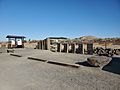
Candy Mountain trailhead parking lot

