Cape Alava facts for kids
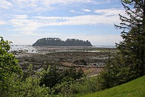
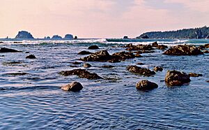
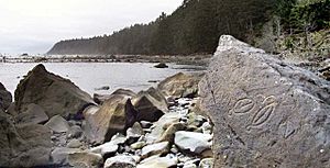
Cape Alava is a point of land that sticks out into the ocean, located in the Pacific Northwest region of the United States. You can find it in Clallam County, Washington. This cape is part of Olympic National Park and the Makah Indian Reservation. You can reach it by hiking about 3 miles (5 km) on a boardwalk trail from a ranger station in the park.
The Cape Alava Trail was named a National Recreation Trail in 1981, which means it's a special trail for outdoor activities.
Contents
What's in a Name?
Cape Alava was named after Don José Manuel de Álava. He was from the Basque Country in Spain. He played an important role in settling a disagreement called the Nootka Convention in 1794.
The Westernmost Point
Cape Alava is the westernmost point in the mainland United States. This means it's the farthest west you can go without leaving the connected 48 states. Its exact location is 124° 44′ 11.8″ W longitude, especially when the tide is low and you can walk out to the west side of Tskawahyah Island.
Other capes, like Cape Flattery in Washington and Cape Blanco in southern Oregon, are also very close to being the westernmost points.
A Look Back in Time
In early 1834, a Japanese ship called the Hojun Maru landed near Cape Alava. This ship was supposed to carry rice to Edo (which is now Tokyo), but a big storm blew it off course. It drifted in the Pacific Ocean for 14 months without its mast or rudder! When it arrived, only three of its crew members were still alive. The local Makah people took care of them for a short time before they were taken to Fort Vancouver.
Cape Alava also became the starting point for the new Pacific Northwest Trail. This trail was created when the Omnibus Public Land Management Act of 2009 was passed.
How the Land Was Formed
The beaches around Cape Alava have many different kinds of rocks and land formations. This interesting mix is because of the ocean's strong waves and ice from a very long time ago.
The rocks and sand here are like a "grab bag" of different materials. They are mostly "Quaternary Sediments," which means they were left behind by glaciers during the last ice age, about 12,000 to 16,000 years ago. This shows how the powerful Pacific Ocean has shaped the land over thousands of years.
Fun Things to Do
Cape Alava is the western end of the Pacific Northwest National Scenic Trail. This long trail is great for hiking and exploring the beautiful natural areas.
See also
 In Spanish: Cabo Alava para niños
 | Mary Eliza Mahoney |
 | Susie King Taylor |
 | Ida Gray |
 | Eliza Ann Grier |


