Cape Wolstenholme facts for kids
Quick facts for kids Cape Wolstenholme |
|
|---|---|
|
|

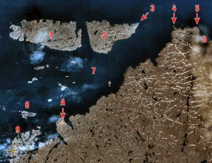
Location of Cape Wolstenholme (4) and Erik Cove (6). Click on image for full legend.
|
|
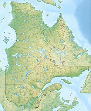
| Location | Nunavik, Quebec, Canada |
| Coordinates | 62°34′50″N 77°30′35″W / 62.58056°N 77.50972°W |
Cape Wolstenholme is a special place at the very northern tip of Quebec, Canada. It's known as a "cape," which is a piece of land that sticks out into a sea or lake. This cape is located on the Hudson Strait, a narrow waterway connecting Hudson Bay to the Atlantic Ocean. It's about 28 kilometers (17 miles) northeast of Ivujivik, Quebec's northernmost village. Cape Wolstenholme is also the northernmost point of the Ungava Peninsula, which is part of the larger Labrador Peninsula.
The cape features tall, rocky cliffs that are about 300 meters (980 feet) high. These cliffs stand out in the landscape and mark the entrance to the Digges Sound. Here, strong ocean currents from Hudson Bay and the Hudson Strait meet. Sometimes, these powerful currents can even trap and crush animals between large pieces of floating ice.
Cape Wolstenholme is a very important home for wildlife. It hosts one of the world's largest groups of Thick-billed murre birds. These birds nest on the cliffs, making it a busy and noisy place during nesting season. A large area of 1,263 square kilometers (488 square miles) around the cape and along the Hudson Strait is being considered to become a park. For now, it's a national park reserve, which means it's protected while waiting for its official park status.
Contents
Cape Wolstenholme's Past
Early Explorers and Traders
In 1610, the famous explorer Henry Hudson was on his last journey. He mapped the coast and named this cape "Wolstenholme." He did this to honor Sir John Wolstenholme, an English merchant who helped pay for Hudson's trip. Sir John was very interested in finding the Northwest Passage, a sea route through North America.
Soon after, some of Hudson's crew members, who had rebelled against him, had a conflict with local Inuit people near the Digges Islands. This was one of the first recorded meetings between Europeans and Inuit in this area. Later, in 1697, Captain Pierre Le Moyne d'Iberville and his team arrived. They were looking for ways to trade in Hudson Bay. They made the first commercial trades with the Inuit at Cape Wolstenholme.
The Hudson's Bay Company Post
In 1909, the Hudson's Bay Company, a well-known trading company, set up a trading post called Wolstenholme. This post was in a small bay just east of the cape, called Erik Cove. The first manager, or "factor," of the post was Ralph Parsons. His job was to grow the trade of Arctic fox fur by working with the Inuit, who already hunted these foxes.
For the first two years, no Inuit visited or traded at the post. But eventually, it became successful and continued to operate until 1947. Today, you can still find parts of the old trading post there.
Other Names for the Cape
Over time, Cape Wolstenholme has had a few different names. In 1744, a mapmaker named Jacques-Nicolas Bellin called it Cap Saint-Louis. For many years, both "Wolstenholme" and "Saint-Louis" were used. Finally, in 1968, "Wolstenholme" became the official name. Older maps also show names like "C Walsingam," "C. Worsnam," and "C. Walsingham."
See also
 In Spanish: Cabo Wolstenholme para niños
 | Audre Lorde |
 | John Berry Meachum |
 | Ferdinand Lee Barnett |


