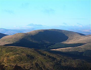
Capel Fell facts for kids
Quick facts for kids Capel Fell |
|
|---|---|
 |
|
| Highest point | |
| Elevation | 678 m (2,224 ft) |
| Prominence | 159 m (522 ft) |
| Listing | Ma,Hu,Tu,Sim,G,D,DN,Y |
| Geography | |
| Location | Dumfries and Galloway, Scottish Borders, Scotland |
| Parent range | Ettrick Hills, Southern Uplands |
| OS grid | NT 16397 06906 |
| Topo map | OS Landranger 79 |
Capel Fell is a hill located in the beautiful Southern Uplands of Scotland. It's part of a group of hills called the Ettrick Hills. Standing at 678 meters (about 2,224 feet) tall, it offers great views of the surrounding Scottish countryside.
Capel Fell: A Hill in the Scottish Uplands
Capel Fell is a well-known hill in the Ettrick Hills range. This range is part of the larger Southern Uplands of Scotland. The hill is located near the border between Dumfries and Galloway and the Scottish Borders. It's a popular spot for hikers and those who love exploring nature.
How Tall is Capel Fell?
Capel Fell reaches a height of 678 meters (which is about 2,224 feet) above sea level. This makes it a significant hill in the area. It also has a "prominence" of 159 meters. Prominence means how much a mountain or hill stands out from the land around it. A higher prominence means it rises more sharply from its surroundings.
Exploring Capel Fell: Popular Routes
Capel Fell is close to the Southern Upland Way, which is a long-distance walking path across Scotland. Many people who climb Capel Fell use parts of this path. Another popular way to reach the top is by following a track from Selcoth Fisheries, which is to the west of the hill. Hikers often choose to climb Capel Fell along with other nearby hills, making for a longer and more adventurous day out.
 | Leon Lynch |
 | Milton P. Webster |
 | Ferdinand Smith |

