Carn a' Chlamain facts for kids
Quick facts for kids Càrn a' Chlamain |
|
|---|---|

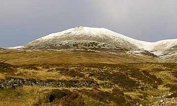
Càrn a' Chlamain seen from Glen Craoinidh to the south
|
|
| Highest point | |
| Elevation | 963 m (3,159 ft) |
| Prominence | c. 330 m (1,080 ft) |
| Listing | Munro, Marilyn |
| Naming | |
| English translation | Hill of the kite or buzzard |
| Language of name | Gaelic |
| Geography | |
| Location | Perth and Kinross, Scotland |
| Parent range | Grampians |
| OS grid | NN916758 |
| Topo map | OS Landranger 43 |
Càrn a' Chlamain, also known as Càrn a' Chlamhain in Gaelic, is a cool mountain in Scotland. It's located about 12 kilometers north of a town called Blair Atholl. This mountain is part of the beautiful Forest of Atholl.
It's the highest point on a wavy, flat area of land called a plateau. This plateau is found northeast of Glen Tilt, which is a valley. Rivers like the River Tarf, which flows into the Tilt, start on the mountain's slopes.
Contents
What is Càrn a' Chlamain?
Càrn a' Chlamain is a special kind of mountain in Scotland. It's known as a Munro. A Munro is a Scottish mountain that is over 3,000 feet (914.4 meters) tall. Càrn a' Chlamain stands at 963 meters high! It's also a Marilyn, which means it's a hill with a certain amount of "prominence" or height above the land around it.
The name "Càrn a' Chlamain" comes from Gaelic. It means "Hill of the kite or buzzard". This tells us that these birds might often be seen flying around the mountain.
What the Summit Looks Like
The very top of Càrn a' Chlamain is easy to spot. It's like a big, rounded hill covered in lots of rocks and boulders. This rocky dome rises up from the moorland (open, wild land) that surrounds it. Imagine a giant's head poking out of the ground!
How to Climb Càrn a' Chlamain
Most people who want to climb Càrn a' Chlamain start their journey from Glen Tilt. It's a popular spot for hikers and adventurers.
The Main Path
The most common way to reach the top begins at a place called Forest Lodge in Glen Tilt. From there, you follow a special path. This path was originally made for "stalkers," who are people who manage deer in the area.
The path goes up the steep side of the glen in a series of zig-zags. This helps make the climb easier. After climbing the steep part, the path crosses the flat plateau until you reach the summit.
Getting to Forest Lodge
There's a small challenge to starting this climb: you can't drive your car all the way to Forest Lodge. You have to travel about 10 kilometers (which is about 6 miles) from a place called Old Blair. Most people choose to walk or ride a bicycle to get to Forest Lodge before they even start climbing the mountain!
Other Ways to Climb
There's another way to reach the summit if you're looking for a different adventure. You can follow the southeast ridge of the mountain. This path can be joined about 3 kilometers (less than 2 miles) down the glen from Forest Lodge. It offers different views and a unique climbing experience.
 | Jewel Prestage |
 | Ella Baker |
 | Fannie Lou Hamer |

