Carpow Roman Fort facts for kids

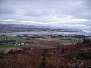
The Tay estuary showing the area around the Roman Fort
|
|
| Alternative name | "Horrea Classis" or "Poreo Classis" |
|---|---|
| Region | Perth and Kinross |
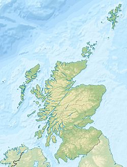
| Coordinates | 56°20′48.3454″N 003°17′03.9177″W / 56.346762611°N 3.284421583°W |
| Type | Roman Fort |
| Area | 11ha (27.5 acres) |
| History | |
| Builder | Legio II Augusta, Legio VI Victrix |
| Founded | AD 210 |
| Abandoned | AD215 |
| Periods | Romano-British |
| Cultures | Roman |
| Satellite of | Ancient Rome |
| Associated with | Legio II Augusta, Legio VI Victrix |
| Site notes | |
| Excavation dates | 1961-1979 |
| Archaeologists | D R Easson, P R Wright, J Leach and J Wilkes |
| Condition | Upstanding scarp to 1.6m |
The Roman Fort of Carpow was a huge military base. It was built where the Tay and Earn rivers meet in what is now Scotland. This fort was very large, covering about 27.5 acres (11 hectares).
Two different Roman legions, the Legio II Augusta and Legio VI Victrix, lived here at different times. A legion was a large unit of the Roman army, usually with thousands of soldiers. Because it housed legions, the fort was built to be strong and permanent. It used stone, brick, and tiles.
The Carpow Fort was used by the Romans from the late 100s AD to the early 200s AD. Archaeologists believe it was a major supply base for the Roman navy. It helped provide supplies for Roman forces in the central lowlands of Scotland. The fort was also used during the military campaigns of Emperor Septimius Severus in this area.
Some historians think the fort was built earlier, around 185 AD, under Commodus. This would have been to support his own military efforts. It has also been suggested that Carpow Fort is the place called "Horrea Classis" or "Poreo Classis" in an old Roman geography book called the Ravenna Cosmography.
Contents
Where Was Carpow Fort Located?
The Carpow Fort was built on a flat area of land near the coast. It was on the southern bank of the River Tay. This spot was about one kilometer east of where the River Tay and River Earn join. To the east of the fort was the Firth of Tay, which is like a wide river mouth. This gave the Romans easy access to the North Sea by boat.
Before the fort was built, the Romans had a line of forts and watchtowers called the Gask Ridge to the north and west. During the time Carpow Fort was active, the Antonine Wall was to the south. The local people living near the fort were called Caledonians by the Romans. Later, the Romans called them Picts. A significant Pictish site called Clatchard Craig was very close to Carpow Fort.
What Does Carpow Fort Look Like Today?
Today, Carpow is a small, quiet village. It has a few houses and is located just east of where the River Earn meets the Tay. The old Roman fort is partly hidden by these modern buildings.
The only part of the fort you can still easily see is its northern wall. This wall survives as a raised ridge, about 1.6 meters (5 feet) high. Other parts of the fort can be seen from the air. When crops grow over the buried remains, they show different colors or heights. These are called crop marks. They reveal the full square shape of the fort's walls. They also show the remains of a building that was likely the "principia." This was the typical headquarters building for a Roman military base.
What Did Archaeologists Find at Carpow?
Archaeologists dug at the Carpow Fort site between 1964 and 1979. These digs helped them learn a lot about the fort. They found coins that showed the fort was used from the late 100s AD to the early 200s AD. The oldest coin they found was from the time of Hadrian, an earlier Roman emperor. The newest coin was from the time of Caracalla and looked brand new.
The excavations also uncovered the remains of several important buildings. They found the "principia" (headquarters), a "praetorium" (the commander's house), a "thermae" (bath house), and a granary (a building for storing grain). They even found pieces of stone and a roof tile with inscriptions. These inscriptions showed that the Legio II Augusta and the Legio VI Victrix legions had been stationed there.
Was Carpow Fort "Horrea Classis"?
The Ravenna Cosmography is an old geography text from the 700s AD. It was written in a city called Ravenna in the Byzantine Empire. This book mentions a place called "Horrea Classis" or "Poreo Classis." This place seems to have been located in the eastern lowlands of Scotland.
"Poreo Classis" doesn't make much sense. It might have been a mistake made by someone copying the text. Or, it could have been a Roman version of an older local name. "Horrea Classis," however, means "Naval Storehouses" in Latin.
Many experts believe that Carpow Fort was this "Horrea Classis." Its location by the sea and the discovery of a large granary certainly fit the description of a naval supply base.
 | Audre Lorde |
 | John Berry Meachum |
 | Ferdinand Lee Barnett |


