Carseldine, Queensland facts for kids
Quick facts for kids CarseldineBrisbane, Queensland |
|||||||||||||||
|---|---|---|---|---|---|---|---|---|---|---|---|---|---|---|---|

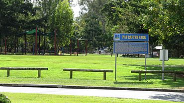
Pat Rafter Park
|
|||||||||||||||
| Population | 10,093 (2021 census) | ||||||||||||||
| • Density | 2,019/km2 (5,230/sq mi) | ||||||||||||||
| Postcode(s) | 4034 | ||||||||||||||
| Area | 5.0 km2 (1.9 sq mi) | ||||||||||||||
| Time zone | AEST (UTC+10:00) | ||||||||||||||
| Location | 14.9 km (9 mi) N of Brisbane CBD | ||||||||||||||
| LGA(s) | City of Brisbane (Bracken Ridge Ward) |
||||||||||||||
| State electorate(s) | Aspley | ||||||||||||||
| Federal Division(s) | Petrie | ||||||||||||||
|
|||||||||||||||
Carseldine is a suburb located in the northern part of Brisbane, Queensland, Australia. It's a friendly place where many people live. In 2021, about 10,093 people called Carseldine home.
Contents
Exploring Carseldine
Carseldine is about 16 kilometers (10 miles) north of Brisbane's city center. You can usually drive there in about half an hour.
Getting Around Carseldine
The suburb is easy to reach by public transport. The North Coast railway line runs along its eastern side. The Carseldine railway station is right there, making it simple to catch a train. A major road, Gympie Road, also goes through Carseldine, connecting it to other areas.
What's in Carseldine?
Carseldine is mostly a residential area, meaning it's where people live in homes. But it also has some great places to shop and visit!
- Shopping: You'll find the Carseldine Homemaker Centre, which has a big Bunnings Warehouse store. There's also a shopping center with a Woolworths supermarket on Beams Road. Plus, there are two smaller convenience centers for quick stops.
- Green Thumbs: If you like plants, Carseldine has two plant nurseries along Beams Road.
- Sports and Fun: You can visit Club Coops or the Aspley Hornets AFL Club for sports and activities.
- Safety: The Carseldine Police Station helps keep the community safe. It opened in 2009.
Carseldine's Story
Carseldine got its name on August 16, 1975. It was named after William Carseldine, who was a fencing contractor. He came to Australia in 1854 and settled nearby in Bald Hills in 1858. He also owned land in the Carseldine area.
Education and Development
A college campus, which later became part of the Queensland University of Technology (QUT), was once located in Carseldine. In 2008, QUT moved its activities to other campuses. The site was empty for a few years, but then it was used for state government offices. In 2016, plans were announced to turn the area into the Carseldine Urban Village. This new development will include homes, shops, and businesses.
Who Lives in Carseldine?
In 2021, Carseldine had a population of 10,093 people. In 2016, about 53% of the people were female and 47% were male. The average age was 40 years old. About 17% of the population were children under 15, and about 22% were people aged 65 and over.
Most people (about 64%) living in Carseldine were born in Australia. Other common birthplaces included India, New Zealand, and England. English was the main language spoken at home for about 74% of residents. Many different religions are practiced in Carseldine, with Catholicism, no religion, and Anglicanism being the most common.
Special Places in Carseldine
Carseldine has some places that are important for their history. These are called heritage-listed sites:
- Holy Spirit Centre at 736 Beams Road
- Elliot Farmhouse at 112 Graham Road
- Brisbane Mud Springs Park at 2 Hawbridge Street
Learning in Carseldine
There are no schools directly within Carseldine itself. However, there are several schools in the nearby suburbs.
- Primary Schools: Aspley East State School (in Aspley), Bald Hills State School (in Bald Hills), and Taigum State School (in Taigum) are close by.
- Secondary Schools: Aspley State High School in Aspley is the nearest high school.
Parks and Green Spaces
Carseldine has many parks where you can play, relax, and enjoy nature. Here are some of them:
- Allira Crescent Park
- Aspley Rest Park
- Balcara Avenue Park
- Beams Road Park (no.440)
- Bensara Place Park
- Bowden Street Park
- Boxwood Place Park
- Chateau Street Park
- Cowie Road Park
- Dannenberg Street Park
- Hawbridge Street Park
- Kentia Street Park
- Lacey Road Park
- Macaranga Crescent Park
- Matisse Street Park
- Matthew Gardiner Park
- Nilkerie Street Park
- Pat Rafter Park (named after the famous tennis player Pat Rafter)
- Philip Vaughan Park
- Ray Street Park
- Strawberry Farm Park
 | William L. Dawson |
 | W. E. B. Du Bois |
 | Harry Belafonte |


