Castle Pines, Colorado facts for kids
Quick facts for kids
Castle Pines, Colorado
|
|
|---|---|
| City of Castle Pines | |

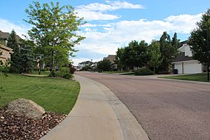
Castle Pines, Colorado.
|
|

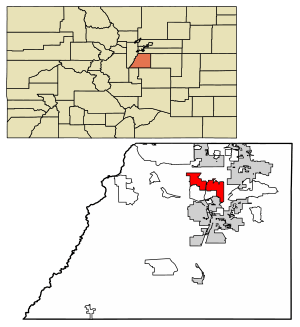
Location of the City of Castle Pines in Douglas County, Colorado.
|
|
| Country | |
| State | |
| County | Douglas County |
| Incorporated | November 6, 2007 |
| Government | |
| • Type | Home rule municipality |
| Area | |
| • Total | 24.849 km2 (9.594 sq mi) |
| • Land | 24.849 km2 (9.594 sq mi) |
| • Water | 0.000 km2 (0 sq mi) |
| Elevation | 1,930 m (6,332 ft) |
| Population
(2020)
|
|
| • Total | 11,036 |
| • Density | 440/km2 (1,150/sq mi) |
| Time zone | UTC−07:00 (MST) |
| • Summer (DST) | UTC−06:00 (MDT) |
| ZIP code |
80108
|
| Area code(s) | 303, 720 |
| FIPS code | 08-12387 |
| GNIS feature ID | 2500981 |
|
|
|
The City of Castle Pines is a city in Douglas County, Colorado, USA. About 11,000 people lived there in 2020. Castle Pines is part of the larger Denver area. It is located between the Town of Castle Rock and the City of Lone Tree.
Contents
History of Castle Pines
Castle Pines became a city on November 6, 2007. It was first called "City of Castle Pines North." This was the first new city in Douglas County since 1995.
On November 2, 2010, people voted to change the name to "City of Castle Pines." In 2019, residents voted for "home rule." This means the city can make more of its own rules about how it is run.
Geography of Castle Pines
Castle Pines is in central Colorado, right next to Interstate 25. It is about 20 miles south of downtown Denver. It is also about 43 miles north of Colorado Springs.
The city is in an area called the Colorado Piedmont. This is on the western edge of the Great Plains. There are a few creeks that flow through the city, like Happy Canyon Creek and Newlin Gulch. These creeks are part of the Cherry Creek water system.
In 2020, the city covered about 9.6 square miles (24.8 square kilometers) of land. Castle Pines is part of the bigger Denver area. It is next to Castle Pines Village and Castle Rock.
People of Castle Pines
| Historical population | |||
|---|---|---|---|
| Census | Pop. | %± | |
| 2010 | 10,360 | — | |
| 2020 | 11,036 | 6.5% | |
| U.S. Decennial Census | |||
In 2010, there were 10,360 people living in Castle Pines. By 2020, the population grew to 11,036 people. The city has about 1,150 people per square mile.
Many families live in Castle Pines. In 2010, about half of the households had children under 18. Most households were married couples. The average age of people in the city was about 39.5 years old.
Castle Pines is known as one of the wealthier cities in the United States.
Economy of Castle Pines
Many adults in Castle Pines work in different jobs. In 2011, most people worked in management, business, science, and arts. Many also worked in sales and office jobs.
The top industries where people worked were:
- Education and healthcare
- Professional and management services
- Finance and real estate
The average value of a home in Castle Pines was about $457,500 in 2011.
Parks and Recreation
Castle Pines has many outdoor spaces for fun. There are 5 parks and 14 miles of trails. These trails are 8-feet wide and paved. You can walk, run, or ride your bike on them. Horseback riding and motorized vehicles are not allowed.
The parks and natural areas in Castle Pines include:
- Elk Ridge Park
- Retreat Park
- Coyote Ridge Park
- Daniel's Gate Park
- Daniels Park
Schools in Castle Pines
Students living in Castle Pines go to schools in the Douglas County School District.
Primary Schools:
- Castle Pines Academy
- American Academy
- DCS Montessori
Elementary Schools:
- Buffalo Ridge Elementary
- Timber Trail Elementary
- DCS Montessori
- American Academy
Middle Schools:
- DCS Montessori
- American Academy
Transportation
Castle Pines is located right next to Interstate 25. For air travel, people use Denver International Airport or the nearby Centennial Airport.
See also
 In Spanish: Castle Pines para niños


