
Castlecomer Plateau facts for kids
Quick facts for kids Castlecomer Plateau |
|
|---|---|

Castlecomer Plateau
Location in Ireland
|
|
| Location | County Kilkenny, Ireland extending into Laois and Carlow. |
| Coordinates | 52°49′N 7°10′W / 52.81°N 7.16°W |
| Elevation | 334 metres (1,096 ft) |
| Surface elevation | 120 metres (390 ft) |
| Highest point – elevation |
Rossmore Plateau 334 |
| Area | 640 square kilometres (250 sq mi) |
| Formed by | Baurnafea fault |
| Geology | Sandstone/shale |
The Castlecomer Plateau is a high, flat area of land in County Kilkenny, Ireland. It also reaches into County Laois and County Carlow. It's sometimes called the South Leinster Coalfield because of its history with coal.
Main roads like the R448 and N77 run along its edges. Important rivers also flow near or through it. The River Nore is to the west, and the River Barrow is to the east. The River Dinin cuts right through the plateau, passing through the town of Castlecomer.
This landscape is a large upland area between the Barrow and Nore river valleys. The eastern part is bigger and higher. It is known as the Rossmore Plateau. This name comes from the village of Rossmore in County Laois. Rossmore is close to the highest point of the plateau, which is 334 meters (about 1,096 feet) high.
The land and soil here have always shaped its history. Not many people live on the plateau. However, it has been a safe place for those who lost their homes. This area also has one of Ireland's few natural coal deposits. This means it has a long history of coal mining.
Farming is hard on the plateau. Temperatures are lower, and the soil is heavier and wetter than in the surrounding lowlands. But the land is great for growing trees. You can find many Sitka spruce trees planted at higher elevations.
The plateau is managed by different local councils. These include County Kilkenny, County Laois, and County Carlow. Some parts of the area are special protected places. They are called Barrow and River Special Areas of Conservation. Long ago, this area was part of the historic kingdom of Osraige (Ossory). It was home to the Uí Duach (Idough) clan.
What Does Castlecomer Mean?

The name Castlecomer comes from the Irish language words Caisleán an Chomair. This means "the Castle at the confluence of the Waters." A "confluence" is where rivers meet.
The word caislén comes from an old word for a fortified building. The "waters" refer to three rivers that meet here: the Dinin, Brokagh, and Cloghogue. The "castle" is a Norman fort built in 1171. It was built by William Marshal, 1st Earl of Pembroke.
Geography of the Plateau
The Castlecomer Plateau covers about 640 square kilometers (247 square miles). It is located in the southeast of Ireland's Central Plain. The plateau is mostly round, except in the southwest. There, it is shaped by the Dinin River Valley.
The middle of the plateau is a lower area, like a basin. It sits at about 120 meters (394 feet) high. The higher parts of the plateau are over 300 meters (984 feet) high. The Dinin River, with its upper and lower sections, drains most of the plateau. These sections join south of Castlecomer. The plateau is mostly made of limestone and other sedimentary rocks.
Climate and Weather
The climate in Kilkenny, like the rest of Ireland, is an oceanic climate. This means the weather can change often, but it rarely has extreme hot or cold temperatures. It is known as a temperate oceanic climate.
Kilkenny is in plant Hardiness zone 9. The weather here is typical for wide river valleys in the region. Nights without clouds can be quite cold. Kilkenny is known for having some of Ireland's highest summer temperatures and lowest winter temperatures.
Images for kids
-
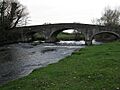
The Dinin river and bridge, on the N77 north of Kilkenny City.
