Cedar Mountain Range facts for kids
Quick facts for kids Cedar Mountain Range |
|
|---|---|
| Highest point | |
| Peak | Flying W Mountain (Cedar Mountain Range) |
| Elevation | 6,217 ft (1,895 m) |
| Dimensions | |
| Length | 20 mi (32 km) NW-SE |
| Width | 6 mi (9.7 km) |
| Geography | |
| Country | United States |
| Settlements | Hachita and Hermanas |
| Range coordinates | 31°57′25″N 108°08′25″W / 31.95694°N 108.14028°W |
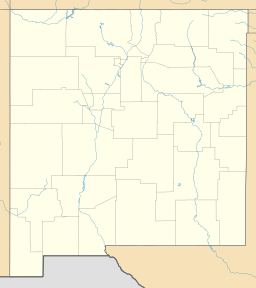
The Cedar Mountain Range is a mountain range in New Mexico, USA. It's about 20 miles (32 km) long. You can find it in the southwest part of Luna County, New Mexico. It's also close to the border with Chihuahua, Mexico.
This mountain range is located in the northwest part of the Chihuahuan Desert. A small section of its northwest end reaches into southeast Grant County, New Mexico. This is where the Continental Divide of the Americas crosses the range. The divide then turns northwest, then west, and finally south. It goes around the northern edge of the Playas Valley. The Continental Divide then continues south into Mexico. It passes through three other mountain ranges: the Pyramid Mountains, Animas Mountains, and San Luis Mountains (New Mexico).
What is the Cedar Mountain Range Like?
The Cedar Mountain Range stretches from northwest to southeast. It is longer than it is wide. At its northwest end is Deer Mountain, which is 5,494 feet (1,675 meters) tall. The Continental Divide makes a loop around a dry streambed, called an arroyo, that drains the northeast side of the mountain. This natural water boundary continues through Deer Mountain. It then heads northwest, circling the northern edge of the Playas Valley.
There are three other important peaks in the range:
- Hat Top Mountain is in the north-central part of the range. It stands at 5,586 feet (1,703 meters) high.
- Old Baldy is next to Hat Top Mountain, to its southeast. It is 5,473 feet (1,668 meters) tall.
- The highest peak is Flying W Mountain. It is located at the very southeast end of the Cedar Mountain Range. Flying W Mountain reaches 6,217 feet (1,895 meters) high.
Where Does the Continental Divide Go?
The Continental Divide of the Americas is like a giant line across North America. It separates the land where water flows to the Pacific Ocean from where it flows to the Atlantic Ocean (or Gulf of Mexico). As it moves southwest from Silver City, New Mexico, it starts to leave the areas with lots of forests.
The divide passes through the southern Little Burro Mountains. Then it crosses the Big Burro Mountains. After that, it takes a winding path around the northeast side of the Cedar Mountain Range. It then crosses the natural water boundary of the northern Playas Valley, which is west of Hachita, New Mexico. Finally, the Continental Divide enters a series of mountain ranges that run north to south, including the Animas Mountains. From there, it travels south into northwest Chihuahua, Mexico.
 | Emma Amos |
 | Edward Mitchell Bannister |
 | Larry D. Alexander |
 | Ernie Barnes |


