Little Burro Mountains facts for kids
Quick facts for kids Little Burro Mountains |
|
|---|---|
| Highest point | |
| Peak | Eagle Point (Little Burro Mountains) (Little Burro Mountains) |
| Elevation | 6,500 ft (2,000 m) |
| Dimensions | |
| Length | 15 mi (24 km) NW-SE |
| Width | 5 mi (8.0 km) |
| Geography | |
| Country | United States |
| State | New Mexico |
| Region | (northwest)-Chihuahuan Desert Continental Divide of the Americas |
| District | Grant County, NM |
| Settlement | Tyrone, NM–Oak Grove, NM (Silver City, NM) |
| Range coordinates | 32°42′20″N 108°23′11″W / 32.705632°N 108.386438°W |
| Borders on | Big Burro Mountains-NW & W Silver City Range–Silver City, NM-NE |
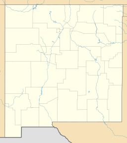
The Little Burro Mountains are a mountain range in Grant County, New Mexico. They are about 15 miles (24 km) long. This range sits next to the larger Big Burro Mountains to its northwest.
You can find the Little Burro Mountains about 8 miles southwest of Silver City. State Road 90 runs along the southern edge of the mountains. This road goes from Silver City to Lordsburg. The Continental Divide of the Americas also crosses the southern part of these mountains.
Contents
About the Little Burro Mountains
The Little Burro Mountains are a smaller range, stretching about 15 miles (24 km). They run from the northwest to the southeast. They are connected to the Big Burro Mountains, which also run in the same direction.
Valleys and Waterways
A small valley sits between the Little Burro and Big Burro Mountains. This valley has Mangas Valley Road. This road connects Oak Grove on State Road 90 to Mangas Springs. Mangas Springs is located near the northeast side of the Big Burro Mountains. Nearby, Mangas Creek joins the Gila River. The Gila River is a long river that flows all the way across Arizona.
Tallest Peaks
The highest point in the Little Burro Mountains is Eagle Peak. It stands at about 6,500 feet (1,981 meters) tall. You can find it at 32°42′20″N 112°56′00″W / 32.705632°N 112.933236°W.
There are two other important peaks:
- Wind Mountain: This peak is in the northern part of the range. It is about 6,247 feet (1,904 meters) high.
- Bald Mountain: This peak is in the southeastern part of the mountains. It is about 6,396 feet (1,950 meters) high. Bald Mountain is also located on the Continental Divide.
Getting Around the Mountains
It is easy to get to the Little Burro Mountains because many roads surround them.
- Mangas Valley Road: This road is on the southwest side. It travels towards the northwest.
- State Road 90: This road runs along the entire southeastern side of the range.
- U.S. Route 180: This major road is on the northeast and north sides. It connects Deming to Alpine, AZ. It also links up with Mangas Springs, which is north of the mountains.
The Continental Divide
The Continental Divide is like a giant line across North and South America. It separates the land where water flows to the Pacific Ocean from where it flows to the Atlantic Ocean (or the Gulf of Mexico).
As the Continental Divide moves southwest from Silver City, it leaves the forested mountain areas. It passes through the southern Little Burro Mountains. Then, it crosses the Big Burro Mountains. After that, it goes around the northeast side of the Cedar Mountain Range. It then crosses the water divide of the northern Playas Valley, west of Hachita. Finally, it enters a series of mountain ranges that run north to south, like the Animas Mountains. From there, it continues south into northwest Chihuahua, Mexico.
 | William Lucy |
 | Charles Hayes |
 | Cleveland Robinson |


