Pyramid Mountains facts for kids
Quick facts for kids Pyramid Mountains |
|
|---|---|
| Highest point | |
| Peak | Pyramid Peak (Pyramid Mountains) |
| Elevation | 1,827 m (5,994 ft) |
| Dimensions | |
| Length | 30 mi (48 km) N-S |
| Width | 12 mi (19 km) E-W-(variable) |
| Geography | |
| Country | United States |
| State | New Mexico |
| Region | (northwest)-Chihuahuan Desert Continental Divide of the Americas |
| District | Hidalgo County, New Mexico |
| Settlement | Lordsburg, New Mexico Colton City, New Mexico–Animas, New Mexico |
| Range coordinates | 32°05′56″N 108°42′33″W / 32.098976°N 108.709221°W |
| Borders on | Lordsburg–I-10-N Animas Mountains-S Animas Valley-W & SW Playas Valley-SE |
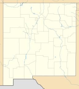
The Pyramid Mountains are a mountain range in Hidalgo County, New Mexico. They stretch about 30 miles (48 km) from north to south. The city of Lordsburg and Interstate 10 are right at their northern edge.
These mountains sit between two large valleys. To the west is the Animas Valley. To the east are the Playas and Lordsburg valleys. A very important line, the Continental Divide, runs through the southern part of the range. The Chihuahuan Desert also reaches into the lower areas of the Pyramid Mountains.
Exploring the Pyramid Mountains
The Pyramid Mountains are a medium-sized mountain range. They run from north to south, just like the two big valleys next to them. The Continental Divide goes right through these mountains. It then continues south into Mexico.
The Animas Valley is on the west side of the mountains. The Playas Valley is on the east side. The Pyramid Mountains are about 30 miles long. They are also about 12 miles wide at their widest point. Many peaks and hills make up this range. You can also find many dry canyons and washes here.
Important Peaks and Hills
The Pyramid Mountains have a northern and a southern part. A lower area separates these two parts. This lower area is about 1,430 meters (4,690 feet) high. It sits between Jose Placencia Canyon and Muir Draw.
Here are some of the main peaks and hills:
- North Peaks:
- Pyramid Peak: This is the highest point at 5,994 feet (1,827 meters).
- Fourmile Hill: 4,339 feet (1,323 meters).
- Leitendorf Hills: 5,640 feet (1,719 meters).
- Swallow Fork Peak: 4,957 feet (1,511 meters) on the west side.
- Cedar Mountain: 5,154 feet (1,571 meters) on the east side.
- South Peaks:
- Cedar Knob: 4,905 feet (1,495 meters) on the east side.
- Lightning Dock Mountain: 5,528 feet (1,685 meters) on the west side.
- Russel Hills: 5,310 feet (1,618 meters) on the east side.
- Kink Peak: 5,361 feet (1,634 meters) on the west side.
- South Pyramid Peak: 5,909 feet (1,801 meters) on the Continental Divide.
- Pinkey Wright Mountain: 5,538 feet (1,688 meters) on the Continental Divide.
The Continental Divide's Path
The Continental Divide is a line that separates which ocean water flows to. It starts to leave the thick forests as it moves southwest from Silver City. It crosses the southern Little Burro Mountains. Then it goes over the Big Burro Mountains.
After that, it takes a winding path. It goes around the northeast side of the Cedar Mountain Range. Then it crosses the water divide of the northern Playas Valley. This is west of Hachita. Finally, it enters a series of north-south mountain ranges. These include the Animas Mountains. The Divide then travels south into northwest Chihuahua, Mexico.
At South Pyramid Peak, the Divide changes direction. It turns from going west to going straight south. Pinkey Wright Mountain is about 3 miles south along this Divide.
 | George Robert Carruthers |
 | Patricia Bath |
 | Jan Ernst Matzeliger |
 | Alexander Miles |


