Cefn yr Ystrad facts for kids
Quick facts for kids Cefn yr Ystrad |
|
|---|---|

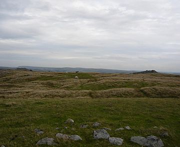
The summit cairns of Cefn yr Ystrad
|
|
| Highest point | |
| Elevation | 619 m (2,031 ft) |
| Prominence | 180 m (590 ft) |
| Parent peak | Pen y Fan |
| Listing | Marilyn, Hewitt, Nuttall |
| Naming | |
| English translation | Ridge of the dale |
| Language of name | Welsh |
| Geography | |
| Location | Powys, Wales |
| Parent range | Brecon Beacons |
| OS grid | SO086137 |
| Topo map | OS Landranger 160 |
Cefn yr Ystrad is a mountain located in the beautiful Brecon Beacons National Park in Wales. It's like a smaller, but still important, part of the main mountains in the area.
This broad ridge stretches for a long way from northeast to southwest. It reaches a height of 619 meters (about 2,031 feet). Cefn yr Ystrad is one of the most southern peaks in the Brecon Beacons. It rises up to the east of the Pontsticill Reservoir. The very top of the mountain is a large, wild area of moorland. You'll find a trig point there, which is a special marker used by surveyors.
The Rocks and Caves of Cefn yr Ystrad
This mountain is made of different layers of rock, like a giant cake! The main types are Carboniferous Limestone and Twrch Sandstone. These layers are usually tilted downwards towards the south.
Sometimes, the sandstone has sunk a bit. This happens because the limestone underneath has dissolved away. Limestone can be eaten away by water, creating cool underground spaces. You can see smooth, flat areas of limestone rock that have been worn down by ice. There are also lots of loose rocks everywhere.
On the top and southern sides of the hill, you'll find many shakeholes. These are like big dips or holes in the ground. Some of them are quite large! They form when the ground above a dissolved limestone area collapses.
Ancient Secrets: Archaeology on the Hill
Cefn yr Ystrad is full of interesting old sites. These sites date from the Bronze Age all the way up to the time of early industries.
One important site is called Carn-y-Bugail. This name means 'cairn of the shepherd'. It's a large burial mound, about 15 meters (50 feet) wide. It's located southeast of the mountain's top. This mound stands about 3 meters (10 feet) high, but parts of it have been disturbed over time.
You can also find many old boundary stones from the 1800s. These stones have letters carved into them, like 'D of B, TM' on one side and 'GH' on the other. They marked the edges of different land estates. These included the lands of the Duke of Beaufort and the Gwynne Holford family.
There are also more recent structures and tracks on the hill. These are connected to old limestone quarries. These quarries, like Cwar Blaen-dyffryn, are now abandoned. They are found on the northern and northwestern sides of the hill.
Exploring Cefn yr Ystrad
Cefn yr Ystrad is considered open country. This means you are free to walk and explore the hill.
A path for walkers and horse riders runs northeast from Pontsticill. This path goes along the northwestern edge of the hill. It leads towards Dyffryn Crawnon and the Usk Valley. It's a great way to discover this part of the Brecon Beacons.
 | Percy Lavon Julian |
 | Katherine Johnson |
 | George Washington Carver |
 | Annie Easley |

