Centereach, New York facts for kids
Quick facts for kids
Centereach, New York
|
|
|---|---|

U.S. Census map
|
|
| Country | United States |
| State | New York |
| County | Suffolk |
| Town | Brookhaven |
| Area | |
| • Total | 8.92 sq mi (23.10 km2) |
| • Land | 8.92 sq mi (23.10 km2) |
| • Water | 0.00 sq mi (0.00 km2) |
| Elevation | 309 ft (94 m) |
| Population
(2020)
|
|
| • Total | 30,980 |
| • Density | 3,473.87/sq mi (1,341.34/km2) |
| Time zone | UTC-5:00 (Eastern Time Zone) |
| • Summer (DST) | UTC-4:00 |
| ZIP Code |
11720
|
| Area code(s) | 631, 934 |
| FIPS code | 36-13376 |
| GNIS feature ID | 0946206 |
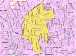
Centereach is a community in Suffolk County, New York. It is called a hamlet, which is a small settlement. It is also a census-designated place, meaning it's an area defined for counting people by the government. In 2020, about 30,980 people lived there.
Contents
History of Centereach
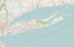
Centereach was first known as West Middle Island. Later, it was called New Village for many years. In 1916, its name changed to Centereach. This happened because another village had the same name. The name "Centereach" means "center reached." It shows that the community is in the middle of Long Island.
Centereach has grown a lot over time. It started as a small hamlet. Now, it is a busy suburban area. In 1940, only 628 people lived there. By 1970, the population grew to almost 20,000!
The first new neighborhoods were built in the early 1950s. These were called Dawn Estates and Eastwood Village. In 1998, a special road design was built in Centereach. It was the first of its kind in New York State. This design helps traffic flow smoothly. It is located where Middle Country Road meets Nicolls Road.
In recent years, many new homes have been built in Centereach. This has brought more people to the area.
Geography of Centereach
Centereach is located on Long Island. It covers about 22.6 square kilometers (8.7 square miles) of land. There is no water within its borders.
New York State Route 25 is a main road that goes through Centereach. It is also known as Middle Country Road. Many shops and businesses are found along this road.
Centereach shares its borders with several other communities. These include:
- East Setauket
- Terryville
- Selden
- Farmingville
- Holtsville
- Holbrook
- Lake Ronkonkoma
- Lake Grove
- South Setauket
- Stony Brook
Population Information
| Historical population | |||
|---|---|---|---|
| Census | Pop. | %± | |
| 1960 | 8,524 | — | |
| 1970 | 9,427 | 10.6% | |
| 1980 | 30,136 | 219.7% | |
| 1990 | 26,720 | −11.3% | |
| 2000 | 27,285 | 2.1% | |
| 2010 | 31,578 | 15.7% | |
| 2020 | 30,980 | −1.9% | |
| U.S. Decennial Census | |||
The population of Centereach has changed over the years. In 2000, there were 27,285 people living here. By 2010, the population grew to 31,578. In 2020, it was 30,980 people.
The community has a mix of different people. Many families live in Centereach. In 2000, about 43% of households had children under 18. The average household had about 3 people. The average family had almost 3.5 people.
The age of people in Centereach varies. In 2000, about 27% of the population was under 18 years old. About 9% of people were 65 years or older. The average age was 35 years old.
Schools in Centereach
Students in Centereach attend schools in different districts. Here are the main school districts and some schools:
- Middle Country Central School District
- Sachem School District
- Centereach High School
- Dawnwood Middle School
- Three Village Central School District - This district covers parts of Centereach, especially areas near Route 347 and Nicholls Road.
Notable People
- Don Heck - He was a famous comic-book artist. He helped create the superhero Iron Man. Don Heck lived in Centereach as an adult.
See also
 In Spanish: Centereach para niños
 | Precious Adams |
 | Lauren Anderson |
 | Janet Collins |


