Central Zone of São Paulo facts for kids
Quick facts for kids
Central Zone of São Paulo
Zona Central
|
|
|---|---|
 |
|
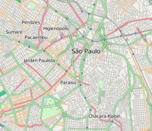
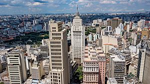
Location of Central Zone of São Paulo
|
|
| Country | |
| State | |
| City | |
| Subprefectures |
Central Zone
Sé
|
| Area | |
| • Total | 8 km2 (3.2 sq mi) |
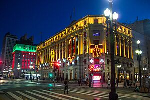
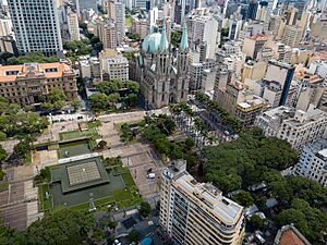
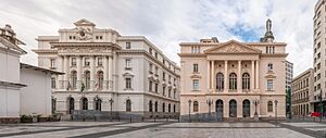
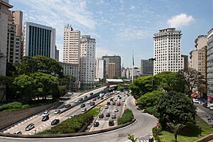
The Central Zone (in Portuguese: Zona Central de São Paulo) is a very important area in the city of São Paulo, Brazil. It's like the main hub for business and shopping in the city.
This area is one of the biggest commercial and business centers in South America. It is managed by the subprefecture of Sé. People sometimes confuse it with other areas like Centro Expandido (Expanded Center) or Centro Histórico de São Paulo (São Paulo Historic Center). The Centro Histórico is just the oldest part of the central region.
What is the Central Zone?
Officially, the Central Zone has clear boundaries around the districts of the Municipality Cathedral. But for many people, the "center of São Paulo" can include other parts of the city. For example, it used to include the Brás and Pari districts. Sometimes, even financial areas like Paulista Avenue are considered part of the wider "center."
People and Life in the Central Zone
The Central Zone is home to about 374,002 people, based on the 2000 census. This includes districts like Sé, Bela Vista, Bom Retiro, and Liberdade. Even though it's the least populated administrative region in São Paulo, it has many public services and job opportunities.
Over the years, the population in the central area has slowly decreased. This means fewer people live there now than before. However, the Central Zone is very well-connected by public transportation. It has four of the five Metrô subway lines and several CPTM commuter train lines.
This area also has many important universities and colleges. These include Mackenzie University, the Armando Alvares Penteado Foundation (FAAP), and parts of the University of São Paulo (USP).
Famous Places in the Central Zone
The Central Zone is full of interesting places to see and visit.
Important Bridges and Roads
- Chá Viaduct
- Santa Ifigênia Viaduct
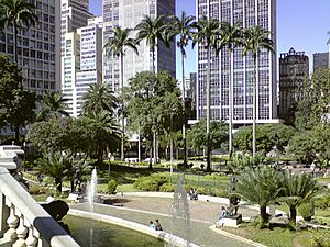
- Anhangabaú Square
Main Avenues and Streets
- Prestes Maia Avenue
- Tiradentes Avenue
- Brigadeiro Luís Antônio Avenue
- Liberdade Avenue
- Estado Avenue
- São João Avenue
- Ipiranga Avenue
- Rio Branco Avenue
- 23 de Maio Avenue
- 9 de Julho Avenue
- Angélica Avenue
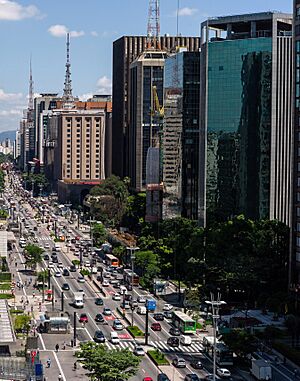
- Paulista Avenue
- Conselheiro Furtado Street
- 15 de Novembro Street
- Rua 25 de Março
- Porto Geral Alley
- Consolação Street
- Augusta Street
- Maria Antonia Street
- Dona Veridiana Street
- Higienópolis Avenue
- Carmo Street
- Vergueiro Street
Famous Squares
- Praça da Sé
- Praça da República
- Praça Doutor João Mendes
- Praça Ramos de Azevedo
- Pátio do Colégio
- Largo do Arouche
- Largo São Bento
- Largo do Paiçandu
- Largo de São Francisco
- Largo da Misericórdia
Metro and Train Stations
- Metro Stations
- Line 1 (Blue)
- Vergueiro
- São Joaquim
- Liberdade
- Sé
- São Bento
- Luz
- Tiradentes
- Armênia
- Line 2 (Green)
- Consolação
- Trianon-Masp
- Brigadeiro
- Line 3 (Red)
- Pedro II
- Sé
- Anhangabaú
- República
- Santa Cecília
- Marechal Deodoro
- Line 4 (Yellow)
- Luz
- República
- Higienópolis-Mackenzie
- Paulista
- Line 1 (Blue)
- CPTM commuter railway stations
- Line 7 (Ruby), Line 10 (Turquoise) and Line 11 (Coral)
- Luz
- Line 8 (Diamond)
- Júlio Prestes
- Line 7 (Ruby), Line 10 (Turquoise) and Line 11 (Coral)
Shopping Centers
- Shopping Light
- Shopping Frei Caneca
- Shopping Paulista
- Shopping Pátio Higienópolis
Parks
- Jardim da Luz
- Parque da Aclimação
- Parque Dom Pedro II
Colleges and Universities
- Escola de Administração de Empresas de São Paulo – Fundação Getúlio Vargas (EAESP/FGV)
- Universidade Presbiteriana Mackenzie
- Faculdade de Direito da Universidade de São Paulo (FDUSP) – USP
- Faculdade de Ciências Médicas da Santa Casa de São Paulo (FCMSCSP)
- Centro de Ciências Exatas e Tecnologia – Pontifícia Universidade Católica de São Paulo – (CCET/PUC-SP)
- Fundação Armando Alvares Penteado (FAAP)
- Escola da Cidade (AEAUSP)
- Liceu de Artes e Ofícios de São Paulo (LAO-SP)
- Faculdade de Tecnologia de São Paulo (FATEC-SP)
- Conservatório Dramático e Musical de São Paulo (CDMSP)
- Universidade Livre de Música – Centro de Estudos Musicais Tom Jobim
Hospitals
- Hospital Samaritano
- Hospital Santa Catarina
- Irmandade da Santa Casa de Misericórdia de São Paulo (ISCMSP)
- Hospital Nove de Julho
- Hospital Sírio-Libanês
- Hospital Alemão Oswaldo Cruz
- Beneficência Portuguesa de São Paulo
Culture and Fun Places
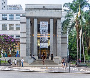
- Mário de Andrade Library
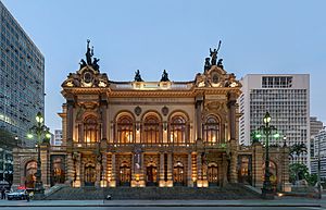
- Theatro Municipal
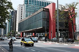
- São Paulo Museum of Art (MASP)
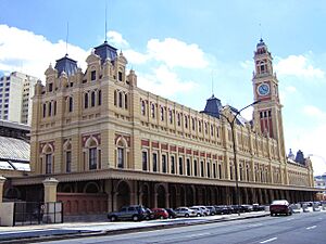
- Museum of the Portuguese Language
- Sala São Paulo
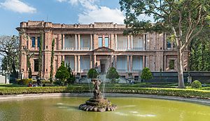
- Pinacoteca do Estado
- Museu de Arte Saca
- Sociedade Brasileira de Cultura Japonesa
Rivers
- Tamanduateí River
Tall Buildings
The Central Zone has many tall and impressive buildings. Here are some of the major ones:
| Rank | Name | Height ft (m) |
Floors | Year |
|---|---|---|---|---|
| 1 | Mirante do Vale | 558/170 | 51 | 1960 |
| 2 | Edifício Itália | 556/168 | 45 | 1965 |
| 3 | Altino Arantes Building | 528/161 | 40 | 1947 |
| 4 | Banco do Brasil Building | 474/143 | 24 | 1955 |
| 5 | Edifício Copan | 460/140 | 45 | 1953 |
| 6 | Barão de Iguape Building | 445/133 | 37 | 1959 |
| 7 | Ipiranga 165 | 440/130 | 36 | 1968 |
| 8 | Martinelli Building | 440/130 | 30 | 1929 |
| 9 | Grande São Paulo Building | 438/129 | 40 | 1971 |
| 10 | Mercantil Finasa | 438/129 | 35 | 1973 |
| 11 | Andraus Building | 390/115 | 32 | 1962 |
| 12 | Conde de Prates Building | 385/112 | 33 | 1955 |
| 13 | CBI Esplanada | 380/110 | 30 | 1948 |
Great Views
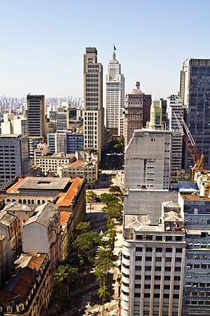
The Torre Banespa (Banespa Tower) on top of the Altino Arantes Building and the Edifício Itália are amazing places to visit. They offer incredible views of São Paulo, letting you see up to 40 kilometers away! You can spot other famous landmarks like the Mercado Municipal, the São Paulo Cathedral, Edifício Copan, and even the distant Serra da Cantareira mountains. The Mirante do Vale Building, finished in 1960, is actually the tallest building in Brazil, even if it's not as well-known for its views.
Panorama
See also
 In Spanish: Zona Central de São Paulo para niños
- Central Business Districts
- List of central business districts
- São Paulo
 | James B. Knighten |
 | Azellia White |
 | Willa Brown |


