Cerro Grande (New Mexico) facts for kids
Quick facts for kids Cerro Grande |
|
|---|---|

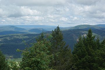
View from the summit looking west toward the Valles Caldera (visible at lower left) before the Las Conchas Fire.
|
|
| Highest point | |
| Elevation | 10,207 ft (3,111 m) NAVD 88 |
| Prominence | 660 ft (200 m) |
| Geography | |
| Parent range | Jemez Mountains |
| Topo map | Bland |
| Climbing | |
| Easiest route | Trail hike |
Cerro Grande is a tall mountain peak in New Mexico. It stands about 10,207 feet (3,111 meters) high. This mountain is found on the edge of the Valles Caldera, which is a very large volcanic crater. It is also close to New Mexico State Road 4, a main road in Los Alamos County, New Mexico.
Like many mountains in the Jemez Mountains, Cerro Grande was once covered in thick conifer forests. These forests mainly had ponderosa pine and aspen trees. There were also open grassy areas called rincons on its slopes.
Contents
What is Cerro Grande?
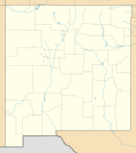
Cerro Grande is a significant summit in the Jemez Mountains range. It is located in Sandoval County, New Mexico. The mountain's height makes it a noticeable feature in the landscape. It offers views of the surrounding areas, including the Valles Caldera.
Location and Natural Features
The mountain is positioned on the northern side of New Mexico State Road 4. This road is a key route through Los Alamos County, New Mexico. Before major fires, Cerro Grande was known for its dense forests. These forests were home to many types of trees.
The main trees found were the ponderosa pine and aspen. Ponderosa pines are large trees with long needles. Aspen trees are known for their white bark and leaves that shimmer in the wind. The mountain also had unique grassy meadows called rincons. These open areas were found on the slopes and near the summit.
Major Fires Affecting Cerro Grande
Cerro Grande has been impacted by two large forest fires. These fires changed the landscape of the mountain and the surrounding areas. They are important events in the history of the region.
The Cerro Grande Fire (2000)
In May 2000, a planned fire, called a prescribed burn, was started on Cerro Grande. This type of fire is set on purpose to help manage forests. However, this particular burn got out of control. It quickly grew into a massive forest fire known as the Cerro Grande Fire.
The fire burned about 48,000 acres (190 square kilometers) of land. It also destroyed hundreds of homes in nearby communities. Even though the fire was huge, much of the forest on Cerro Grande itself was not badly damaged. Some parts were not harmed at all.
The Las Conchas Fire (2011)
Eleven years later, in 2011, another major fire hit the area. This was the Las Conchas Fire. Unlike the previous fire, the Las Conchas Fire severely burned the entire Cerro Grande mountain. This caused significant damage to the forests that had survived the 2000 fire. The landscape of Cerro Grande changed a lot after this event.
 | James B. Knighten |
 | Azellia White |
 | Willa Brown |


