Chase, Maryland facts for kids
Quick facts for kids
Chase, Maryland
|
|
|---|---|

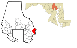
Location of Chase in the State of Maryland
|
|
| Country | |
| State | |
| County | |
| Elevation | 8 m (26 ft) |
| Time zone | UTC-5 (Eastern (EST)) |
| • Summer (DST) | UTC-4 (EDT) |
| ZIP code |
21220, 21027
|
| Area code(s) | 410 |
| GNIS feature ID | 0589943 |
Chase is a small community in eastern Baltimore County, Maryland, in the United States. It is not an official city, but rather an "unincorporated community." This means it's a recognized place without its own local government.
Contents
Where is Chase Located?
Chase is found at coordinates 39°21′48″N 76°22′16″W / 39.36333°N 76.37111°W. It sits right on the water! It's next to the Gunpowder River, Middle River, Dundee Creek, Saltpeter Creek, and the famous Chesapeake Bay. Other nearby places include Middle River, Bowleys Quarters, Essex, and Aberdeen Proving Grounds.
The Story of Chase
How Chase Began
Chase started in 1850. It was first called "Chase's Station." This was a stop along the Baltimore Railroad line. After the Civil War, many freed African Americans moved to Chase. They built farms and homes along Eastern Avenue Extended.
A community called Bengies also grew nearby. It was west of Chase, also along Eastern Avenue Extended. Over time, Chase and Bengies grew closer. They eventually became known as Bengies-Chase, or just Chase.
Early Jobs and Growth
For many years, the main jobs in Chase were working for the Baltimore Railroad or on local farms. Chase stayed a mostly rural community with many African American residents. In the mid-1900s, it started to become a suburb of Baltimore City.
World War II and New Residents
During World War II, more people moved to Chase. This happened because the Glenn L. Martin Company opened a large aircraft factory in Middle River. Many people came to work there.
Important Events in Chase's History
Plane Crash in 1959
On May 12, 1959, a plane called Capital Airlines Flight 75 crashed in Chase. It was flying from LaGuardia Airport to Atlanta.
Special Testing Area
From 1949 to 1969, the United States Army used Carroll Island and Graces Quarters. These areas are near Chase. They were used for testing and getting rid of certain materials. These sites were part of Aberdeen Proving Grounds. They are now off-limits to the public because of past activities. Some cleanup has happened, but the areas are still restricted.
Radio Station for Safety
In the 1970s, a special radio station called WGU-20 was built near Graces Quarters. It was set up by a government agency. Its job was to warn people all along the Eastern seaboard if there was an emergency.
Changes to Mail Service
In the 1980s, Chase became part of the 21220 zip code. A new, bigger post office was built in Middle River to serve the whole area. The old zip code (21027) and post office are still used for P.O. boxes.
Train Accident in 1987
On January 4, 1987, an Amtrak train crashed into a freight train in Chase. This accident was very serious. It led to new safety rules for trains and drug testing for railroad workers. President Ronald Reagan even honored some local people from Chase for helping the passengers.
Making Chase Better Today
Since the 1990s, people have been working to improve Chase. Similar efforts are happening in Essex and Middle River. Some changes include updating apartment complexes, opening a new road (the MD 43 extension) in 2006, and adding sidewalks along Eastern Avenue in 2007. These efforts aim to make Chase an even better place to live.
 | Lonnie Johnson |
 | Granville Woods |
 | Lewis Howard Latimer |
 | James West |

