Cheam Peak facts for kids
Quick facts for kids Cheam Peak |
|
|---|---|

Cheam Peak
|
|
| Highest point | |
| Elevation | 2,104 m (6,903 ft) |
| Prominence | 334 m (1,096 ft) |
| Geography | |
| Location | British Columbia, Canada |
| Parent range | North Cascades |
| Topo map | NTS Map: 092.H.04 |
| Climbing | |
| First ascent | 1888 A. O. Campbell, Ebe B. Knight and party; probably ascended earlier by the local Indigenous peoples |
| Easiest route | Southwest Route (3.8 km trail with 632m elevation gain) |
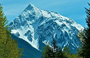
Cheam Peak or Mount Cheam is a tall mountain in British Columbia, Canada. Its name comes from the Halkomelem language, which is spoken by local Indigenous peoples. The word "Cheam" refers to the lowlands below the mountain. The Halkomelem name for the mountain itself is Lhílheqey, which means "glacier" or "rehydrate." This name points to the west side of the peak.
Contents
About Cheam Peak

Cheam Peak has a shape like a pyramid with steep sides facing north, northwest, south, and east. The north side is the steepest. A smaller peak called "Red Pyramid" or "Red Tower" (about 1,400 meters tall) splits the two northern faces. On the west side, a ridge separates the northwest and south faces. Below the gently sloping south face, you can find a beautiful area with Spoon Lake.
Cheam Peak is the most northern mountain in a small group called the Cheam Range. This range is part of the North Cascades mountains, which stretch from Washington into Canada. Cheam Peak stands tall over the eastern Fraser Valley, near towns like Bridal Falls and Agassiz. It's just east of Chilliwack, British Columbia.
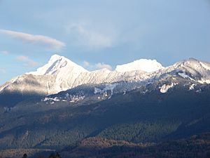
Cheam Peak and three mountains near it are sometimes called the "Four Sisters" or "Four Brothers." They form part of the mountain wall that frames the Lower Mainland area. On a clear day, you can even see them from Vancouver Island. They are a very important part of the mountain view for towns like Mission and Dewdney. Behind these mountains is Wahleach Lake, which sits in a high valley surrounded by the Cheam Range.
Mountain History
Cheam Peak has a rich history with the local Indigenous peoples. The Halkomelem name for the peak, Theeth-uhl-kay, means "the source" or "the place where waters begin." For the Sto:lo people, this mountain is like a "mother mountain" or an old woman watching over her children in the valley below. Lady Peak, which is to the south, is seen as the old woman's dog.
The official name, "Cheam," is thought to come from a Halkomelem word for "wild strawberries." However, some say it refers to the lowlands below the mountain. This name describes the ridge that includes Cheam and Lady Peaks, as well as the lower slopes around Spoon Lake.
The first time people recorded climbing Cheam Peak was in 1888. A group led by A. O. Campbell and Ebe B. Knight made the climb. However, it's very likely that local Indigenous peoples had climbed it much earlier.
Climbing Cheam Peak
The north face of Cheam Peak drops about 2,000 meters to the valley floor. This side is very steep and has not been climbed often. However, there is an easier trail that leads to the top from a high mountain area to the southwest.
Hiking to the Summit
Hiking to Cheam Peak is a popular activity. The trail starts from old logging roads that you can reach from Chilliwack Lake Road. It's easier to get to the trailhead with a four-wheel-drive vehicle, but it is possible without one.
From the start of the trail, it's about 3.8 kilometers (2.4 miles) to the peak. The path goes through beautiful mountain meadows and then climbs up about 632 meters (2,073 feet). The climb is moderately steep.
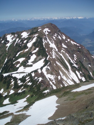
Once you reach the summit, you'll get amazing views! You can see the Fraser Valley to the north and west. To the south, you'll see the rest of the Cheam Range and the North Cascades mountains. You can also reach Lady Peak from a path that branches off about halfway up the Cheam Peak Trail.

Weather at Cheam Peak
Cheam Peak is in a "marine west coast" climate zone. This means it gets a lot of moisture from the Pacific Ocean. Weather systems move east towards the Cascade Range. When they hit the mountains, the air is forced upwards, which causes rain or snow to fall. Because of this, the Cascade Mountains get a lot of precipitation, especially snow in winter.
Temperatures on the mountain can drop very low, sometimes below -20°C (-4°F). With wind, it can feel even colder, below -30°C (-22°F). The best time to climb Cheam Peak is usually from July through September, when the weather is most favorable.
 | Anna J. Cooper |
 | Mary McLeod Bethune |
 | Lillie Mae Bradford |


