Chibougamau Lake facts for kids
Quick facts for kids Chibougamau Lake |
|
|---|---|

Watershed of Nottaway River
|
|
| Location | Baie-James |
| Coordinates | 49°50′08″N 74°13′47″W / 49.83556°N 74.22972°W |
| Type | Natural |
| Primary inflows | Blondeau River, France River, Nepton River, Énard River |
| Primary outflows | Chibougamau River |
| Basin countries | Canada |
| Max. length | 35.0 kilometres (21.7 mi) |
| Max. width | 15.2 kilometres (9.4 mi) |
| Surface area | 206 kilometres (128 mi) |
| Surface elevation | 379 metres (1,243 ft) |
| Settlements | Chibougamau |
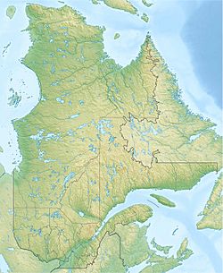
Chibougamau Lake is a large freshwater lake in Quebec, Canada. It is located in the Nord-du-Québec region, near the town of Chibougamau.
The lake's surface usually freezes over from early November until mid-May. However, it's generally safe to travel on the ice from mid-November to mid-April.
Contents
About Chibougamau Lake
Chibougamau Lake is quite big, covering an area of about 206 square kilometres (80 sq mi). It is located about 10 kilometres (6.2 mi) southeast of the town of Chibougamau. The lake is 35 kilometres (22 mi) long (north to south) and 15.2 kilometres (9.4 mi) wide at its widest point. The Chibougamau River starts from this lake.
Nearby Areas
The land around Chibougamau Lake is drained by several other lakes and rivers. Here are some of the main ones:
- To the north: Waconichi Lake
- To the east: Boisvert River
- To the south: Obatogamau Lakes and Eau Jaune Lake
- To the west: Bourbeau Lake, Chibougamau River, Opémisca Lake, and the Obatogamau River
Islands of the Lake
Chibougamau Lake has many islands because of its uneven shape. The most important islands include Marguerite, Tommy, Boulder, Commissaires, and Merrill. There are also many smaller islands like Okay, Refuge, Gordon, and Dewar.
Main Bays
The lake has many bays around its edges. Some of the main bays include:
- Magnetite Bay
- Islands Bay
- Nepton Bay
- Girard Bay
- Sunday Bay
- Inlet Bay
- Hematite Bay
- Bear Bay
- Portage Bay
An explorer named Henry O'Sullivan wrote about the lake's gentle shores. He noted that mountains like "The Wizard" were to the north. In 1895, he mentioned that "Shabokoma Lake" (an old name for Chibougamau Lake) was surprisingly large, about 42 miles (68 km) long.
Rivers Flowing In
Several rivers and lake outlets flow into Chibougamau Lake:
- North Side:
- The France River flows into McKenzie Bay.
- Water from Lymburner Lake flows into Gunn Bay.
- East Side:
- Outlets from Robert Lake and Roberge Lake.
- The Nepton River flows into Nepton Bay.
- Water from Forest Lake and Jenozeau Lake.
- The Armitage River flows into Girard Bay.
- South Side:
- Water from Lake Jacques flows into Comer Bay.
- The Énard River flows into Inlet Bay.
- West Side:
- Water from Wilson Lake flows into Lac Caché, which then connects to Chibougamau Lake.
- The Blondeau River flows into McKenzie Bay.
Where the Water Flows Out
The water leaves Chibougamau Lake from its west side, at the end of Commencement Bay. It flows over Rainbow Falls. Then, the water moves southwest into Dorés Lake (Chibougamau River). This lake is next to Chibougamau Lake, separated by the Gouin Peninsula. The water then leaves Dorés Lake from Malouf Bay.
The small community of Obalski is located south of Chibougamau Lake, near the railway.
Name History
In 1831, a surveyor named Joseph Bouchette used the names "Utsissagomo" and "Vomiting Lake" for this large body of water. People became interested in the area around 1870 because of the minerals found there. Also, in the 1800s, people started to enjoy hunting and fishing in the region.
In 1871, another surveyor, Walter McOuat, mentioned the unique rocks found near Chibougamau and Waconichi lakes. In 1907, Joseph Obalski, who was an Inspector of Mines in Quebec, started using the name "Lac Chibougamau," which is very close to what we use today.
The current spelling, Chibougamau Lake, was officially recognized on December 5, 1968, by the Commission de toponymie du Québec, which manages place names in Quebec. Over time, the lake's name has been spelled in many different ways, like Shabagamog, Shibogama, and Chibougamou.
Mining in the Area
The area around Chibougamau Lake has a history of mining. Some mining sites are found on the Gouin Peninsula and to the northwest of the lake, including Merrill Island. The railway from Saint-Félicien helped the region grow economically, especially in mining and forestry. This railway runs south of the lake and connects to the town of Chibougamau, which is on the west side of the lake.
 | William L. Dawson |
 | W. E. B. Du Bois |
 | Harry Belafonte |


