Waconichi Lake facts for kids
Quick facts for kids Waconichi Lake |
|
|---|---|

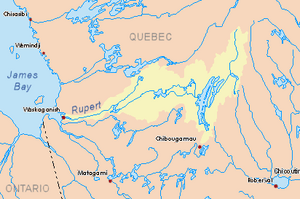
Watershed of Rupert River
|
|
| Location | Eeyou Istchee Baie-James |
| Coordinates | 50°09′11″N 74°00′16″W / 50.15306°N 74.00444°W |
| Type | Natural |
| Primary inflows |
|
| Primary outflows | Wanonichi River |
| Basin countries | Canada |
| Max. length | 32.9 kilometres (20.4 mi) |
| Max. width | 5.6 kilometres (3.5 mi) |
| Surface elevation | 386 metres (1,266 ft) |
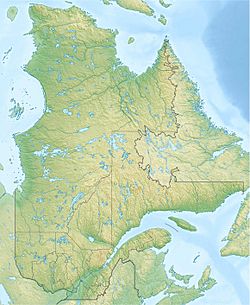
Waconichi Lake is a freshwater lake located in Quebec, Canada. It's part of a special protected area called the Albanel, Mistassini and Waconichi Lakes Wildlife Sanctuary. This lake is found in the Eeyou Istchee James Bay Regional Government area, which is in the Nord-du-Québec region. The lake's surface stretches across the Richardson and Bignell townships.
The main way people make a living in this area is through forestry, which means cutting down trees for wood. After that, tourism, like fishing and camping, is the next most important activity.
You can get to Waconichi Lake by forest roads. One main road, Route 167, comes from the town of Chibougamau. There's also a smaller road on the west side of the lake that connects to Route 167 and goes north towards the Assinica Wildlife Sanctuary.
Waconichi Lake usually freezes over from early November until mid-May. However, it's generally safe to travel on the ice from mid-November to mid-April.
About Waconichi Lake's Location and Features
Waconichi Lake is quite long, stretching about 32.9 kilometres (20.4 mi). At its widest point, it measures about 5.6 kilometres (3.5 mi). The lake sits at an elevation of 386 metres (1,266 ft) above sea level.
Many smaller streams and rivers flow into Waconichi Lake, bringing it fresh water. These include Bordeleau Creek, which flows into Spawning Bay, and water from Galloway and Winsh Lakes, which enters Osprey Bay. Other streams like the Richardson Lake outlet, Dufresne Lake outlet, Siikuunsiiwan Creek, Rignell Creek, and Coubana Creek also feed the lake.
The lake has several important bays, such as Spawning Bay, Road Bay, Cliff Bay, Osprey Bay, and Kastell Bay. There are also a few islands in the lake, including Musset Island, Heart Island, and Mimi Island.
The water from Waconichi Lake flows out from a bay in its northeastern part. This water then travels through a small waterfall called the "Fall of the Foam" and continues down the Waconichi River. The Waconichi River eventually connects to Lake Mistassini, which is a much larger lake.
Nearby Towns and Waterways
The mouth of Waconichi Lake is located:
- About 31.4 kilometres (19.5 mi) north of Chibougamau Lake.
- About 24 kilometres (15 mi) south of the village of Mistissini.
- About 4.6 kilometres (2.9 mi) south of where the Waconichi River begins.
- About 93.8 kilometres (58.3 mi) south of the mouth of Lake Mistassini.
- About 49.7 kilometres (30.9 mi) northeast of downtown Chibougamau.
- About 85.9 kilometres (53.4 mi) northeast of the village of Chapais, Quebec.
Other important rivers and lakes near Waconichi Lake include:
- To the North: Chébistuane River, Barlow River, and Mistago River.
- To the East: Lake Éva, Boisvert River, Nepton River, and Chief River.
- To the South: France River, Chibougamau Lake, Dorés Lake, and Chibougamau River.
- To the West: Chevrillon Lake and parts of the Chibougamau River.
The Name Waconichi
The name "Waconichi" comes from the Innu people, who are Indigenous to this region. In their language, "Waconichi" means "mountain of crumbled rocks."
Over the years, the name has been spelled in different ways. For example, in a report from 1901 by Surveyor Henry O'Sullivan, it was called "Lake Wahwanichi." This report described areas between Lake Saint-Jean and James Bay. Other spellings that have been used include Wacounipi, Wakonichi, Wakurinitche, and Wakwconvertche.
The official spelling, "lac Waconichi," was formally chosen on December 5, 1968, by the Commission de toponymie du Québec, which is the organization responsible for place names in Quebec.
 | Claudette Colvin |
 | Myrlie Evers-Williams |
 | Alberta Odell Jones |


