Chimney Tops facts for kids
Quick facts for kids Chimney Tops |
|
|---|---|

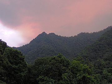
Chimney Tops, looking south from Newfound Gap Road (US Route 441).
|
|
| Highest point | |
| Elevation | 4724 feet (1440 m) NAVD 88 |
| Prominence | 120 ft (37 m) |
| Geography | |
| Location | Sevier County, Tennessee |
| Parent range | Great Smoky Mountains |
| Topo map | NPS |
| Climbing | |
| Easiest route | Chimney Tops Trail, short climb |
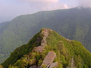
Chimney Tops is a famous mountain in the central Great Smoky Mountains. It stands tall at about 4,724 feet (1,440 meters) above sea level. This mountain is special because it has two rocky peaks that look a bit like chimneys.
Chimney Tops is located on the eastern side of a larger mountain area called Sugarland Mountain. While you can see all around from the top, other mountains like Mount Le Conte and Mt. Mingus surround it on three sides.
What is Chimney Tops Made Of?
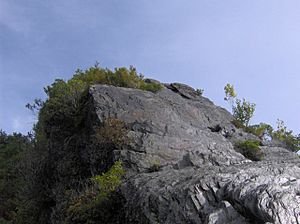
Chimney Tops is unique in the Smokies because its top is made of bare rock. Most other peaks are covered in trees and soil. The rock at the top has been exposed over time by natural forces like wind and rain.
The mountain's bedrock is mostly a type of rock called Anakeesta Formation metamorphic rock. This includes slate and phyllite. These rocks were formed about 200 million years ago. This happened when the North American and African land plates slowly crashed into each other. This huge collision created the Appalachian Mountains.
A Look at Chimney Tops' History
The Cherokee people have a special name for Chimney Tops: Duniskwalgunyi. This means "forked antler," because the two peaks look like a deer's antlers.
An old Cherokee story, "Aganunitsi and the Uktena," mentions this mountain. In the story, a medicine man named Aganunitsi searches for a giant reptile called the Uktena. He looks in many places, including Duniskwalgunyi, to find a special amulet.
The Road Prong Trail, which runs near the base of Chimney Tops, is one of the oldest paths in the Smokies. In the 1700s and 1800s, this path was known as the Indian Gap Trail.
Later, in 1832, a road called the Oconaluftee Turnpike was built along parts of this old trail. During the American Civil War, a Cherokee leader named Col. Will Thomas expanded this road.
The mountain got its current name, Chimney Tops, from people who lived in a nearby valley called the Sugarlands. Before the national park was created, this valley was a small community. People could clearly see Chimney Tops from their homes. Some even said the top of the mountain looked like it was covered in soot from a chimney.
How to Visit Chimney Tops
A popular way to see Chimney Tops is by hiking the Chimney Tops Trail. You can find the trailhead about 6.9 miles southeast of the Sugarlands Visitor Center on Newfound Gap Road.
Before 2016, hikers could climb all the way to the top of the rocky peaks. The trail used to end at the base of the higher peak. There were also smaller paths to the lower peak.
Another way to reach the area is to follow the Appalachian Trail west from Newfound Gap. This trail connects to the Road Prong Trail, which then leads to the Chimney Tops Trail. This route is longer than starting from the Chimney Tops parking lot.
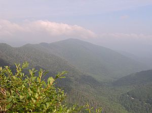
From the summit, you can see amazing views. You can spot Mount Le Conte and Mount Kephart to the east. To the west, you can see Sugarland Mountain, and to the north, the Sugarlands valley.
In late 2016, a severe fire affected many trails in the Great Smoky Mountains, including the Chimney Tops area. The trail reopened in October 2017. Now, there's a new observation area where you can view both rocky peaks. However, because of the intense heat from the fires, climbing directly onto the summit is no longer allowed for safety.
 | Percy Lavon Julian |
 | Katherine Johnson |
 | George Washington Carver |
 | Annie Easley |


