The Sugarlands facts for kids
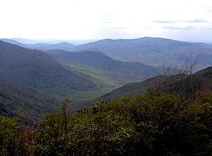
The Sugarlands is a beautiful valley located in the northern part of the Great Smoky Mountains in the southeastern United States. This area was once home to small communities, but today it is where the main office for Great Smoky Mountains National Park is located. You'll also find the Sugarlands Visitor Center here, which is a popular spot for people entering the park.
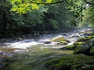
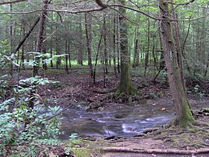
The Sugarlands is just south of Gatlinburg, making it an easy place for visitors to start their adventure. The valley stretches from Grapeyard Ridge and Roaring Fork in the east to the slopes of Sugarland Mountain in the west. Mount Le Conte towers over the valley, rising about 5,000 feet high. The West Fork of the Little Pigeon River flows through the Sugarlands, collecting water from the surrounding mountains.
When the first European settlers arrived in the early 1800s, they named the valley after the many sugar maple trees growing there. People used the sap from these trees to make syrup, which was a common sweetener before cane sugar became widely available. Even though many of these trees were cleared by early settlers, sugar maples are still very common throughout the park today.
Contents
Valley's Geology
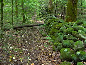
The ground in the Sugarlands is made of a type of sandstone called Roaring Fork sandstone. This rock formed from ancient ocean sediments almost a billion years ago! Over millions of years, especially during the last Ice Age, strong forces like water and ice carried rocks down from the mountains. This left the valley covered with a mix of boulders and smaller rocks called alluvium. Early farmers had to move these rocks to plant their crops, and they often stacked them to create simple stone walls. Many of these old walls can still be seen today.
Sugarlands History
In the stories of the Cherokee people, the Sugarlands was part of an area known as "Walasi'yi," which means "Frog place." This area included Mount Le Conte and Bull Head. One Cherokee legend, "Aganunitsi and the Uktena," tells of a Shawano medicine man named Aganunitsi. He searched for a giant serpent called Uktena to get a magical jewel. His search led him to Walasi'yi, where he found a huge frog.
Early Settlers and Life
The first European settlers arrived in the Sugarlands around 1800. They built homes near what is now Gatlinburg. Families like the Reagans and Ogles farmed land along Mill Creek, and William Trentham settled in the Fighting Creek area. Over time, three small communities grew in the valley: Forks-of-the-River, Fighting Creek, and Sugarlands proper. Most of the people living here when the park was created were descendants of these early families.
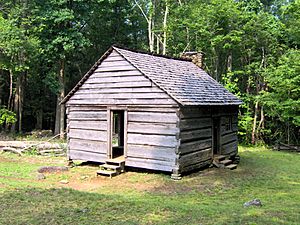
For most of the 1800s, people in the Sugarlands lived in simple log cabins. These cabins usually had one room, about 16 by 20 feet, with a chimney made of slate and clay. Around 1900, more modern frame houses slowly began to replace the log cabins.
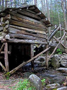
A typical farm included the cabin, a small vegetable garden surrounded by a fence, and several other buildings. There would often be a smokehouse for preserving meat, a woodshed, and a springhouse built over a natural spring. Farmers also had barns, corn cribs, chicken coops, and toolsheds. The Sugarlands had at least five gristmills, which ground corn into meal. Noah "Bud" Ogle's mill, powered by a water wheel, can still be seen today at Cherokee Orchard.
The Civil War's Impact
The U.S. Civil War (1861-1865) was a very difficult time for the Sugarlands, just like many other parts of Southern Appalachia. Most people in East Tennessee supported the Union, which made them targets for Confederate soldiers from North Carolina. During the war, a Confederate colonel named Will Thomas improved a road called the Oconaluftee Turnpike. This made it easier for Confederate groups to reach Sevier County, and the Sugarlands was one of the first communities they would encounter.
Early in the war, Thomas's forces took over Gatlinburg and built a small fort. However, they had to leave when Union forces threatened to surround them.
Life in the Late 1800s and Early 1900s
After the Civil War, some farms in the Sugarlands grew enough extra crops to sell or trade. Successful farmers opened small general stores, often in their homes. These stores sold things like flour, meat, coffee, and tobacco. They also bought or traded for items like chickens, eggs, honey, and furs, which the store owner would then take to larger towns to sell.
Around 1900, sawmills began to appear in the area to cut down the thick forests of the Smokies. Many Sugarlanders found jobs with the Little River Lumber Company in Elkmont. They would walk across Sugarland Mountain to get there. The bark from cut trees was often used for tanning leather.
Life was often hard in Appalachia during the early 1900s, and the Sugarlands was no different. A former resident, Alie Newman Maples, wrote in a poem: "The Sugarlands so clear and clean, Altho our meals were mighty lean."
In 1912, a women's group called Pi Beta Phi started a school in Gatlinburg to help with poverty. Teachers from this school noted that the Sugarlands had even poorer homes than Gatlinburg. Some children didn't know simple games or about Christmas. Despite this, the Pi Phis opened another school in the Sugarlands in 1920. While people were first unsure, they eventually welcomed the schools. These schools helped children get an education and improved the health and economy of the area.
Moonshining in the Mountains
By 1900, making illegal alcohol, known as moonshining, became common in the Smokies. The thick forests, hidden coves, and easy access to corn made valleys like the Sugarlands perfect places to hide and operate illegal stills. While moonshining happened, it wasn't as widespread as some stories suggest. Gladys Trentham Russell, who grew up in the area, said that less than 20% of families were involved. Some people used moonshine for medicine. However, she did say that "bootleggers" and "bad men" made some parts of the Sugarlands unsafe for women and children.
The National Park Arrives
In the 1800s, mountain areas became popular vacation spots. People wanted clean air and beautiful scenery. Some believed that mineral springs in the mountains had healing powers. Colonel W. B. Townsend, who owned the Little River Lumber Company, saw the value in creating recreation areas on land that had been logged. By 1909, his company's train started offering daily trips from Knoxville to Elkmont. Tourists also began visiting Gatlinburg, especially after a hotel opened in 1916. With tourism, Sugarlanders found new ways to sell their furs and farm products.
Many Sugarlanders became famous mountain guides. Wiley Oakley (1885–1954) was one of the most well-known. He lived on Mount Le Conte and was called the "Roamin' Man of the Mountains." His amazing sense of direction and knowledge of plants, animals, and local stories were very helpful to park scientists and historians later on.
When land was bought for the national park in the 1920s and 1930s, most people living in the Sugarlands had to move. While many were happy to sell their land for more money than they thought it was worth, some didn't want to leave their homes. Most accepted the offers, but a few had to be forced out.
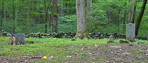
After the park was formed, the Civilian Conservation Corps (CCC) built a camp in the Sugarlands. From 1933 to 1942, the CCC built roads and trails for the park. The ruins of this camp can still be seen today. When the CCC camp closed after World War II, it marked the end of people living permanently in the Sugarlands. The forest quickly grew back over the old farmlands. Today, only a few small cemeteries and scattered stone ruins remain as signs of the communities that once thrived here.
Sugarlands Today
The Sugarlands Visitor Center is where the park's two main paved roads, Fighting Creek Gap Road and Newfound Gap Road (US-441), meet. From here, it's about 25 miles to Cades Cove in the western Smokies, 22 miles to Newfound Gap, and 34 miles to Cherokee, North Carolina. Gatlinburg is only two miles north.
Hiking Trails
The Old Sugarlands Trail is a path for both hikers and horses. It connects the Fighting Creek area with the Cherokee Orchard area. The Bullhead Trail branches off from the Old Sugarlands Trail and goes up the slopes of Bull Head before meeting the Boulevard Trail on top of Mount Le Conte. The Huskey Gap Trail starts near the visitor center and goes up Sugarland Mountain to the Sugarland Mountain Trail. Both the Boulevard Trail and Sugarland Mountain Trail connect to the famous Appalachian Trail along the mountain ridge.
There are also two short paths called "Quiet Walkways" that connect Newfound Gap Road to an area with old stone ruins along the West Fork of the Little Pigeon River. Behind the Sugarlands Visitor Center, there's a loop trail that passes the John Ownby Cabin and the ruins of the Noah McCarter place. Cherokee Orchard Road connects US-441 in Gatlinburg to the Cherokee Orchard and Roaring Fork areas, and it passes by the Noah Ogle homestead.
Historical Buildings
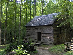
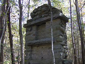
The Noah Ogle Place, the John Ownby Cabin near the Sugarlands Visitor Center, and the Alex Cole Cabin (now at Roaring Fork) are the last remaining buildings from the communities that lived in the valley before the park was created. You can still find old stone foundations, fallen chimneys, and simple rock walls scattered throughout the valley. These give clues about how the early Appalachian settlements were laid out. However, the farmland has mostly been taken back by the forest.
John Ownby Cabin
Built in 1860, the John Ownby Cabin is the only building left from the old Forks-of-the-River community. It was repaired in 1964 and added to the National Register of Historic Places in 1976.
Noah Ogle Place
The Noah Ogle Place is located along LeConte Creek, just south of Gatlinburg. It includes a cabin, a barn, and a tub mill that were part of Noah "Bud" Ogle's (1863–1913) farm. The cabin is a "saddlebag" style, meaning two cabins are built around the same chimney. Ogle's barn is the last four-pen barn in the park. His tub mill, one of only two left in the park, uses water from LeConte Creek to power a turbine and grind grain.
Alex Cole Cabin
The Alex Cole Cabin was originally located along the West Fork of Little Pigeon River. It was later moved to the Jim Bales Place along the Roaring Motor Nature Trail. Like many Sugarlanders, Albert Alexander "Alex" Cole (1870–1958) and his sons worked for the Little River Lumber Company in Elkmont. They would walk across Sugarland Mountain every week to get there. Later, during the tourism boom, Cole became a popular mountain guide because he knew so much about the Mount Le Conte area.
Rock House
The "Rock House" is a stone structure found along a faint path off the Old Sugarlands Trail. Its origin is unknown, but it might be connected to the CCC camp that was about a mile away. The Rock House has two rooms and still contains old items like broken bottles, bed frames, and an old camp stove. It wasn't on maps in 1931 but appeared on maps by 1942. It is now in disrepair and should be explored carefully.
|
 | Bayard Rustin |
 | Jeannette Carter |
 | Jeremiah A. Brown |


