
Chisasibi facts for kids
Quick facts for kids
Chisasibi
ᒋᓵᓰᐲ
chisaasiipii |
|
|---|---|
| Cree Nation of Chisasibi | |

Chisasibi
Location in Quebec
|
|
| Country | Canada |
| Province | Quebec |
| Region | Nord-du-Québec |
| TE | Eeyou Istchee |
| Established | 1980 |
| Government | |
| • Type | Cree reserved land (TC) |
| Area
(2021)
|
|
| • Land | 825.11 km2 (318.58 sq mi) |
| Population
(2021)
|
|
| • Total | 4,985 |
| • Density | 6.0/km2 (16/sq mi) |
| Time zone | UTC−05:00 (EST) |
| • Summer (DST) | UTC−04:00 (EDT) |
| Postal Code |
J0M 1E0
|
| Area code(s) | 819 |
| Website | chisasibi.ca |
Chisasibi (Cree: ᒋᓵᓰᐲ, romanized: Cisâsîpî) means "Great River" in the Cree language. It is a village and a special land area set aside for the Cree people. Chisasibi is located on the eastern shore of James Bay in Quebec, Canada.
The village sits on the south side of the La Grande River, which is also known as the Grand River. It is less than 10 km (6.2 mi) from where the river flows into James Bay. Chisasibi is one of nine Cree villages in this region. It is also a part of the Grand Council of the Crees of Quebec.
Contents
A Look Back: Chisasibi's History
The Cree people have lived in this area for many hundreds of years. Long ago, they moved around a lot, following animals and seasons. In 1803, a company called the Hudson's Bay Company built a trading post called Fort George. It was first on the north side of the river. Later, in 1837, it moved to a large island at the river's mouth.
Fort George became a permanent village. This happened as the local Cree people started to settle down. They stopped moving around as much in the early 1900s. By 1940, about 750 people lived there. This number grew to almost 2,000 by 1980.
In the mid-1970s, a big project began. This was the James Bay Project, which built dams for electricity. Rivers upstream were redirected into the La Grande River. This made the river flow much stronger. The stronger flow caused the island where Fort George was located to erode. It also made it harder for solid ice to form in winter.
Because of these changes, the Quebec Government built a new community. It was on the mainland's south shore. In 1981, the people and about 200 houses moved to this new site. The village was then renamed Chisasibi.
Life in Chisasibi: The Cree Nation

Chisasibi is the northernmost Cree village you can reach by road. It is also the farthest north community in eastern North America with year-round road access. A paved road, about 90 km (56 mi) long, connects Chisasibi to the James Bay Road. This road runs alongside the La Grande River.
The James Bay Road was built between 1971 and 1974. It was part of the big James Bay hydroelectric project. It connects the town of Matagami to Radisson. The Chisasibi Airport is located about 1.7 nautical miles (3.1 km; 2.0 mi) northwest of the village. You can fly to and from this airport with Air Creebec.
Even though Chisasibi is very far north, it is not the very end of the road. The road continues north from the La Grande-1 generating station (LG-1). It goes to a place called Longue Pointe. This is the farthest north you can drive by road east of the Hudson Bay.
Many Cree people in Chisasibi still hunt, trap, and fish. They do this mainly to feed their families and community. Other jobs in Chisasibi include healthcare and education services. Some people work for Hydro-Québec, the company that manages the hydroelectric dams. There are also some hotels and restaurants.
The community is led by an elected Chief, a Deputy Chief, and a Council. They help manage the Cree Nation of Chisasibi Office. Other Cree villages close to Chisasibi include Whapmagoostui, about 200 km (120 mi) north. Wemindji is about 100 km (62 mi) to the south.
Who Lives in Chisasibi: Population and Languages
In 2021, the population of Chisasibi was 4,985 people. Most of the people living in Chisasibi are Cree. There are also other First Nations people, Inuit, and non-native people. The average age in Chisasibi is about 30 years old. Many young people live here, with a large part of the population being under 15.
| Population growth | ||
|---|---|---|
| Year | Pop. | ±% |
| 1991 | 2,306 | — |
| 1996 | 3,251 | +41.0% |
| 2001 | 3,467 | +6.6% |
| 2006 | 3,972 | +14.6% |
| 2011 | 4,484 | +12.9% |
| 2016 | 4,872 | +8.7% |
| 2021 | 4,985 | +2.3% |
| Source: Statistics Canada Community Profiles | ||
Speaking Cree and English
The main language spoken in Chisasibi is Cree. Most people speak Cree as their first language. English is also very important. It is often used for official business and communication.
About 81% of the people in Chisasibi speak Cree as their first language. A smaller number speak other Indigenous languages. For Canada's official languages, about 8% speak English as their first language. About 3% speak French as their first language.
Overall, about 76% of the people speak English. About 3.5% speak French. Many people, about 15%, can speak both English and French.
Learning in Chisasibi: Education

The Cree School Board runs the schools in Chisasibi. There is Waapinichikush Elementary School for younger students. It has about 788 students. For older students, there is James Bay Eeyou School, which is a high school. It has about 494 students. This high school opened in 1980.
In the past, students from other Cree villages like Eastmain, Whapmagoostui, and Wemindji would come to Chisasibi for high school. This was because Chisasibi was the only place with high school classes in the region at that time.
Today, adults in Chisasibi can also continue their education. They can take classes for general learning or for job training.
Chisasibi's Weather: Climate
Chisasibi has a subarctic climate. This means it has very cold and snowy winters. The summers are mild and often rainy. This type of climate is common in the central parts of Quebec.
| Climate data for Chisasibi, Quebec (1915-1969) | |||||||||||||
|---|---|---|---|---|---|---|---|---|---|---|---|---|---|
| Month | Jan | Feb | Mar | Apr | May | Jun | Jul | Aug | Sep | Oct | Nov | Dec | Year |
| Mean daily maximum °C (°F) | −17.5 (0.5) |
−15.6 (3.9) |
−9.1 (15.6) |
−0.1 (31.8) |
7.1 (44.8) |
14.1 (57.4) |
17.4 (63.3) |
15.9 (60.6) |
11.7 (53.1) |
5.5 (41.9) |
−1.8 (28.8) |
−10.8 (12.6) |
0.6 (33.1) |
| Daily mean °C (°F) | −23.3 (−9.9) |
−22.0 (−7.6) |
−15.8 (3.6) |
−5.7 (21.7) |
2.3 (36.1) |
8.8 (47.8) |
12.3 (54.1) |
11.5 (52.7) |
7.9 (46.2) |
2.5 (36.5) |
−4.8 (23.4) |
−15.2 (4.6) |
−4.3 (24.3) |
| Mean daily minimum °C (°F) | −29.0 (−20.2) |
−28.2 (−18.8) |
−22.4 (−8.3) |
−11.0 (12.2) |
−2.6 (27.3) |
3.3 (37.9) |
7.1 (44.8) |
7.1 (44.8) |
4.2 (39.6) |
−0.3 (31.5) |
−7.7 (18.1) |
−19.6 (−3.3) |
−9.2 (15.4) |
| Average precipitation mm (inches) | 25.1 (0.99) |
21.4 (0.84) |
26.0 (1.02) |
20.7 (0.81) |
32.7 (1.29) |
45.7 (1.80) |
77.3 (3.04) |
66.2 (2.61) |
64.9 (2.56) |
66.4 (2.61) |
63.1 (2.48) |
46.2 (1.82) |
585.8 (23.06) |
| Source: worldclimate.com | |||||||||||||
Images for kids
-
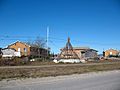
Homes and teepee
-
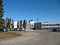
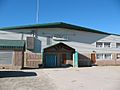
Administrative Centre
-
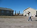
A Cree girl in Chisasibi
-
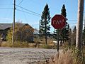
A stop sign, written in Cree
-
Chisasibi General Store
-

Chisasibi Courthouse (2015)


