Claresholm facts for kids
Quick facts for kids
Claresholm
|
|
|---|---|
|
Town
|
|
| Town of Claresholm | |
| Motto(s):
Now you're living ... Now you're home
|
|
| Country | Canada |
| Province | Alberta |
| Region | Southern Alberta |
| Census division | 3 |
| Municipal district | Municipal District of Willow Creek No. 26 |
| Incorporated | |
| • Village | May 30, 1903 |
| • Town | August 31, 1905 |
| Area
(2021)
|
|
| • Land | 10.51 km2 (4.06 sq mi) |
| Elevation | 1,030 m (3,380 ft) |
| Population
(2021)
|
|
| • Total | 3,804 |
| • Density | 362.1/km2 (938/sq mi) |
| Time zone | UTC−7 (MST) |
| • Summer (DST) | UTC−6 (MDT) |
| Postal code span |
T0L 0T0
|
| Area code(s) | +1-403, +1-587 |
| Highways | Highways 2 Highway 520 |
| Waterways | Willow Creek |
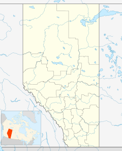
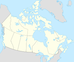
Claresholm is a friendly town located in southern Alberta, Canada. It sits right on Highway 2, which is a main road. You can find it about 91 kilometers (57 miles) northwest of Lethbridge and 125 kilometers (78 miles) south of Calgary. It's a great place to learn about history and enjoy the outdoors!
Contents
Claresholm's Past: A Journey Through Time
Claresholm has a really interesting history, starting way back when trains were powered by steam!
Early Days: From Watering Stop to Town
- 1891: The area where Claresholm is now was first used as a watering stop for steam engines on the Canadian Pacific Railway. This was along the old Macleod Trail.
- 1902: The very first settlers arrived and started building a community.
- 1903: Claresholm officially became a village.
- 1905: Just two years later, it grew big enough to become a town! This was also the same year that Alberta became a province in Canada.
- The town was named after Clare, who was the wife of an early pioneer in the area.
Growing Up: Farms, Hospitals, and Air Bases
- 1913: Alberta opened a special farm and a School of Agriculture in Claresholm. This helped people learn better farming methods.
- 1921: The town got its first hospital, making sure people could get medical care. A new hospital was built in 1939.
- 1941: During World War II, a big air force base called RCAF Station Claresholm was built near the town. It was part of the British Commonwealth Air Training Plan. Pilots from Canada and other countries came here to learn how to fly planes for the war.
- 1951: The base was used again to train pilots, this time for the Korean War and also for NATO (North Atlantic Treaty Organization) pilots.
- 1958: The air base closed down. The large airplane hangars were then used for different kinds of businesses. Part of the old base even became an industrial airport. If you visit the Claresholm Museum, you can see cool things from the air base, like a Link Trainer, which was a machine used to teach pilots how to fly.
Weather in Claresholm: Understanding the Climate
Claresholm has a type of weather called a humid continental climate. This means it has warm summers and cold winters.
Chinook Winds: A Special Weather Event
One cool thing about the weather in Claresholm is the Chinook winds. These are warm, dry winds that can cause the temperature to rise very quickly, sometimes from freezing cold to above freezing in just a few hours! It's like a sudden warm breath in the middle of winter.
| Climate data for Claresholm, Alberta | |||||||||||||
|---|---|---|---|---|---|---|---|---|---|---|---|---|---|
| Month | Jan | Feb | Mar | Apr | May | Jun | Jul | Aug | Sep | Oct | Nov | Dec | Year |
| Record high °C (°F) | 18.0 (64.4) |
24.0 (75.2) |
25.0 (77.0) |
29.0 (84.2) |
33.0 (91.4) |
33.9 (93.0) |
37.0 (98.6) |
36.7 (98.1) |
34.4 (93.9) |
30.0 (86.0) |
22.2 (72.0) |
21.0 (69.8) |
37.0 (98.6) |
| Mean daily maximum °C (°F) | 1.0 (33.8) |
2.4 (36.3) |
6.4 (43.5) |
12.5 (54.5) |
17.5 (63.5) |
21.1 (70.0) |
25.0 (77.0) |
24.7 (76.5) |
19.2 (66.6) |
13.1 (55.6) |
4.9 (40.8) |
1.3 (34.3) |
12.4 (54.3) |
| Daily mean °C (°F) | −5.6 (21.9) |
−4.2 (24.4) |
−0.1 (31.8) |
5.8 (42.4) |
10.5 (50.9) |
14.5 (58.1) |
17.6 (63.7) |
17.0 (62.6) |
11.6 (52.9) |
6.4 (43.5) |
−1.1 (30.0) |
−4.9 (23.2) |
5.6 (42.1) |
| Mean daily minimum °C (°F) | −12.2 (10.0) |
−10.9 (12.4) |
−6.6 (20.1) |
−1.0 (30.2) |
3.6 (38.5) |
7.9 (46.2) |
10.1 (50.2) |
9.2 (48.6) |
4.1 (39.4) |
−0.4 (31.3) |
−7.0 (19.4) |
−11.1 (12.0) |
−1.2 (29.8) |
| Record low °C (°F) | −41.1 (−42.0) |
−40.0 (−40.0) |
−38.0 (−36.4) |
−27.2 (−17.0) |
−10.0 (14.0) |
−4.0 (24.8) |
0.0 (32.0) |
−3.0 (26.6) |
−13.0 (8.6) |
−28.0 (−18.4) |
−37.0 (−34.6) |
−44.0 (−47.2) |
−44.0 (−47.2) |
| Average precipitation mm (inches) | 15.6 (0.61) |
16.7 (0.66) |
24.3 (0.96) |
30.4 (1.20) |
59.1 (2.33) |
89.3 (3.52) |
47.3 (1.86) |
46.1 (1.81) |
44.7 (1.76) |
16.0 (0.63) |
19.3 (0.76) |
15.4 (0.61) |
424.2 (16.70) |
| Average rainfall mm (inches) | 0.0 (0.0) |
0.6 (0.02) |
3.5 (0.14) |
18.7 (0.74) |
55.2 (2.17) |
89.3 (3.52) |
47.3 (1.86) |
46.0 (1.81) |
43.8 (1.72) |
9.2 (0.36) |
2.1 (0.08) |
0.5 (0.02) |
316.1 (12.44) |
| Average snowfall cm (inches) | 15.6 (6.1) |
16.1 (6.3) |
20.8 (8.2) |
11.7 (4.6) |
4.0 (1.6) |
0.0 (0.0) |
0.0 (0.0) |
0.1 (0.0) |
1.0 (0.4) |
6.8 (2.7) |
17.2 (6.8) |
14.9 (5.9) |
108.1 (42.6) |
| Source: Environment Canada | |||||||||||||
Who Lives in Claresholm?
The number of people living in Claresholm changes over time. This is called population.
How Many People Call Claresholm Home?
|
||||||||||||||||||||||||||||||
- In 2021, a group called Statistics Canada counted the population of Claresholm. There were 3,804 people living there.
- These people lived in 1,709 homes out of 1,826 total homes in the town.
- This number was a small increase from the 3,790 people counted in 2016.
- Claresholm covers a land area of about 10.51 square kilometers (4.06 square miles).
- This means there were about 362 people living in each square kilometer in 2021.
 | Madam C. J. Walker |
 | Janet Emerson Bashen |
 | Annie Turnbo Malone |
 | Maggie L. Walker |


