Clarkia, Idaho facts for kids
Quick facts for kids
Clarkia, Idaho
|
|
|---|---|
|
Town
|
|

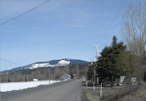
A view to the north of Clarkia from Poplar St.
|
|
| Country | United States |
| State | Idaho |
| County | Shoshone |
| Area | |
| • Total | 45.07 sq mi (116.7 km2) |
| • Land | 45.07 sq mi (116.7 km2) |
| • Water | 0 sq mi (0 km2) |
| Elevation | 2,828 ft (862 m) |
| Population
(2000)
|
|
| • Total | 97 |
| • Density | 2.15/sq mi (0.83/km2) |
| Time zone | UTC-8 (Pacific Time Zone) |
| • Summer (DST) | UTC-7 |
| ZIP code |
83812
|
| Area code(s) | 208 |
Clarkia is a small, quiet community located in the beautiful forests of Shoshone County, Idaho. It's surrounded by tall trees like Douglas-fir, Ponderosa Pine, and Western Larch. This little town sits just east of State Highway 3, close to the West Fork of the St. Maries River.
The Story of Clarkia
Long before settlers arrived, the Coeur d'Alene people lived in this area for thousands of years. They called this place Chatnna, which means "Meadow." Clarkia got its name from Captain William Clark, who was part of the famous Lewis and Clark expedition.
The first people who lived in Clarkia made their living by cutting down Western White Pine trees for lumber. In 1909, about 60 people lived in Clarkia. By 1960, the population had grown to an estimated 200 people.
Who Lives in Clarkia?
According to a count done in 2000, Clarkia had 97 residents. The average household in Clarkia earned about $39,375 per year. The average family size was 2.68 people.
Many jobs in Clarkia were related to farming, making up about 40.5% of all jobs in 2000. Other important jobs were in education, health, and social services. A large number of people, about 47.6%, worked for government agencies.
Clarkia shares a school district for kindergarten through 8th grade with the nearby communities of Avery and Calder. Today, all students from Clarkia attend school in the Deary school district.
Nature and Geography
Clarkia is located in a flat, open meadow area. This meadow was formed a very long time ago by a large body of water called Lake Clarkia. This ancient lake existed during the Miocene Epoch, which was millions of years ago.
The mud and sand from this old lake contain many amazing and well-preserved fossils of plants from the mid-Miocene period. You can even see these fossils at a place called the Fossil Bowl. It's a public fossil dig and a motorcross racetrack located right on Highway 3 in Clarkia!
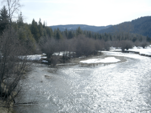
The West and Middle Forks of the St. Maries River meet near Clarkia. From there, they flow northwest, following State Highway 3, all the way to St. Maries. Clarkia is on the eastern edge of the Columbia River Plateau and to the west of the Bitterroot Mountains.
Clarkia's Climate
Clarkia has a type of weather called a humid continental climate. This means that the area experiences big changes in temperature throughout the year. Summers are usually warm to hot, and sometimes humid. Winters are cold, and can sometimes be very cold.
 | William L. Dawson |
 | W. E. B. Du Bois |
 | Harry Belafonte |


