Clear Lake (Douglas County, Oregon) facts for kids
Quick facts for kids Clear Lake |
|
|---|---|

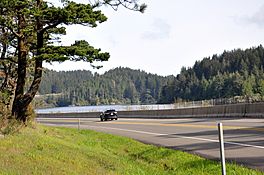
View of the lake along U.S. Route 101
|
|
| Location | near Winchester Bay |
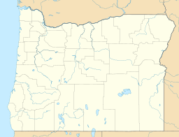
| Coordinates | 43°38′37″N 124°10′57″W / 43.64361°N 124.18250°W |
| Lake type | Natural, oligotrophic |
| Primary inflows | Small intermittent streams |
| Primary outflows | Through Edna Lake and Clear Creek to Eel Lake |
| Catchment area | 2 square miles (5.2 km2) |
| Basin countries | United States |
| Surface area | 317 acres (128 ha) |
| Average depth | 54 feet (16 m) |
| Max. depth | 119 feet (36 m) |
| Water volume | 16,600 acre-feet (20,500,000 m3) |
| Residence time | 2.7 years |
| Shore length1 | 8.7 miles (14.0 km) |
| Surface elevation | 233 feet (71 m) |
| Settlements | Reedsport |
| 1 Shore length is not a well-defined measure. | |
Clear Lake is a natural lake located on the Oregon Coast in the United States. It was formed by sand dunes that blocked an old river valley. This lake is very important because it provides clean drinking water for the city of Reedsport, which is about 4 miles (6 km) away. To keep the water safe and pure, people are not allowed to visit Clear Lake.
About Clear Lake
Clear Lake is a beautiful natural lake in Oregon. It sits near the Pacific Ocean. The lake is special because it was created by huge sand dunes. These dunes slowly moved and blocked the path of an ancient stream. This created a natural dam, which then formed the lake we see today.
Where is Clear Lake Located?
You can find Clear Lake along U.S. Route 101, a major highway that runs along the west side of the lake. The small town of Winchester Bay is just north of the lake. If you travel a bit further northwest, you'll find Umpqua Lighthouse State Park and the mouth of the Umpqua River. To the west, along the coast, is the famous Oregon Dunes National Recreation Area.
How Water Flows from Clear Lake
Water from Clear Lake doesn't just stay put. It flows south into another lake called Edna Lake. From there, it continues through a stream called Clear Creek. Eventually, this water reaches Eel Lake.
Clear Lake is quite high up, about 229 feet (70 m) above sea level. It's actually the highest of several lakes in this area that were formed by sand dunes. These lakes include Eel Lake and Tenmile Lake. All the water from these lakes generally flows south. It ends up in Tenmile Creek in Coos County. Finally, Tenmile Creek flows west and empties into the Pacific Ocean near the community of Lakeside.
 | Percy Lavon Julian |
 | Katherine Johnson |
 | George Washington Carver |
 | Annie Easley |


