
Cleveland, Texas facts for kids
Quick facts for kids
Cleveland, Texas
|
|
|---|---|
|
City
|
|
 |
|

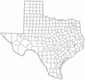
Location in the State of Texas
|
|
 |
|
| Country | United States |
| State | Texas |
| County | Liberty |
| Incorporated | 1935 |
| Area | |
| • Total | 18.99 sq mi (49.19 km2) |
| • Land | 18.98 sq mi (49.16 km2) |
| • Water | 0.01 sq mi (0.03 km2) |
| Elevation | 151 ft (46 m) |
| Population
(2020)
|
|
| • Total | 7,471 |
| • Density | 434.01/sq mi (167.57/km2) |
| Time zone | UTC-6 (CST) |
| • Summer (DST) | UTC-5 (CDT) |
| ZIP codes |
77327-77328
|
| Area code(s) | 281/346/713/832 |
| FIPS code | 48-15436 |
| GNIS feature ID | 2409482 |
Cleveland is a city in the U.S. state of Texas. It is located in Liberty County, near the big city of Houston. In 2020, about 7,471 people lived there.
Contents
History of Cleveland
The town of Cleveland started to form in 1878. A local judge named Charles Lander Cleveland gave 63.6 acres of his land to a railway company. He wanted the town to be named after him.
Since 1900, Cleveland has been an important meeting point for two major railway lines. The town officially became a city in 1935.
The forests around Cleveland are popular for outdoor activities. People from the Houston area come to camp, hike, hunt, and fish. The Sam Houston National Forest is just north of the city.
Cleveland has fun places like the Texan Theater. It also hosts an annual livestock show and rodeo called Dairy Days. The Austin Memorial Library Center offers many services for the community.
For a long time, Cleveland has been a center for shipping timber and wood products. The city's economy also relies on oil, gas, cattle, farm goods, and sand and gravel.
Geography and Climate
Cleveland is located in Texas. The city covers about 4.8 square miles of land. The northern edge of Cleveland borders the Sam Houston National Forest.
The weather in Cleveland is usually hot and humid in the summer. Winters are generally mild or cool. This type of weather is called a humid subtropical climate.
Cleveland's Climate
| Climate data for Cleveland, Texas (1991–2020 normals, extremes 1962–2018) | |||||||||||||
|---|---|---|---|---|---|---|---|---|---|---|---|---|---|
| Month | Jan | Feb | Mar | Apr | May | Jun | Jul | Aug | Sep | Oct | Nov | Dec | Year |
| Record high °F (°C) | 83 (28) |
90 (32) |
91 (33) |
98 (37) |
98 (37) |
102 (39) |
105 (41) |
112 (44) |
110 (43) |
98 (37) |
87 (31) |
84 (29) |
112 (44) |
| Mean maximum °F (°C) | 77.2 (25.1) |
80.4 (26.9) |
84.8 (29.3) |
87.8 (31.0) |
91.6 (33.1) |
94.7 (34.8) |
97.1 (36.2) |
98.9 (37.2) |
95.8 (35.4) |
90.2 (32.3) |
83.2 (28.4) |
78.0 (25.6) |
99.5 (37.5) |
| Mean daily maximum °F (°C) | 60.8 (16.0) |
65.0 (18.3) |
71.6 (22.0) |
77.1 (25.1) |
83.4 (28.6) |
88.9 (31.6) |
91.4 (33.0) |
92.4 (33.6) |
87.5 (30.8) |
79.2 (26.2) |
68.7 (20.4) |
61.7 (16.5) |
77.3 (25.2) |
| Daily mean °F (°C) | 49.8 (9.9) |
53.7 (12.1) |
60.3 (15.7) |
66.0 (18.9) |
73.4 (23.0) |
79.4 (26.3) |
81.6 (27.6) |
81.9 (27.7) |
76.9 (24.9) |
67.7 (19.8) |
57.6 (14.2) |
50.9 (10.5) |
66.6 (19.2) |
| Mean daily minimum °F (°C) | 38.9 (3.8) |
42.5 (5.8) |
49.0 (9.4) |
54.9 (12.7) |
63.4 (17.4) |
69.8 (21.0) |
71.7 (22.1) |
71.3 (21.8) |
66.4 (19.1) |
56.3 (13.5) |
46.6 (8.1) |
40.2 (4.6) |
55.9 (13.3) |
| Mean minimum °F (°C) | 23.6 (−4.7) |
26.7 (−2.9) |
31.6 (−0.2) |
39.4 (4.1) |
50.4 (10.2) |
62.1 (16.7) |
66.4 (19.1) |
65.7 (18.7) |
52.3 (11.3) |
40.3 (4.6) |
31.5 (−0.3) |
24.8 (−4.0) |
20.4 (−6.4) |
| Record low °F (°C) | 11 (−12) |
16 (−9) |
20 (−7) |
29 (−2) |
36 (2) |
50 (10) |
55 (13) |
54 (12) |
39 (4) |
25 (−4) |
19 (−7) |
5 (−15) |
5 (−15) |
| Average precipitation inches (mm) | 4.45 (113) |
4.29 (109) |
3.76 (96) |
3.73 (95) |
5.25 (133) |
5.19 (132) |
3.46 (88) |
4.56 (116) |
5.10 (130) |
5.75 (146) |
5.39 (137) |
4.60 (117) |
55.53 (1,410) |
| Average snowfall inches (cm) | 0.1 (0.25) |
0.0 (0.0) |
0.0 (0.0) |
0.0 (0.0) |
0.0 (0.0) |
0.0 (0.0) |
0.0 (0.0) |
0.0 (0.0) |
0.0 (0.0) |
0.0 (0.0) |
0.0 (0.0) |
0.0 (0.0) |
0.1 (0.25) |
| Average precipitation days (≥ 0.01 in) | 10.1 | 9.4 | 8.8 | 7.3 | 8.1 | 9.8 | 8.1 | 8.1 | 7.5 | 6.7 | 8.3 | 10.7 | 102.9 |
| Average snowy days (≥ 0.1 in) | 0.1 | 0.0 | 0.0 | 0.0 | 0.0 | 0.0 | 0.0 | 0.0 | 0.0 | 0.0 | 0.0 | 0.1 | 0.2 |
| Source: NOAA(mean maxima/minima 1981–2010) | |||||||||||||
People in Cleveland
| Historical population | |||
|---|---|---|---|
| Census | Pop. | %± | |
| 1930 | 1,422 | — | |
| 1940 | 1,783 | 25.4% | |
| 1950 | 5,183 | 190.7% | |
| 1960 | 5,838 | 12.6% | |
| 1970 | 5,627 | −3.6% | |
| 1980 | 5,977 | 6.2% | |
| 1990 | 7,124 | 19.2% | |
| 2000 | 7,605 | 6.8% | |
| 2010 | 7,675 | 0.9% | |
| 2020 | 7,471 | −2.7% | |
| U.S. Decennial Census 1850–1900 1910 1920 1930 1940 1950 1960 1970 1980 1990 2000 2010 |
|||


| Race / Ethnicity (NH = Non-Hispanic) | Pop 2000 | Pop 2010 | Pop 2020 | % 2000 | % 2010 | % 2020 |
|---|---|---|---|---|---|---|
| White alone (NH) | 3,842 | 3,510 | 3,109 | 50.52% | 45.73% | 41.61% |
| Black or African American alone (NH) | 2,055 | 1,819 | 1,599 | 27.02% | 23.70% | 21.40% |
| Native American or Alaska Native alone (NH) | 22 | 12 | 24 | 0.29% | 0.16% | 0.32% |
| Asian alone (NH) | 44 | 99 | 76 | 0.58% | 1.29% | 1.02% |
| Pacific Islander alone (NH) | 0 | 1 | 2 | 0.00% | 0.01% | 0.03% |
| Other race alone (NH) | 15 | 7 | 15 | 0.20% | 0.09% | 0.20% |
| Mixed race or Multiracial (NH) | 67 | 96 | 237 | 0.88% | 1.25% | 3.17% |
| Hispanic or Latino (any race) | 1,560 | 2,131 | 2,409 | 20.51% | 27.77% | 32.24% |
| Total | 7,605 | 7,675 | 7,471 | 100.00% | 100.00% | 100.00% |
In 2020, the city of Cleveland had 7,471 people. There were 2,729 households and 1,873 families living in the city.
In 2010, Cleveland had 7,675 people. About 45.7% were White, 23.7% Black, and 1.3% Asian. About 27.8% of the people were Hispanic or Latino.
In 2000, there were 7,605 people living in Cleveland. About 34% of households had children under 18. The average household had 2.63 people.
The population included 27.4% under 18 years old. About 14% of the people were 65 years or older. The average age in Cleveland was 33 years.
Education in Cleveland
Cleveland is served by a few different school districts. Most of the city is in the Cleveland Independent School District. Some smaller parts are in the Tarkington Independent School District. Tarkington ISD also uses a Cleveland zip code.
Parts of Cleveland in Montgomery County are served by Cleveland ISD. Other parts are in the Splendora Independent School District.
As of 2023, Cleveland High School is the main high school for Cleveland ISD. Splendora High School serves Splendora ISD, and Tarkington High School serves Tarkington ISD.
Students in these school districts can attend classes at the Lone Star College System.
Transportation
Highways
The main road through Cleveland is U.S. Highway 59. This highway will soon be called Interstate 69. It goes southwest towards Houston and northeast into East Texas. This road helps connect Cleveland to other cities like Livingston and Lufkin.
There is also a business route, U.S. Highway 59 Business. This is the older path of U.S. 59 that runs through the middle of Cleveland. It is known as Washington Avenue.
SH 105 goes east and west. Cleveland is about halfway between Beaumont and Navasota on this highway. A new bypass road was built around Cleveland to help with traffic.
Railroads
Cleveland is a key spot for two railway lines. One line, run by Union Pacific, goes north and south. It follows a path similar to U.S. Highway 59. The other line, run by Burlington Northern Santa Fe, goes east and west.
A company called Union Tank Car Company has a facility in Cleveland. They repair and maintain tank cars for trains there.
Airports
Cleveland has its own small airport called Cleveland Municipal Airport. This airport is for general aviation, not large passenger planes. For commercial flights, people in Cleveland use George Bush Intercontinental Airport in Houston.
Notable People
- Jason Grimsley was born in Cleveland. He went to school in Tarkington ISD, which is near Cleveland. Jason was a professional baseball pitcher. He played for several teams, including the Philadelphia Phillies and the New York Yankees.
- Gib Lewis spent his early years in Cleveland. He graduated from Cleveland High School in 1955. Later, he became the Speaker of the Texas House of Representatives. He was the first person to hold that important job for five terms.
Images for kids
-
-
Location in the State of Texas
-

See also
 In Spanish: Cleveland (Texas) para niños
