Cnoc an Chuillinn facts for kids
Quick facts for kids Cnoc an Chuillinn |
|
|---|---|

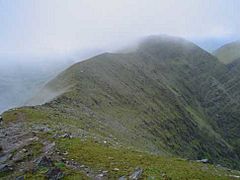
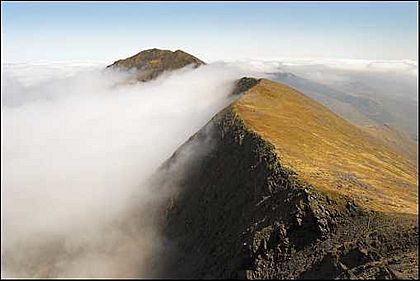
Ridge and summit of Cnoc an Chuillinn East Top (near), and Cnoc an Chuillinn (far), as seen looking westwards from Maolan Bui
|
|
| Highest point | |
| Elevation | 958 m (3,143 ft) |
| Prominence | 53 m (174 ft) |
| Listing | Furth, Hewitt, Arderin, Simm, Vandeleur-Lynam |
| Geography | |
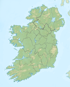
| Location | County Kerry, Ireland |
| Parent range | MacGillycuddy's Reeks |
| OSI/OSNI grid | V823833 |
| Topo map | OSI Discovery 78 |
| Geology | |
| Mountain type | Purple sandstone & siltstone Bedrock |
Cnoc an Chuillinn (pronounced 'Knock an Hwill-in') is a tall mountain in County Kerry, Ireland. Its name comes from the Irish language and means "hill of the steep slope." Standing at 958 meters (about 3,143 feet) high, it's one of the highest peaks in Ireland.
This mountain is part of the MacGillycuddy's Reeks range. This is Ireland's highest mountain range. Sometimes, people mistakenly call it 'Knockacullion'. However, that name is used for other places in Ireland.
Exploring Cnoc an Chuillinn

Cnoc an Chuillinn is located in the eastern part of the MacGillycuddy's Reeks. This area is home to many of Ireland's tallest mountains. Cnoc an Chuillinn marks the start of a high ridge. A ridge is like a long, narrow mountain top.
Nearby Peaks and Features
As you move east along this ridge, you'll find several other important peaks:
- Cnoc an Chuillinn East Top: This peak is 926 meters (3,038 feet) high. It's a smaller peak connected to Cnoc an Chuillinn.
- Maolán Buí: This mountain reaches 973 meters (3,192 feet).
- Cnoc na Péiste: This is a very high peak at 988 meters (3,241 feet).
- The Big Gun: This peak stands at 939 meters (3,081 feet).
- Cruach Mhór: The ridge finishes with this mountain, which is 932 meters (3,058 feet) tall.
Between Cnoc an Chuillinn and its East Top, there's a path leading south-east. This path goes down to Brassel Mountain, which is 575 meters (1,886 feet) high. Brassel Mountain is known for its steep climbs. It offers a different way to reach the main Reeks ridge. This route is less common than the ones from Hag's Glen.
To the west of Cnoc an Chuillinn is Cnoc na Toinne, which is 845 meters (2,772 feet) high. After that, the land drops down to a low point called a 'col'. From this col, you can go down the famous Devil's Ladder into the Hag's Glen.
Understanding Mountain Lists
Cnoc an Chuillinn is recognized on several important mountain lists. These lists help people classify mountains based on their height and how much they stand out from the land around them.
- Simm Classification: Cnoc an Chuillinn is the 316th-highest mountain in Britain and Ireland on this list.
- Furth Classification: This mountain is one of 34 "Furths." A Furth is a mountain over 3,000 feet (914 meters) tall. It also meets other special rules, like being separate enough from other mountains. These mountains are outside of Scotland. Cnoc an Chuillinn is sometimes called one of the 13 "Irish Munros." A Munro is a mountain in Scotland that meets these rules.
- Arderin, Hewitt, and Vandeleur-Lynam Lists: Cnoc an Chuillinn is also on these lists. These lists are important for mountain climbers and hikers. They help them track which peaks they have climbed.
It's important to use the correct name for the mountain. The name Cnoc an Chuillinn is sometimes spelled wrong. People might swap letters or use too few 'l's or 'n's.
 | Frances Mary Albrier |
 | Whitney Young |
 | Muhammad Ali |


