
Cochecton, New York facts for kids
Quick facts for kids
Cochecton, New York
|
|
|---|---|

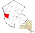
Location of Cochecton in Sullivan County, New York
|
|

Cochecton, New York
Location in New York
|
|
| Country | United States |
| State | New York |
| County | Sullivan |
| Area | |
| • Total | 37.09 sq mi (96.06 km2) |
| • Land | 36.29 sq mi (94.00 km2) |
| • Water | 0.79 sq mi (2.06 km2) |
| Elevation | 1,250 ft (381 m) |
| Population
(2020)
|
|
| • Total | 1,448 |
| • Density | 36.20/sq mi (13.98/km2) |
| Time zone | UTC-5 (Eastern (EST)) |
| • Summer (DST) | UTC-4 (EDT) |
| ZIP Code |
12726
|
| Area code(s) | 845 |
| FIPS code | 36-16661 |
| GNIS feature ID | 0978844 |
Cochecton (pronounced "cuh-SHEK-ton") is a small town in Sullivan County, New York, United States. It's located in the west-central part of the county. In 2020, about 1,448 people lived there.
The name "Cochecton" comes from the Lenape language. It means "place of red stone hills" or "foaming water." The town sits right on the Delaware River, across from Damascus, Pennsylvania. A bridge connects the two places.
Contents
A Look Back: Cochecton's History
Early Borders and Town Formation
Long ago, in 1664, Cochecton was an important spot. It marked the border between New York and New Jersey. A special point called "station rock" on the Delaware River showed where New York, New Jersey, and Pennsylvania met. After a long disagreement, the final border was moved south, near Port Jervis.
The town of Cochecton was officially created in 1828. It was formed from a part of another town called Bethel. Later, in 1869, the Town of Delaware was formed from a piece of Cochecton.
The Oldest Train Station in New York
Cochecton was once a stop on the Erie Railroad, a major train line. Passenger trains stopped running here in 1966. Today, the Cochecton Railroad Station is the oldest surviving train station for passengers in all of New York State!
In the early 1990s, the station was in danger of being torn down. A local group called the "Cochecton Preservation Society" worked hard to save it. They carefully moved the old building about a mile away to a new spot along the railroad tracks. This amazing effort saved a piece of history for everyone to enjoy.
Famous Connections and Local Landmarks
Cochecton is known for a few interesting things. It was supposedly the home of Tammany, a wise Native American leader of the Lenape people. He later became a symbol for America, especially during the American Revolutionary War.
The famous Woodstock Festival happened nearby in Bethel. After the festival, the Yasgur family, who hosted it on their farm, changed their address to Cochecton.
Several important buildings and places in Cochecton are listed on the National Register of Historic Places. This means they are special and protected because of their history. Some of these include the Drake-Curtis House, Ellery Calkins House, Cochecton Presbyterian Church, Reilly's Store, and the Valleau Tavern.
Cochecton's Geography and Climate
Where is Cochecton Located?
Cochecton's western border is the Delaware River, which also forms the border with Pennsylvania. The Cochecton–Damascus Bridge connects Cochecton to Damascus Township in Pennsylvania.
The town covers about 37.4 square miles (96.06 square kilometers). Most of this area is land, with a small part being water.
Weather in Cochecton
Because Cochecton is in a deep valley along the upper Delaware River, its weather is a bit different. It has a climate called "hemiboreal." This means it has mild to warm summers and cold winters.
The town gets rain and snow pretty evenly throughout the year. The driest month is November, and the wettest is May.
Who Lives in Cochecton? Demographics
| Historical population | |||
|---|---|---|---|
| Census | Pop. | %± | |
| 1830 | 438 | — | |
| 1840 | 622 | 42.0% | |
| 1850 | 1,981 | 218.5% | |
| 1860 | 2,771 | 39.9% | |
| 1870 | 1,490 | −46.2% | |
| 1880 | 1,328 | −10.9% | |
| 1890 | 1,174 | −11.6% | |
| 1900 | 1,117 | −4.9% | |
| 1910 | 1,142 | 2.2% | |
| 1920 | 1,112 | −2.6% | |
| 1930 | 1,154 | 3.8% | |
| 1940 | 1,189 | 3.0% | |
| 1950 | 1,136 | −4.5% | |
| 1960 | 1,070 | −5.8% | |
| 1970 | 1,181 | 10.4% | |
| 1980 | 1,330 | 12.6% | |
| 1990 | 1,318 | −0.9% | |
| 2000 | 1,327 | 0.7% | |
| 2010 | 1,372 | 3.4% | |
| 2020 | 1,448 | 5.5% | |
| U.S. Decennial Census | |||
In 2000, there were 1,328 people living in Cochecton. About 555 households and 376 families called the town home. The population density was about 36 people per square mile.
Many households (27.2%) had children under 18 living with them. Most households (56%) were married couples. The average household had about 2.38 people.
The population was spread out by age. About 22.5% were under 18, and 17.4% were 65 or older. The average age was 42 years old.
The median income for a household in Cochecton was $41,250. This means half of the households earned more than this, and half earned less. About 7.2% of the population lived below the poverty line.
The town's population was highest in the 1800s, reaching about 3,000 people.
Communities and Locations in Cochecton
Cochecton is made up of several smaller communities and areas:
- Cochecton (formerly Cushetunk) – This is the main village, located on Route 97 by the Delaware River.
- Cochecton Center (formerly Stephensburgh) – A small community south of Lake Huntington on Route 52. The old Cochecton Center Methodist Episcopal Church is a historic landmark here.
- East Cochecton – A community located between Cochecton and Fosterdale.
- Fosterdale – Found in the eastern part of the town, where Routes 17B and 52 meet.
- Lake Huntington – A community south of Fosterdale on Route 52. The Jewish Center of Lake Huntington is a historic building here.
- Nobody Station – A unique name for a location in the southwestern part of town.
- Skinners Falls – A spot along the Delaware River, south of Cochecton village.
- Tylertown – A location in the southeastern part of the town.
Notable Person from Cochecton
- Frank Schulte – He was a baseball player who played outfield for the Chicago Cubs. He was part of the teams that won the 1907 World Series and 1908 World Series. Frank Schulte was born right here in Cochecton!
Images for kids
-
Location of Cochecton in Sullivan County, New York
See also
 In Spanish: Cochecton para niños
