Colonia, New Jersey facts for kids
Quick facts for kids
Colonia, New Jersey
|
|
|---|---|

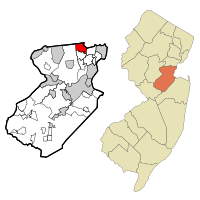
Location in Middlesex County (left) and the state of New Jersey (right)
|
|
| Country | |
| State | |
| County | Middlesex |
| Township | Woodbridge |
| Area | |
| • Total | 4.03 sq mi (10.45 km2) |
| • Land | 4.03 sq mi (10.44 km2) |
| • Water | 0.00 sq mi (0.01 km2) 0.11% |
| Elevation | 69 ft (21 m) |
| Population
(2020)
|
|
| • Total | 18,609 |
| • Density | 4,617.62/sq mi (1,782.99/km2) |
| Time zone | UTC−05:00 (Eastern (EST)) |
| • Summer (DST) | UTC−04:00 (Eastern (EDT)) |
| ZIP Code |
07067
|
| Area code(s) | 732/848 |
| FIPS code | 34-14380 |
| GNIS feature ID | 02389346 |
Colonia is a community in Woodbridge Township, Middlesex County, New Jersey, in the United States. It is known as a census-designated place (CDP). This means it's an area identified by the government for collecting population data. In 2020, about 18,609 people lived in Colonia.
Contents
History of Colonia
In 1919, a new road was built in the area. This road became part of the Lincoln Highway. The Lincoln Highway was one of the first plans for a road that would cross the entire United States. The new section of road in Colonia helped avoid two railroad crossings. This made travel easier and safer.
Geography of Colonia
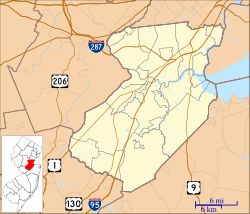
Colonia is located in the northeastern part of Middlesex County, New Jersey. It sits in the northwest corner of Woodbridge Township. Nearby towns include Clark to the north and Edison to the west.
The community covers about 4 square miles (10.4 square kilometers). Only a tiny part of this area is water. The Rahway River flows through the area. Colonia has a warm, humid climate. Average temperatures range from about 33°F (0.5°C) in January to 78.1°F (25.6°C) in July.
The Garden State Parkway goes through Colonia. This is a major highway in New Jersey. There is a service plaza in Colonia for northbound traffic. It's a unique stop because it's on private land.
Population and People
Colonia has seen its population grow over the years.
| Historical population | |||
|---|---|---|---|
| Census | Pop. | %± | |
| 1990 | 18,238 | — | |
| 2000 | 17,811 | −2.3% | |
| 2010 | 17,795 | −0.1% | |
| 2020 | 18,609 | 4.6% | |
| Population sources: 1990-2010 2000 2010 2020 |
|||
In 2010, there were 17,795 people living in Colonia. Most residents were White (80.37%). There were also people of Black or African American (5.26%) and Asian (10.70%) backgrounds. About 9.27% of the population identified as Hispanic or Latino.
Families made up a large part of the community. Many households (65.6%) were married couples living together. The average household had almost three people. The median age in Colonia was about 42 years old.
Parks and Fun Activities
Colonia is home to Merrill Park, a large county park. It covers 179 acres and offers many things to do. The park is kept nice by local funding and community groups.
Merrill Park has:
- Four tennis courts
- Three baseball fields
- A soccer field
- A football field
- Two basketball courts
- Two softball fields
- Seven picnic areas you can reserve
- Other open picnic areas
- Three playgrounds, including a "Progressive Playground"
There are also walking paths around the sports fields. You can find many small trails throughout the park for exploring.
Schools in Colonia
Colonia has several schools that are part of the Woodbridge Township School District.
Public Schools
- Elementary Schools (Kindergarten to 5th grade):
- Claremont Avenue Elementary School #20
- Lynn Crest Elementary School #22
- Oak Ridge Heights Elementary School #21
- Pennsylvania Avenue Elementary School #27
- Middle School (6th to 8th grade):
- Colonia Middle School
- High School (9th to 12th grade):
- Colonia High School
Private School
- St. John Vianney Grammar School (Kindergarten to 8th grade)
Famous People from Colonia
Many notable people have connections to Colonia, including:
- John Carlson (born 1990), a professional ice hockey player who won the Stanley Cup.
- John Gorka (born 1958), a folk singer and songwriter.
- Kelsey Grammer (born 1955), a well-known actor from TV shows like Frasier and Cheers.
- Eric LeGrand (born 1990), a football player who was paralyzed during a game. He is now an inspiration to many.
- Tico Torres (born 1953), the drummer for the famous rock band Bon Jovi.
See also
 In Spanish: Colonia (Nueva Jersey) para niños
 | Mary Eliza Mahoney |
 | Susie King Taylor |
 | Ida Gray |
 | Eliza Ann Grier |


