Cone Mountain facts for kids
Quick facts for kids Cone Mountain |
|
|---|---|

Cone Mountain
|
|
| Highest point | |
| Elevation | 2,909 m (9,544 ft) |
| Prominence | 394 m (1,293 ft) |
| Parent peak | Mount Mercer (2970 m) |
| Listing | Mountains of Alberta |
| Geography | |
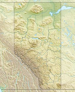
| Location | Alberta, Canada |
| Parent range | Sundance Range |
| Topo map | NTS 82J/14 |
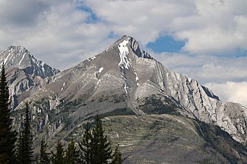
Cone Mountain is a cool peak located in the Canadian Rockies in Alberta, Canada. It's the very last mountain at the southern end of the Sundance Range.
People started calling it Cone Mountain in 1915 because it looks like a cone! In 1924, the Geographical Names Board of Canada officially gave it this name.
What's the Weather Like on Cone Mountain?
Cone Mountain has a subarctic climate. This means it gets really cold and snowy winters, but the summers are usually mild.
In winter, temperatures can fall below -20 °C (that's -4 °F!). With the wind, it can feel even colder, sometimes below -30 °C (-22 °F).
When snow melts or rain falls on Cone Mountain, the water flows into the Bow River. This river then joins the bigger Saskatchewan River.
How Was Cone Mountain Formed?
The rocks that make up Cone Mountain are sedimentary rock. These rocks were formed a very long time ago, from the Precambrian to the Jurassic periods.
They were laid down in shallow seas, like layers of sand and mud. Later, during a time called the Laramide orogeny, these rock layers were pushed up. They even moved over younger rocks, creating the mountain we see today.
 | William Lucy |
 | Charles Hayes |
 | Cleveland Robinson |


