Cooma-Monaro Shire facts for kids
Quick facts for kids Cooma-MonaroNew South Wales |
|||||||||||||||
|---|---|---|---|---|---|---|---|---|---|---|---|---|---|---|---|

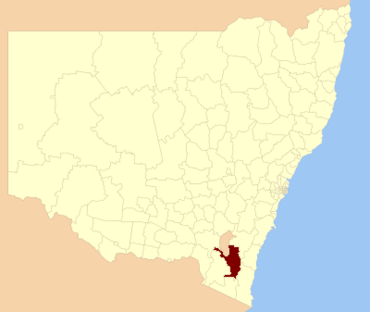
Location in New South Wales
|
|||||||||||||||
| Population | 10,073 (2013 est) | ||||||||||||||
| • Density | 1.92637/km2 (4.9893/sq mi) | ||||||||||||||
| Established | 1981 | ||||||||||||||
| Abolished | 12 May 2016 | ||||||||||||||
| Area | 5,229 km2 (2,018.9 sq mi) | ||||||||||||||
| Mayor | Dean Lynch | ||||||||||||||
| Council seat | Cooma | ||||||||||||||
| Region | Monaro | ||||||||||||||
| State electorate(s) | Monaro | ||||||||||||||
| Federal Division(s) | Eden-Monaro | ||||||||||||||
| Website | Cooma-Monaro | ||||||||||||||
|
|||||||||||||||
The Cooma-Monaro Shire was a special area in southern New South Wales, Australia. It was a local government area, which means it had its own council to manage local services.
This area got its name from two older areas: the Municipality of Cooma and the Monaro Shire. The Cooma Municipality started in 1879. The Monaro Shire was created a bit later, in 1906. These two areas joined together in 1981 to form the Cooma-Monaro Shire. In 2004, a small part of the Yarrowlumla Shire also became part of Cooma-Monaro.
In 2015, there was a review of how local government areas were set up. It was suggested that Cooma-Monaro Shire should combine with two other shires: Bombala and Snowy River. This new, larger council area would cover about 15,162 square kilometres and have around 21,000 people.
On May 12, 2016, the Cooma-Monaro Shire officially merged with the Bombala and Snowy River shires. Together, they formed a new council called the Snowy Monaro Regional Council.
The last person to be the mayor of Cooma-Monaro Shire Council was Dean Lynch. He was an independent politician, meaning he didn't belong to a major political party. After the merger, Dean Lynch was chosen to be the Administrator for the new Snowy Monaro Regional Council.
Places in Cooma-Monaro Shire
The main town in the Cooma-Monaro Shire was Cooma. It was first mapped out in March 1849.
The Shire also included other small towns like Nimmitabel, Numeralla, Bredbo, and Michelago. You could also find villages and their surrounding areas such as Adaminaby, Anglers Reach, Shannons Flat, Yaouk, Old Adaminaby, Peak View, Countegany, Jerangle, and Rock Flat.
How the Council Worked
The Cooma-Monaro Shire Council was made up of nine councillors. These councillors were elected by the people living in the area. They were chosen to represent everyone in the Shire.
All nine councillors were elected at the same time for a four-year term. This means they served for four years before another election was held. The mayor was then chosen by the councillors themselves at their very first meeting.
The last election for the Cooma-Monaro Shire Council happened on September 8, 2012. All nine councillors elected were independent or not officially linked to a major political party.
 | Emma Amos |
 | Edward Mitchell Bannister |
 | Larry D. Alexander |
 | Ernie Barnes |

