Monaro (New South Wales) facts for kids
Quick facts for kids MonaroNew South Wales |
|||||||||||||||
|---|---|---|---|---|---|---|---|---|---|---|---|---|---|---|---|

|
|||||||||||||||
| LGA(s) | Snowy Monaro | ||||||||||||||
| State electorate(s) |
|
||||||||||||||
| Federal Division(s) | Eden-Monaro | ||||||||||||||
|
|||||||||||||||
The Monaro region is in the south of New South Wales, Australia. Its name comes from an Aboriginal word meaning "big plain." Sometimes, people used to spell it "Manaro" or "Maneroo."
A small part of Victoria, near Snowy River National Park, is also part of the Monaro region. Even though the Australian Capital Territory isn't officially in Monaro, some towns here have strong connections with Canberra.
In 2016, the Snowy Monaro Regional Council was formed. This council helps manage local services for the area. It brought together three smaller local government areas: Bombala, Cooma-Monaro, and Snowy River.
The Monaro region is the traditional home of the Ngarigo people. They are the original custodians of this land. The Ngarigo people continue to live and thrive here. This area is known for its snowfields, large timber forests, and the famous Snowy River.
Did you know the car company Holden named some of its popular models after this region? The Holden Monaro coupe and sedan models were named after the Monaro area.
Geography of Monaro
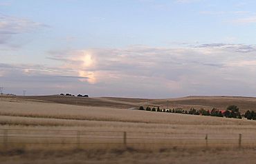
The Monaro region is a large, flat area called a plateau. It sits about 1,000 metres (3,280 feet) above sea level. This plateau stretches from the Murrumbidgee River valley in the north to the Errinundra Plateau in the south. On its eastern side, the land drops sharply towards the coast.
Much of the Monaro is very old highland. Near Cooma and Nimmitabel, you can find special black soils called chernozems. These are some of the best soils in Australia. In other parts, the soil is less fertile. Before clearing, these areas had dry forests. Today, they are often used for pastures. The region is also home to a unique plant community called the Southern Tablelands Temperate Grassland.
The Monaro region has rolling hills. These hills rise to very rugged peaks in the Tinderry Mountains. There are also shallow valleys in the upper Murrumbidgee area. The basaltic Monaro Range acts as a natural barrier. It separates the areas where water flows into the Snowy from where it flows into the Murrumbidgee.
Because the climate in the basaltic areas can be quite cold, growing crops is difficult. For example, Nimmitabel has even had frosts in January! So, the main farming activities here are raising sheep and beef cattle.
Monaro's Climate
The Monaro region is located east of the Snowy Mountains. This means that rain-bearing winds from the west drop their rain and snow on the mountains first. This leaves the Monaro region in a "rain shadow." A rain shadow is an area that gets much less rain because mountains block the clouds.
The amount of rain changes across the region. Around Dalgety, it gets about 430 millimetres (17 inches) of rain each year. At the eastern edge of the plateau, it can get up to 700 millimetres (26 inches). Sometimes, big storms from cyclones can bring a lot of rain. For example, in June 1975, Nimmitabel received 256 millimetres (over 10 inches) of rain in just one day!
Summers in Monaro are warm to very warm. The average highest temperature is around 28 °C (82 °F) near Canberra and Queanbeyan. On the highest parts of the plateau, it's cooler, around 22 °C (71 °F). Summer nights can be cool.
Winters are very cold, especially compared to other parts of mainland Australia outside the Alps. In July, the average lowest temperature is about -0.3 °C (31.5 °F) in Canberra. In Bombala, it's even colder, around -1.5 °C (29.3 °F).
Getting Around Monaro
The Monaro Highway is the main road that goes through the region. It runs south from Canberra through the Monaro area.
Other important roads include the Snowy Mountains Highway. This highway crosses the Monaro between Tumut and Bega. The Kosciuszko Road connects Cooma to Jindabyne. The Snowy River Way runs from Bombala to Jindabyne. These roads help people travel and explore the beautiful Monaro region.
Towns in Monaro
The main towns in the Monaro region are Cooma, Jindabyne, Berridale, and Bombala.
Other smaller towns and villages you can find here include:
Larger areas within the Monaro include Shannons Flat, Yaouk, Eucumbene, Bunyan, Jerangle, Countegany, and Kybeyan.
 | Valerie Thomas |
 | Frederick McKinley Jones |
 | George Edward Alcorn Jr. |
 | Thomas Mensah |

