Coral Sea Islands facts for kids
 |
|
| Geography | |
|---|---|
| Location | Coral Sea |
| Major islands | Willis Island, Cato Island |
| Administration | |
| Demographics | |
| Population | 4 (2018) |
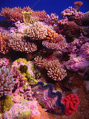
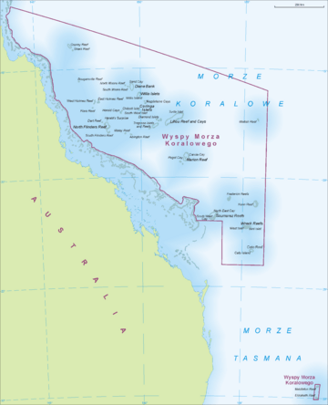
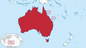
The Coral Sea Islands Territory is an external territory of Australia. This means it's a special area managed by Australia, even though it's not part of the main country. It includes many small, mostly empty tropical islands and reefs in the Coral Sea. This sea is located northeast of Queensland, Australia.
The only island where people live is Willis Island. The territory covers a huge area of 780,000 square kilometers, but most of this is ocean. It stretches east and south from the edge of the Great Barrier Reef. It includes places like Heralds Beacon Island, Osprey Reef, the Willis Group, and fifteen other groups of reefs and islands. Cato Island is the highest point in this territory.
Contents
Discovering the Coral Sea Islands
The Coral Sea Islands were first mapped in 1803. In the 1870s and 1880s, people tried to mine the islands for guano, which is bird droppings used as fertilizer. However, there wasn't enough fresh water, so people couldn't live there for long.
The Coral Sea Islands officially became an Australian external territory in 1969. This happened because of a law called the Coral Sea Islands Act. Before that, the area was considered part of Queensland. In 1997, the territory grew to include Elizabeth Reef and Middleton Reef. These reefs are about 800 kilometers further south.
These two reefs are much closer to Lord Howe Island, which is in New South Wales, Australia. They are only about 150 kilometers away. The islands, small sandy islands (cays), and reefs of the Great Barrier Reef are not part of this territory. They belong to Queensland. The outer edge of the Great Barrier Reef forms the border between Queensland and the Coral Sea Islands Territory.
How the Territory is Managed
The Coral Sea Islands Territory is owned by Australia. It is managed from Canberra by the Department of Infrastructure, Regional Development and Cities. Australia is also in charge of defending the territory. The Royal Australian Navy visits the islands regularly.
Australia has automatic weather stations on many of the islands and reefs. These stations help forecast the weather. Australia also claims a 200-nautical-mile (about 370 km) special fishing zone around the islands.
There isn't much economic activity here. However, there is a growing industry for charter fishing and diving tours. Only three or four people live in the territory. They work at the weather station on Willis Island (South Islet), which was set up in 1921. In November 2011, the Australian government announced plans for a large protected area in the Coral Sea. This area would cover about 989,842 square kilometers.
The Supreme Court of Norfolk Island has power over the islands. The laws of the Australian Capital Territory also apply here.
In June 2004, a group of activists from Australia made a symbolic political protest. They declared the Coral Sea Islands a self-governing micronation. On November 17, 2017, this group announced that their "kingdom" was no longer active. This happened after the results of a survey about marriage laws in Australia.
Exploring the Geography of the Coral Sea Islands
The territory has about 30 different reefs and atolls. Twelve of these are completely underwater or only show up at low tide. The other 18 have about 51 small islands or cays. Some of these cays have plants growing on them. For example, the atoll Lihou Reef alone has 18 cays.
The atolls vary greatly in size. Lihou Reef is one of the largest atolls in the world by total area, including its lagoon. Its lagoon is about 100 by 30 kilometers, covering 2,500 square kilometers. However, the land area of its 18 individual islets is only about 0.91 square kilometers. All the islands are very low, not rising much above the sea.
The Willis Islets are important places where birds and turtles lay their eggs. They have very few natural resources. Their total land area is less than 3 square kilometers. There are no big ports or harbors, only places where ships can anchor offshore.
Most of the atolls are grouped into two main areas. However, Mellish Reef to the east, and Middleton Reef and Elizabeth Reef to the south, are separate.
Northwestern Island Groups
This area includes many interesting reefs and atolls:
- Osprey Reef: A submerged atoll, about 25 by 12 kilometers. Its lagoon can be up to 30 meters deep.
- Shark Reef: A small, long submerged reef south of Osprey Reef.
- Bougainville Reef: A small submerged atoll that dries at half tide.
- East Holmes Reef: A submerged atoll, about 14 by 10 kilometers.
- West Holmes Reef: Another submerged atoll with two small cays.
- Flora Reef: A small submerged atoll.
- Diane Bank: A sunken atoll with shallow depths. It has Sand Cay in the Northwest.
- North Moore Reef: A small submerged atoll.
- South Moore Reef: A small submerged reef south of North Moore Reef.
- Willis Islets: A sunken atoll with three islets. South Islet, or Willis Island, is 10 meters high.
- Magdelaine Cays & Coringa Islets: A large, partly sunken atoll structure with four islets.
- Herald Cays, Northeast Cay: Surrounded by a reef.
- Herald Cays, Southwest Cay: Southwest of Northeast Cay.
- Lihou Reef and Cays: The largest atoll in the Coral Sea.
- Diamond Islets & Tregosse Reefs: A large, partly sunken atoll with four islets and two small submerged reefs.
- North Flinders Reef: A large atoll with two islets. Flinders Cay is the larger one.
- South Flinders Reef: Another atoll.
- Herald's Surprise: A small submerged reef north of Flinders Reefs.
- Dart Reef: A small submerged reef northwest of Flinders Reefs.
- Malay Reef: A small submerged reef that is hard to see.
- Abington Reef: A submerged reef, almost at the surface.
- Marion Reef: A large circular atoll with three small sand cays: Paget Cay, Carola Cay, and Brodie Cay.
The atolls in the Northwestern Group (except Osprey Reef, Shark Reef, and Marion Reef) are located on the Coral Sea Plateau. This is a continuous area where the ocean depth is less than 1,000 meters.
- The Flinders Reefs (North and South), Herald's Surprise, and Dart Reef form a group of reefs.
- The Magdelaine Cays, Coringa Islets, and Herald Cays are part of the 8,856 square kilometer Coringa-Herald National Nature Reserve. This reserve was created on August 16, 1982. It is about 400 kilometers east of Cairns. The six islets in this reserve have a total land area of 1.24 square kilometers.
- Lihou Reef was also declared a Nature Reserve on August 16, 1982. It covers an area of 8,440 square kilometers.
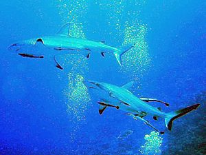
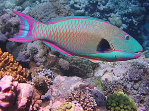
These Nature Reserves were created to protect the amazing wildlife in these parts of the territory. Together, they form the Coral Sea Reserves Ramsar Site.
Mellish Reef: A Distant Atoll
Mellish Reef is about 300 kilometers east of the Northwestern Group. This makes it the furthest reef from the Australian continent in the Coral Sea Islands Territory. It is shaped like a boomerang, about 10 kilometers long and 3 kilometers wide. The reefs around it, which form a narrow lagoon, are completely underwater at high tide. The only permanent land on this reef is Heralds-Beacon Islet. This small island is 600 meters by 120 meters and rises only a few meters above the high-water mark.
Southeastern Island Groups
This area includes several important reefs:
- Frederick Reefs: These reefs form a lagoon called Anchorage Sound. The complex is about 10 by 4 kilometers. Observatory Cay is the only part that is always dry land here.
- Kenn Reefs: A submerged atoll about 15 by 8 kilometers. It has an islet called Observatory Cay, which is 2 meters high.
- Saumarez Reefs: These are the southernmost reefs on the Coral Sea Shelf. They form a large crescent shape, about 27 by 14 kilometers. There are two sand cays here: North East Cay and South West Cay.
- Wreck Reefs: An atoll about 25 by 5 kilometers. It has islets like Bird Islet, West Islet, and Porpoise Cay.
- Cato Reef: Cato bank is 21 by 13 kilometers. Cato Reef itself surrounds a lagoon. Cato Island, located in the west of the lagoon, is 650 by 300 meters and 6 meters high. It is the highest point in the territory.
Extreme South: Elizabeth and Middleton Reefs
Elizabeth and Middleton reefs are considered the southernmost coral reefs in the world. They are located where tropical and cooler ocean currents meet. This mix of currents helps create a very diverse range of marine life. These atolls are mostly underwater and only show up at low tide. They were added to the territory in 1989. On December 23, 1987, they were protected as the Elizabeth and Middleton Reefs Marine National Park Reserve. This reserve covers 1,880 square kilometers.
- Elizabeth Reef: An atoll about 8.2 by 5.5 kilometers. It has one islet, Elizabeth Island (Elizabeth Cay), which has no plants. It is 600 by 400 meters, and its highest point is only 0.8 meters.
- Middleton Reef: An atoll about 8.9 by 6.3 kilometers. It has one islet called The Sound, which is 100 by 70 meters. Its highest point is 1.5 meters.
Summary of Islets and Cays
| Complex | Type | Islets/cays |
|---|---|---|
| West Holmes Reef | Atoll | 2 |
| Diane Bank | Atoll (mostly sunken) | Diane Bank Cay |
| Willis Group | Atoll (partially sunken) | South Islet (Willis Island), Mid Islet, North Cay |
| Magdelaine Cays and Coringa Islets | Atoll (partially sunken) | Northwest Islet, Southeast Cay, Southwest, Chilcott Islets |
| Herald Cays (North) | Reef | Northwest Cay |
| Herald Cays (South) | Reef | Southeast Cay |
| Lihou Reef and Cays | Atoll | 18 |
| Diamond Islands and Tregosse Reefs | Atoll (partially sunken) | West Diamond, Central Diamond, East Diamond, Southwest Diamond Islets |
| Flinders Reefs (North) | Atoll | Flinders, Main, Victoria Cays |
| Marion Reef | Atoll | Paget, Carola, Brodie Cays |
| Mellish Reef | Atoll | Heralds-Beacon Islet |
| Frederick Reefs | Atoll | Observatory Cay |
| Kenn Reef | Atoll | Observatory Cay |
| Saumarez Reef | Atoll | Northeast, Southwest Cays |
| Wreck Reef | Atoll | Bird, West Islets, Porpoise Cay |
| Cato Reef | Atoll | Cato Island |
| Middleton Reef | Atoll | The Sound |
| Elizabeth Reef | Atoll | Elizabeth Island |
| Total number of islands/cays | 51 | |
Structures Built by Humans
Automatic, unmanned weather stations are located on these reefs or atolls:
- Bougainville Reef
- Cato Island
- Flinders Reef (Flinders Coral Cay)
- Frederick Reef
- Holmes Reef
- Lihou Reef (Turtle Islet)
- Marion Reef
- Moore Reef
Lighthouses, which help guide ships, are found on these reefs or islands:
- Bougainville Reef
- East Diamond Islet
- Frederick Reefs
- Lihou Reef
- Saumarez Reef
Willis Island is the only inhabited island and has several buildings and structures.
See also
 In Spanish: Territorio de las Islas del Mar del Coral para niños
 | Isaac Myers |
 | D. Hamilton Jackson |
 | A. Philip Randolph |


